Devils Alley Hiker-Biker Campsite
- Apr–Oct
- best months
Clear at last check
Weather is good · OpenWeather · checked 23 h ago
Is Devils Alley Hiker-Biker Campsite open right now?
Closure in the area
There's a closure order in Chesapeake and Ohio Canal National Historical Park. It doesn't name Devils Alley Hiker-Biker Campsite, so check the source for the area it covers.
Closures: Detours; Towpath; Points of Interest
Park closure covering Chesapeake and Ohio Canal National Historical Park · NPS · Chesapeake and Ohio Canal National Historical Park
Hiking in Gold Mine Tract
Park alert covering Chesapeake and Ohio Canal National Historical Park · NPS · Chesapeake and Ohio Canal National Historical Park
DC Water Sewer Overflow
Park alert covering Chesapeake and Ohio Canal National Historical Park · NPS · Chesapeake and Ohio Canal National Historical Park
As of · Source: NPS · Chesapeake and Ohio Canal National Historical Park. Agencies don't list every closure — check before you go.
- At 453 ft
- Chesapeake and Ohio Canal National Historical Park
Mile 144.5 - No fee charged; this is a first-come first served walk in campsite. Stay is limited to one night per site, per trip. Campground has a chemical toilet, water, a picnic table, and grill. Please Note: Potable water may not be available at each campsite. Water is treated with iodine. Please plan to have water purification tablets with you. Water is turned off from November 15 to April 15 each year.
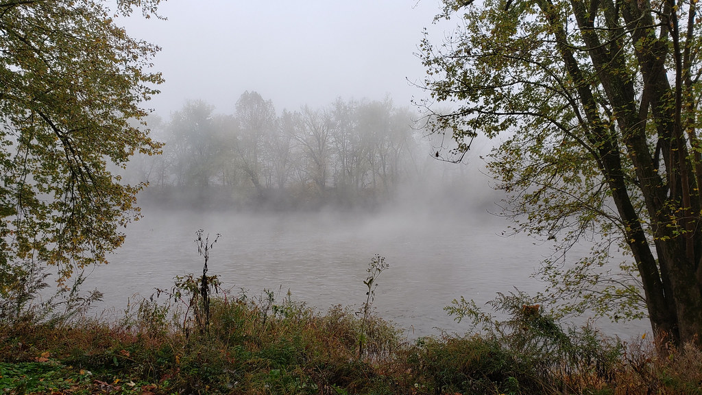 Long Pond Red TrailHikingPhoto: asciipip, CC BY-SA 2.0 (via Flickr)0.6 mi
- Western Maryland Rail TrailHiking0.9 mi
- Little Orleans CampgroundCamping1.2 mi
- Fifteenmile CreekCanoeing4 mi
- Potomac RiverRiver fishing5.8 mi
- Niagara FallsWaterfall7.9 mi
 Cacapon Resort State ParkState parkPhoto: Brian M. Powell (user Bitmapped on en.wikipedia), CC BY-SA 3.0 (via Wikimedia Commons)8.1 mi
 Berkeley Springs State ParkState parkPhoto: Jeanne Mozier from the Washington Heritage Trail, Public domain (via Wikimedia Commons)9.7 mi
Source: Roamze catalog (indexable pages within 10 miles, PostGIS distance)
- Little Orleans CampgroundCamping · ~2 min drive
- Fifteenmile Creek CampsiteCamping · ~2 min drive
- Campsite 68Camping · ~4 min drive
- Indigo Neck Hiker Biker CampsiteCamping · ~5 min drive
- Stickpile Hill Hiker-Biker Overnight (HBO) CampsiteCamping · ~5 min drive
- Sorrel Ridge Hiker-Biker Overnight (HBO) CampsiteCamping · ~7 min drive
- Gary's Family CampgroundCamping · ~8 min drive
- Camp ClevelandCamping · ~10 min drive
- Paw Paw CampgroundCamping · ~10 min drive
- Purslane Run Hiker-Biker Overnight (HBO) CampsiteCamping · ~11 min drive
Best time to visit Devils Alley Hiker-Biker Campsite
Best months: April–October. Best months have typical highs of 55–85 °F, lows of 30 °F or warmer (32 °F where the station doesn't record snow), at most one snowy day and no more than 12 wet days.
Jan
40° / 21°
7 wet
Feb
43° / 23°
6 wet
Mar
52° / 30°
8 wet
Apr
64° / 40°
10 wet
May
73° / 49°
11 wet
Jun
81° / 58°
10 wet
Jul
85° / 62°
9 wet
Aug
83° / 60°
9 wet
Sep
77° / 53°
8 wet
Oct
66° / 42°
7 wet
Nov
54° / 32°
6 wet
Dec
44° / 25°
7 wet
Typical high / low (°F) and days with rain or snow, 1991–2020. Measured at Cacapon St Pk #2, WV, 9.9 mi away at 958 ft. The station sits about 500 ft higher than this place, so expect it a little warmer here. This station doesn't record snowfall. Source: NOAA NCEI U.S. Climate Normals 1991–2020.
