Mount Muller
- 3,761 ft
- summit
- 1
- way up
Is Mount Muller open right now?
Alert in the area
The Forest Service lists 5 alerts for Olympic National Forest.
Roads to be Closed for Wildlife on October 1, 2026
Agency alert covering Olympic National Forest · USFS · Olympic National Forest
FS-2451 and Copper Creek Trail Closure
Agency alert covering Olympic National Forest · Order 06-09-26-10 · USFS · Olympic National Forest
FS-2160 Road Closure for Bridge Inspection
Agency alert covering Olympic National Forest · Order 06-09-26-07 · USFS · Olympic National Forest
High Steel Bridge and surrounding area closed to pedestrians/off trail hiking
Agency alert covering Olympic National Forest · Order 06-09-24-08 · USFS · Olympic National Forest
Alcohol ban in effect along Lake Cushman corridor
Agency alert covering Olympic National Forest · USFS · Olympic National Forest
As of · Source: USFS · Olympic National Forest. Agencies don't list every closure — check before you go.
Mount Muller is a summit of 3,761 feet in the Pacific Ranger District/Forks of Olympic National Forest in Washington, about 17 miles from the town of Clallam Bay. Several trails start close by. Mt. Muller Trail #882 and the North Strait View 3040 Trail are each about 0.7 miles away, and Mount Muller Trail is about a mile off. The Spruce Railroad Trail is roughly 1.6 miles away. For paddling, the East Twin River is about 3 miles away and Deep Creek about 4.4 miles. Klahowya Campground sits roughly 6 miles out.
Conditions and forecast
Daily highs and lows, wind and the chance of precipitation at the summit and route start for the next 7 days, from the Open-Meteo model.
- Summit elevation
- 3,761 ft
Elevation from USGS 3D Elevation Program terrain data (about 10 m resolution).
Map © Mapbox © OpenStreetMap contributors Questions about Mount Muller
How tall is Mount Muller?
3,761 ft (1,146 m).
How many routes go to the summit of Mount Muller?
One: Mount Muller Trail.
- Sourdough Mountain4,612 ft · Washington2 routes7.0 mi away
 Pyramid Mountain3,103 ft · Washington2 routes8.0 mi awayPhoto: Ron Clausen, CC BY-SA 4.0 (via Wikimedia Commons)
- Slide Peak4,338 ft · Washington1 route11 mi away
 Mount Storm King4,551 ft · Washington1 route11 mi awayPhoto: Jefftaylor@xwb.com (talk), CC BY-SA 3.0 (via Wikimedia Commons)
 Bogachiel Peak5,468 ft · Washington2 routes16 mi awayPhoto: Eggbones, CC BY-SA 4.0 (via Wikimedia Commons)
- Hurricane Hill5,768 ft · Washington2 routes22 mi away
 Mt. Muller Trail #882HikingPhoto: U.S. Forest Service- Pacific Northwest Region, Public domain (via Wikimedia Commons)0.7 mi
- NORTH STRAIT VIEW 3040 TRAILHiking0.7 mi
- Mount Muller TrailHikingPhoto: U.S. Forest Service- Pacific Northwest Region, Public domain (via Wikimedia Commons)1 mi
 Spruce Railroad TrailHikingPhoto: inte the husky, CC BY 3.0 (via Wikimedia Commons)1.6 mi
 East Twin RiverCanoeingPhoto: Evvekk, CC0 (via Wikimedia Commons)3.1 mi
- Deep CreekCanoeing4.4 mi
- North Fork Calawah RiverCanoeing6.3 mi
- Klahowya CampgroundCamping6.3 mi
Source: Roamze catalog (indexable pages within 10 miles, PostGIS distance)
- Pyramid MountainSummit · ~14 min drivePhoto: Ron Clausen, CC BY-SA 4.0 (via Wikimedia Commons)
 Aurora PeakSummit · ~15 min drivePhoto: Elwhajeff / Jefftaylor@xwb.com (talk), CC BY-SA 3.0 (via Wikimedia Commons)
- Mount Storm KingSummit · ~19 min drivePhoto: Jefftaylor@xwb.com (talk), CC BY-SA 3.0 (via Wikimedia Commons)
 Mount AppletonSummit · ~26 min drivePhoto: Ron Clausen, CC BY-SA 4.0 (via Wikimedia Commons)
- Bogachiel PeakSummit · ~27 min drivePhoto: Eggbones, CC BY-SA 4.0 (via Wikimedia Commons)
 Cat PeakSummit · ~33 min drivePhoto: brewbooks, CC BY-SA 2.0 (via Wikimedia Commons)
 Mount FitzhenrySummit · ~34 min drivePhoto: Martin Bravenboer, CC BY 3.0 (via Wikimedia Commons)
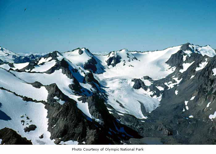 Mount CarrieSummit · ~35 min drivePhoto: National Park Service, Public domain (via Wikimedia Commons)
 Mount FairchildSummit · ~36 min drivePhoto: Martin Bravenboer, CC BY 3.0 (via Wikimedia Commons)
 Iron Mine HillSummit · ~37 min drivePhoto: Michal Klajban, CC BY-SA 4.0 (via Wikimedia Commons)
Also worth it near here
