Northeast 42nd Street Boat Ramp
- May–Sep
- best months
Clear at last check
Weather is good · OpenWeather · checked 22 h ago
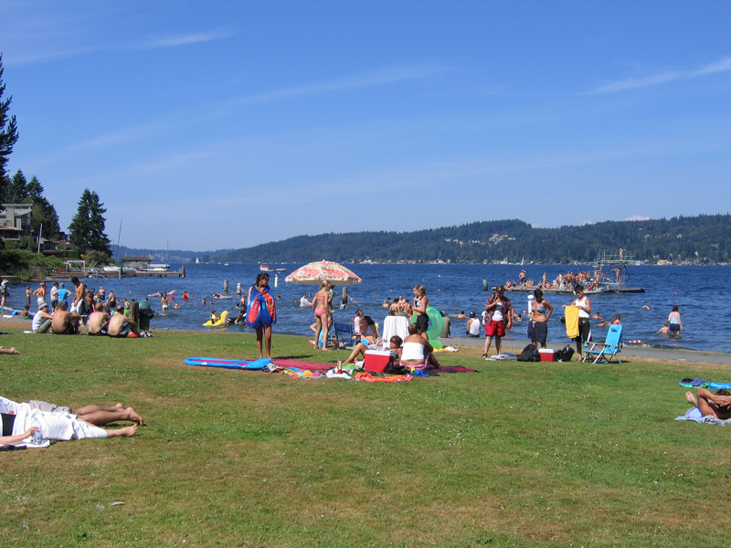
Northeast 42nd Street Boat Ramp is a city-managed boat launch in Washington, about 0.2 miles from Yarrow Point. It sits within the 42nd Street Swimming Area, which makes it a straightforward stop for getting a boat onto the water close to town. Summer is the most comfortable time to launch. Typical averages from a nearby weather station show July and August highs around 76 to 77°F, with only about six wet days a month, while winter months bring highs in the mid-40s and rain on most days. Several other outings are close by. The Seattle and Seattle Eastside climbing area is about a mile away, and the Beach Walk and Cross Park Trail North are both within 3 miles. Paddlers can also look to Bear Creek, roughly 8 miles off.
- Managed by
- City Land
- Seattle and Seattle EastsideRock climbing1.1 mi
- Beach WalkHiking2.5 mi
- Cross Park Trail NorthHiking2.8 mi
- Loop TrailHiking3.5 mi
- World Wall IIRock climbing3.5 mi
- Lookout LoopHiking3.6 mi
- UW RockRock climbing3.7 mi
 Bear CreekCanoeingPhoto: Brianhe, CC BY-SA 4.0 (via Wikimedia Commons)7.8 mi
Source: Roamze catalog (indexable pages within 10 miles, PostGIS distance)
- Bear CreekCanoeing · ~13 min drivePhoto: Brianhe, CC BY-SA 4.0 (via Wikimedia Commons)
- Marina Park Boat RampBoat launch · ~3 min drive
 Issaquah CreekCanoeing · ~23 min drivePhoto: jimapics, CC BY-SA 2.0 (via Wikimedia Commons)
- Sweyolocken Boat LaunchBoat launch · ~8 min drive
 Snoqualmie RiverCanoeing · ~24 min drivePhoto: Steven Pavlov, CC BY-SA 4.0 (via Wikimedia Commons)
- Sunnyside Avenue North Boat RampBoat launch · ~9 min drive
 Raging RiverCanoeing · ~34 min drivePhoto: Steven Pavlov, CC BY-SA 4.0 (via Wikimedia Commons)
- Waterway 19 Canoe/Kayak LaunchBoat launch · ~9 min drive
- Patterson CreekCanoeing · ~22 min drive
- SE 40th Boat LaunchBoat launch · ~9 min drive
Also worth it near here
Best time to visit Northeast 42nd Street Boat Ramp
Best months: May–September. Best months have typical highs of 55–85 °F, lows of 30 °F or warmer (32 °F where the station doesn't record snow), at most one snowy day and no more than 12 wet days.
Jan
47° / 37°
19 wet · 1 snow
Feb
50° / 37°
16 wet · 1 snow
Mar
54° / 39°
18 wet
Apr
59° / 43°
15 wet
May
65° / 48°
12 wet
Jun
70° / 53°
10 wet
Jul
76° / 57°
6 wet
Aug
77° / 57°
6 wet
Sep
71° / 53°
9 wet
Oct
61° / 47°
14 wet
Nov
52° / 41°
18 wet
Dec
46° / 37°
20 wet · 1 snow
Typical high / low (°F) and days with rain or snow, 1991–2020. Measured at Seattle Sand Pt Wsfo, WA, 3.2 mi away at 60 ft. Source: NOAA NCEI U.S. Climate Normals 1991–2020.

Map and trail data © OpenStreetMap contributors
