Snoqualmie Falls Forest Theater Campsites
Campground
Campground · 1.8 mi from the trail
Silent Creek Trail is an easy out-and-back hike in Washington, about 2 miles from the community of Upper Preston. The trail is roughly 2.3 miles long, with a total elevation gain of about 290 feet, and it is rated easy. The route is steady, with the steepest stretch at about 0.8 miles in, where the grade reaches about 11%. The trail starts at around 865 feet and reaches a high point of about 931 feet before returning to the starting elevation. Summer is the most comfortable time to go. Typical averages from the nearby Snoqualmie Falls weather station show July and August highs in the mid-70s with only six or seven wet days a month, while winter months bring highs in the mid-40s and rain on about 20 days. Timber Trail lies just 0.3 miles away, and Deep Creek Trail and Whitaker Trail are both within about 1.5 miles. Paddlers can reach the Raging River about 3 miles off.
Snoqualmie Falls Forest Theater Campsites
Campground
 If it rainsShakespeare at English Wikipedia, CC BY-SA 3.0 · Wikimedia Commons
Railway station in Snoqualmie, the United States of America
Places © OpenStreetMap contributors · Photos: Shakespeare at English Wikipedia, CC BY-SA 3.0 (commons)
More in Gold BarNot on Roamze yet. Their page has how to reach them.
 Raging RiverCanoeingPhoto: Steven Pavlov, CC BY-SA 4.0 (via Wikimedia Commons)3 mi
 Snoqualmie RiverCanoeingPhoto: Steven Pavlov, CC BY-SA 4.0 (via Wikimedia Commons)5.3 mi
 The WoodsRock climbingPhoto: brewbooks, CC BY-SA 2.0 (via Flickr)6.1 miThe Woods AlcoveRock climbingPhoto: brewbooks, CC BY-SA 2.0 (via Flickr)6.1 mi
Source: Roamze catalog (indexable pages within 10 miles, PostGIS distance)
 Preston TrailHiking · ~6 min drivePhoto: Leslie Seaton from Seattle, WA, USA, CC BY 2.0 (via Wikimedia Commons)
 East Tiger Summit TrailHiking · ~7 min drivePhoto: brewbooks from near Seattle, USA, CC BY-SA 2.0 (via Wikimedia Commons)
 East Fork TrailHiking · ~9 min drivePhoto: Leslie Seaton from Seattle, WA, USA, CC BY 2.0 (via Wikimedia Commons)Cable Line TrailHiking · ~9 min drivePhoto: Leslie Seaton from Seattle, WA, USA, CC BY 2.0 (via Wikimedia Commons)Lingering TrailHiking · ~8 min drivePhoto: Leslie Seaton from Seattle, WA, USA, CC BY 2.0 (via Wikimedia Commons)Swamp TrailHiking · ~10 min drivePhoto: Leslie Seaton from Seattle, WA, USA, CC BY 2.0 (via Wikimedia Commons)
Also worth it near here
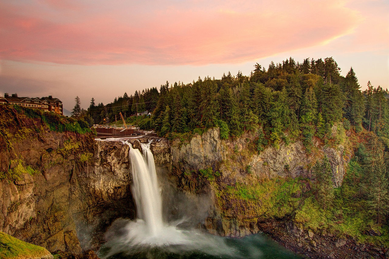 Snoqualmie FallsWaterfall · ~4 min drivePhoto: Meher Anand Kasam, CC BY-SA 3.0 (via Wikimedia Commons)Raging RiverCanoeing · ~5 min drivePhoto: Steven Pavlov, CC BY-SA 4.0 (via Wikimedia Commons)
 Easy Tiger (upper)Mountain biking · ~6 min drivePhoto: brewbooks from near Seattle, USA, CC BY-SA 2.0 (via Wikimedia Commons)
Best months: July–September. Best months have typical highs of 55–85 °F, lows of 30 °F or warmer (32 °F where the station doesn't record snow), at most one snowy day and no more than 12 wet days.
Jan
46° / 36°
20 wet · 1 snow
Feb
50° / 35°
17 wet
Mar
54° / 37°
20 wet
Apr
59° / 40°
18 wet
May
64° / 46°
15 wet
Jun
69° / 51°
13 wet
Jul
76° / 54°
7 wet
Aug
77° / 54°
6 wet
Sep
70° / 49°
11 wet
Oct
59° / 44°
16 wet
Nov
51° / 38°
20 wet
Dec
46° / 36°
20 wet · 1 snow
Typical high / low (°F) and days with rain or snow, 1991–2020. Measured at Snoqualmie Falls, WA, 2.2 mi away at 440 ft. Source: NOAA NCEI U.S. Climate Normals 1991–2020.
Map and trail data © OpenStreetMap contributors
