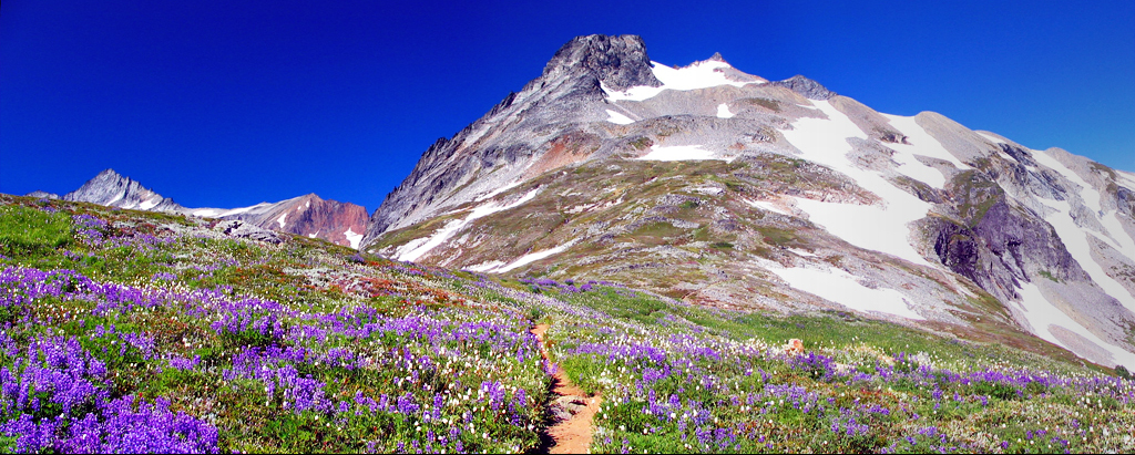
Horseshoe Basin Trail
 Photo: lamblukas from San Francisco, United States, CC BY 2.0 (via Wikimedia Commons)
- 1.5 mi
- round trip
- 2,808 ft
- climb
- 4,992 ft
- high point
- Out and back
- route
Is Horseshoe Basin Trail open right now?
Closure in the area
There's a closure order in North Cascades National Park. It doesn't name Horseshoe Basin Trail, so check the source for the area it covers (3 listed).
Cascade River Road Closed for the Winter Season
Park closure covering North Cascades National Park · NPS · North Cascades National Park
Fire Closures - Trail, Area, and Camp Closures
Park closure covering North Cascades National Park · NPS · North Cascades National Park
Hozomeen Gate Remains Closed
Park closure covering North Cascades National Park · NPS · North Cascades National Park
Be Aware of Break-ins along State Route 20
Park alert covering North Cascades National Park · NPS · North Cascades National Park
Diablo Lake Boat Launch Inaccessible to Powerboats
Park alert covering North Cascades National Park · NPS · North Cascades National Park
As of · Source: NPS · North Cascades National Park. Agencies don't list every closure — check before you go.
Horseshoe Basin Trail is a 3-mile out-and-back hike in Washington's North Cascades National Park, within the Stephen Mather Wilderness. The route starts at about 4,027 feet and climbs to a high point of 4,992 feet, with a total elevation gain of 2,808 feet over the course of the trip. The climb is front-loaded, and the trail is rated hard. The National Park Service manages the land, and there is no fee to enter. Plan on about 2.5 hours for the hike. The trail sits close to several other destinations. Cascade Pass Trail is about 0.4 miles away, and Doubtful Lake Trail and Sahale Arm Trail are each within about 2 miles. For climbing, Boston Basin is roughly 2.6 miles off.
Local outfitters
- Triangle Recreation Camp38 mi away
Not on Roamze yet. Their page has how to reach them.
- Cascade Pass TrailHikingPhoto: lamblukas from San Francisco, United States, CC BY 2.0 (via Wikimedia Commons)0.4 mi
 Doubtful Lake TrailHikingPhoto: Michael Wifall, CC BY-SA 2.0 (via Wikimedia Commons)1.5 mi
 Sahale Arm TrailHikingPhoto: Ron Clausen (talk · contribs), CC BY-SA 4.0 (via Wikimedia Commons)1.7 mi
- Boston BasinRock climbing2.6 mi
- Middle Fork Cascade RiverCanoeing4.1 mi
- South Fork Cascade RiverCanoeing6 mi
 Mineral Park CampgroundCampingPhoto: Recreation.gov (RIDB) / public domain6.8 mi
- Main PeakRock climbing7 mi
Source: Roamze catalog (indexable pages within 10 miles, PostGIS distance)
- Cascade Pass TrailHiking · Next doorPhoto: lamblukas from San Francisco, United States, CC BY 2.0 (via Wikimedia Commons)
- Doubtful Lake TrailHiking · ~3 min drivePhoto: Michael Wifall, CC BY-SA 2.0 (via Wikimedia Commons)
- Upper Stehekin Valley TrailHiking · ~4 min drive
- Boston Basin TrailHiking · ~5 min drive
 Maple Pass TrailHiking · ~21 min drivePhoto: Walter Siegmund (talk), CC BY 2.5 (via Wikimedia Commons)
- Sahale Arm TrailHiking · ~3 min drivePhoto: Ron Clausen (talk · contribs), CC BY-SA 4.0 (via Wikimedia Commons)
- Cascade RiverHiking · ~10 min drive
- Eldorado Basin TrailHiking · ~9 min drive
- Park Creek TrailHiking · ~6 min drive
- Middle Fork Cascade River TrailHiking · ~6 min drive