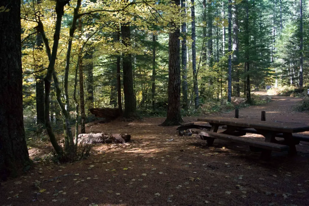
Quartz Creek Trail Backcountry Campsite
Campground
Campground · 6.6 mi from the trail
Alert in the area
The Forest Service lists 6 alerts for Gifford Pinchot National Forest.
Fire Restrictions
Agency alert covering Gifford Pinchot National Forest · USFS · Gifford Pinchot National Forest
Seasonal Road Closures
Agency alert covering Gifford Pinchot National Forest · USFS · Gifford Pinchot National Forest
Road Repairs & Road Closures in 2026
Agency alert covering Gifford Pinchot National Forest · USFS · Gifford Pinchot National Forest
Washout on Forest Road 93
Agency alert covering Gifford Pinchot National Forest · USFS · Gifford Pinchot National Forest
Upper State Route 504 closed at milepost 45.2 due to large slide
Agency alert covering Gifford Pinchot National Forest · USFS · Gifford Pinchot National Forest
As of · Source: USFS · Gifford Pinchot National Forest. Agencies don't list every closure — check before you go.
Badger Ridge Trail is a moderate hike in Washington's Mount St. Helens National Volcanic Monument, within the Gifford Pinchot National Forest. The route is an out-and-back, about 1.9 miles long, with a total elevation gain of 2,078 feet. The high point is 5,315 feet, and the trail starts at about 4,985 feet, so the climb is roughly 1,000 feet each way. The steepest stretch comes early, around 0.44 miles from the start, with a grade of 32 percent. Summer is the most comfortable time to go. Typical averages from a nearby weather station at a similar elevation show July highs around 62°F and lows near 44°F, while winter highs stay in the low 30s. The Forest Service manages the land. Badger Peak Trail sits just 0.2 miles away, and the Mosquito Meadows Trail is about 2.3 miles off. Pinto Rock, a climbing area, and Pinto Creek, a canoeing spot, are both about 2.9 miles from the trail.
Quartz Creek Trail Backcountry Campsite
Campground
Dining Hall
Restaurant
Places © OpenStreetMap contributors
More in PackwoodNot on Roamze yet. Their page has how to reach them.
 Lower Falls CampgroundCampingPhoto: Recreation.gov (RIDB) / public domain9.1 mi
Source: Roamze catalog (indexable pages within 10 miles, PostGIS distance)
 Strawberry Mountain TrailHiking · ~12 min drivePhoto: Greg Willis from Denver, CO, usa, CC BY-SA 2.0 (via Wikimedia Commons)
 Ghost Lake TrailHiking · ~14 min drivePhoto: Greg Willis from Denver, CO, usa, CC BY-SA 2.0 (via Wikimedia Commons)
Best months: July–September. Best months have typical highs of 55–85 °F, lows of 30 °F or warmer (32 °F where the station doesn't record snow), at most one snowy day and no more than 12 wet days.
Jan
34° / 24°
Feb
34° / 23°
Mar
36° / 24°
Apr
40° / 26°
May
48° / 33°
Jun
54° / 37°
Jul
62° / 44°
Aug
64° / 45°
Sep
57° / 41°
Oct
46° / 33°
Nov
37° / 26°
Dec
33° / 22°
Typical high / low (°F) and days with rain or snow, 1991–2020. Measured at Rainier Paradise Rs, WA, 35.3 mi away at 5,427 ft. This station doesn't record snowfall. Source: NOAA NCEI U.S. Climate Normals 1991–2020.
Map and trail data © OpenStreetMap contributors
