Boston Basin Low Camp
- Jun–Sep
- best months
Is Boston Basin Low Camp open right now?
Closure in the area
There's a closure order in North Cascades National Park. It doesn't name Boston Basin Low Camp, so check the source for the area it covers (3 listed).
Cascade River Road Closed for the Winter Season
Park closure covering North Cascades National Park · NPS · North Cascades National Park
Fire Closures - Trail, Area, and Camp Closures
Park closure covering North Cascades National Park · NPS · North Cascades National Park
Hozomeen Gate Remains Closed
Park closure covering North Cascades National Park · NPS · North Cascades National Park
Be Aware of Break-ins along State Route 20
Park alert covering North Cascades National Park · NPS · North Cascades National Park
Diablo Lake Boat Launch Inaccessible to Powerboats
Park alert covering North Cascades National Park · NPS · North Cascades National Park
As of · Source: NPS · North Cascades National Park. Agencies don't list every closure — check before you go.
- Stephen Mather WildernessNorth Cascades National Park
Boston Basin Low Camp is a campground in Washington.
Local outfitters
- Triangle Recreation Camp38 mi away
- Skagit River Woods Camping Country Club39 mi away
Not on Roamze yet. Their page has how to reach them.
- Boston BasinRock climbing0.9 mi
- Boston Basin TrailHiking0.9 mi
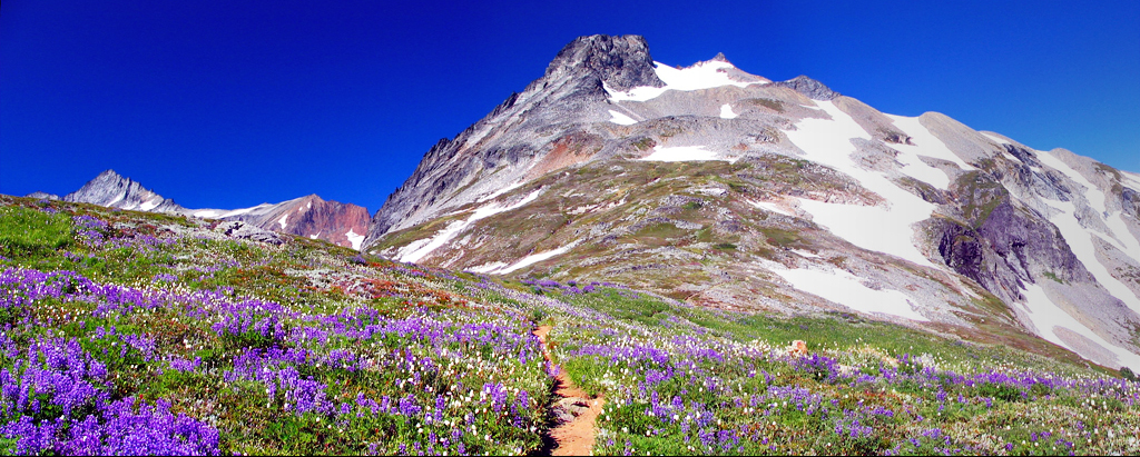 Sahale MountainSummitPhoto: Jeffrey Pang from Madison, NJ, USA, CC BY 2.0 (via Wikimedia Commons)1.2 mi
 Doubtful Lake TrailHikingPhoto: Michael Wifall, CC BY-SA 2.0 (via Wikimedia Commons)1.8 mi
- Middle Fork Cascade RiverCanoeing4 mi
 Mineral Park CampgroundCampingPhoto: Recreation.gov (RIDB) / public domain5.3 mi
- South Fork Cascade RiverCanoeing6.1 mi
 Marble Creek CampgroundCampingPhoto: Recreation.gov (RIDB) / public domain9.9 mi
Source: Roamze catalog (indexable pages within 10 miles, PostGIS distance)
- Mineral Park CampgroundCamping · ~9 min drive
- Hidden Lake PeakHut camping · ~11 min drive
- Marble Creek CampgroundCamping · ~17 min drive
- Lookout MountainHut camping · ~22 min drive
- Boston Basin High CampCamping · Next door
- Sahale Glacier CampCamping · ~2 min drive
- Johannesburg CampCamping · ~2 min drive
- Pelton Basin CampCamping · ~4 min drive
- Basin Creek CampCamping · ~5 min drive
- Kool-Aid Lake CampCamping · ~7 min drive
Also worth it near here
- Boston BasinRock climbing · ~2 min drive
- Sahale MountainSummit · ~2 min drivePhoto: Jeffrey Pang from Madison, NJ, USA, CC BY 2.0 (via Wikimedia Commons)
- Doubtful Lake TrailHiking · ~3 min drivePhoto: Michael Wifall, CC BY-SA 2.0 (via Wikimedia Commons)
 Cascade RiverCanoeing · ~10 min drivePhoto: Joe Mabel, CC BY-SA 4.0 (via Wikimedia Commons)
Best time to visit Boston Basin Low Camp
Best months: June–September. Best months have typical highs of 55–85 °F, lows of 30 °F or warmer (32 °F where the station doesn't record snow), at most one snowy day and no more than 12 wet days.
Jan
40° / 32°
18 wet · 4 snow
Feb
44° / 33°
16 wet · 3 snow
Mar
49° / 35°
18 wet · 2 snow
Apr
58° / 39°
16 wet
May
66° / 46°
14 wet
Jun
70° / 50°
12 wet
Jul
78° / 54°
7 wet
Aug
79° / 54°
7 wet
Sep
71° / 50°
11 wet
Oct
57° / 44°
17 wet
Nov
45° / 37°
20 wet · 1 snow
Dec
39° / 33°
19 wet · 3 snow
Typical high / low (°F) and days with rain or snow, 1991–2020. Measured at Newhalem, WA, 14.9 mi away at 525 ft. We don't have this place's elevation, so higher spots nearby can run cooler. Source: NOAA NCEI U.S. Climate Normals 1991–2020.
Map and trail data © OpenStreetMap contributors
