Big Piney Mountain
- 2,935 ft
- summit
- Jun–Oct
- best months
Is Big Piney Mountain open right now?
Closure in the area
There's a closure order in George Washington and Jefferson National Forest. It doesn't name Big Piney Mountain, so check the source for the area it covers (2 listed).
Enchanted Creek Road (National Forest System Road 1881) will be closed for repairs until 12/31/27
Agency closure covering George Washington and Jefferson National Forest · USFS · George Washington and Jefferson National Forest
Bolar Mountain Recreation Area - Twin Ridge Road Closure
Agency closure covering George Washington and Jefferson National Forest · USFS · George Washington and Jefferson National Forest
Prescribed Fire Operations Mount Rogers National Recreation Area- Porter and Little Mountain
Agency alert covering George Washington and Jefferson National Forest · USFS · George Washington and Jefferson National Forest
Road Closures James River and Warm Springs Ranger District
Agency alert covering George Washington and Jefferson National Forest · USFS · George Washington and Jefferson National Forest
Virginia Creeper National Recreation Trail Closure Update
Agency alert covering George Washington and Jefferson National Forest · USFS · George Washington and Jefferson National Forest
As of · Source: USFS · George Washington and Jefferson National Forest. Agencies don't list every closure — check before you go.
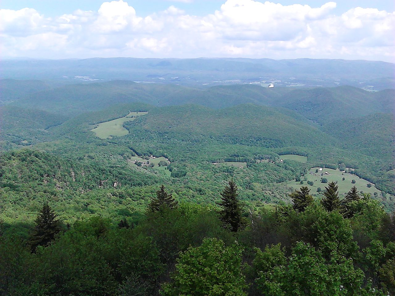
Big Piney Mountain is a summit in the Warm Springs Ranger District of the George Washington and Jefferson National Forest in western Virginia. The nearest town is Warm Springs, about 3.3 miles away. The most comfortable time to visit is late spring through early fall. Typical averages from the nearby Hot Springs weather station run from highs near 72°F in May to about 64°F in October. The summit sits well above that station, so temperatures on top run cooler. Piney Mountain lies just 1.4 miles away, and the Warm Springs Mountain Trail is 1.6 miles away. For overnight stays, Hidden Valley Campground is about 5 miles off and Blowing Springs about 8 miles.
Conditions and forecast
Daily highs and lows, wind and the chance of precipitation at the summit for the next 7 days, from the Open-Meteo model.
- Summit elevation
- 2,935 ft
Elevation from USGS 3D Elevation Program terrain data (about 10 m resolution).
We don't know of a mapped trail or route to the summit of Big Piney Mountain. Plan the approach with local maps, a guidebook or a local guide, and check conditions before you go.
Questions about Big Piney Mountain
How tall is Big Piney Mountain?
2,935 ft (895 m).
Is there a trail to the top of Big Piney Mountain?
We don't know of a mapped trail or route to the summit. Plan the approach with local maps, a guidebook or a local guide.
- Little Mare Mountain3,441 ft · Virginia1 route6.3 mi away
- Little Brushy Mountain3,551 ft · Virginia1 route6.3 mi away
- Duncan Knob3,837 ft · Virginia1 route6.4 mi away
- Beards Mountain2,845 ft · Virginia1 route9.9 mi away
- Coles Mountain3,169 ft · Virginia1 route12 mi away
- Middle Mountain3,183 ft · Virginia1 route14 mi away
- Piney MountainHiking1.4 mi
- Warm Springs Mountain TrailHiking1.6 mi
- Tower Hill MountainHiking2.4 mi
- Little Mare MountainHiking2.9 mi
- Bear RockHiking3 mi
 Hidden Valley CampgroundCampingPhoto: Nyttend, Public domain (via Wikimedia Commons)5.2 mi
 Blowing SpringsCampingPhoto: The Ninjaneer, CC0 (via Wikimedia Commons)8.3 mi
- Stuart RunCanoeing8.5 mi
Source: Roamze catalog (indexable pages within 10 miles, PostGIS distance)
 Elliott KnobSummit · ~40 min drivePhoto: MONGO, CC BY-SA 3.0 (via Wikimedia Commons)
 Bald KnobSummit · ~48 min drivePhoto: User:Scochran4, CC BY-SA 3.0 (via Wikimedia Commons)
- Little Mare MountainSummit · ~11 min drive
- Little Brushy MountainSummit · ~11 min drive
- Duncan KnobSummit · ~11 min drive
- Coles MountainSummit · ~21 min drive
- Middle MountainSummit · ~23 min drive
- Knob MountainSummit · ~26 min drive
- Fore MountainSummit · ~31 min drive
- Big House MountainSummit · ~33 min drive
Best time to visit Big Piney Mountain
Best months: June–October. Best months have typical highs of 55–85 °F, lows of 30 °F or warmer (32 °F where the station doesn't record snow), at most one snowy day and no more than 12 wet days.
Jan
40° / 21°
10 wet
Feb
44° / 23°
10 wet
Mar
52° / 30°
11 wet
Apr
64° / 39°
13 wet
May
72° / 48°
14 wet
Jun
79° / 56°
12 wet
Jul
82° / 60°
12 wet
Aug
80° / 59°
11 wet
Sep
74° / 53°
9 wet
Oct
64° / 41°
9 wet
Nov
53° / 31°
9 wet
Dec
43° / 25°
10 wet
Typical high / low (°F) and days with rain or snow, 1991–2020. Measured at Hot Springs, VA, 7.5 mi away at 2,244 ft. The station sits about 700 ft lower than this place, so expect it a little cooler here. This station doesn't record snowfall. Source: NOAA NCEI U.S. Climate Normals 1991–2020.
