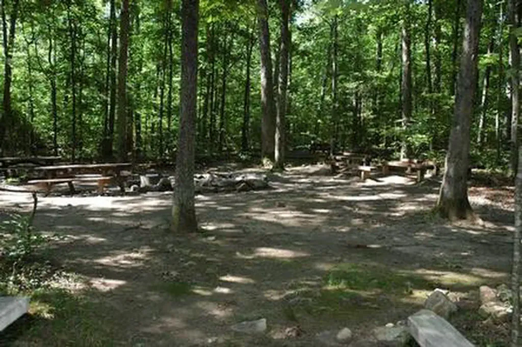
Strasburg Riverlot
Campground
Campground · 1.2 mi from the trail
Strasburg Trail is a short, easy hike in Virginia, about half a mile from the town of Strasburg. The route is only 0.4 miles long, and the climb is minimal, with a total elevation gain of 7 feet and a total loss of 13 feet over the course of the walk. The trail starts at about 527 feet and reaches a high point of 533 feet before descending slightly. The most comfortable months for a visit are typically late spring and early fall. Typical averages from a nearby weather station in Woodstock show May highs around 73°F and September highs around 79°F, while July averages climb to about 86°F. The trip takes about half an hour, so it works well as a quick stop before or after exploring the surrounding area. Within a few miles you'll find the Massanutten Trail and the Tuscarora - Doll Ridge hike. Climbers can head to Talking Headwall, and Elizabeth Furnace Group Camp offers camping about 4 miles away.
Strasburg Riverlot
Campground
 If it rainsNyttend, Public domain · Wikimedia Commons
Places © OpenStreetMap contributors, Places © Overture Maps Foundation · Photos: Nyttend, Public domain (commons)
More in Front Royal Massanutten TrailHikingPhoto: jimmytoering from Maryland, United States, CC BY 2.0 (via Wikimedia Commons)2.2 mi
 Talking HeadwallRock climbingPhoto: Jarek Tuszyński, CC BY 3.0 (via Wikimedia Commons)4.1 mi
 Elizabeth Furnace Group CampCampingPhoto: Recreation.gov (RIDB) / public domain4.1 mi
 Elizabeth Furnace Group Campground ACampingPhoto: scooterhigher, CC BY-SA 3.0 (via Wikimedia Commons)4.2 miBuzzard RocksRock climbingPhoto: Jarek Tuszyński, CC BY 3.0 (via Wikimedia Commons)4.3 mi
Source: Roamze catalog (indexable pages within 10 miles, PostGIS distance)
Massanutten TrailHiking · ~4 min drivePhoto: jimmytoering from Maryland, United States, CC BY 2.0 (via Wikimedia Commons) Hayes-Ramseur Loop TrailHiking · ~7 min drivePhoto: Doug Kerr from Albany, NY, United States, CC BY-SA 2.0 (via Wikimedia Commons)
 Tuscarora - Veach GapHiking · ~9 min drivePhoto: v343790, CC BY 3.0 (via Wikimedia Commons)Massanutten TrailHiking · ~14 min drivePhoto: jimmytoering from Maryland, United States, CC BY 2.0 (via Wikimedia Commons)Massanutten TrailHiking · ~7 min drivePhoto: jimmytoering from Maryland, United States, CC BY 2.0 (via Wikimedia Commons)Massanutten TrailHiking · ~8 min drivePhoto: jimmytoering from Maryland, United States, CC BY 2.0 (via Wikimedia Commons)
Best months: April–June and August–October. Best months have typical highs of 55–85 °F, lows of 30 °F or warmer (32 °F where the station doesn't record snow), at most one snowy day and no more than 12 wet days.
Jan
42° / 21°
8 wet
Feb
46° / 23°
7 wet
Mar
54° / 30°
8 wet
Apr
65° / 39°
10 wet
May
73° / 49°
12 wet
Jun
82° / 58°
11 wet
Jul
86° / 63°
10 wet
Aug
85° / 61°
10 wet
Sep
79° / 54°
9 wet
Oct
68° / 42°
8 wet
Nov
56° / 31°
7 wet
Dec
46° / 25°
8 wet
Typical high / low (°F) and days with rain or snow, 1991–2020. Measured at Woodstock 2 Ne, VA, 8.2 mi away at 675 ft. This station doesn't record snowfall. Source: NOAA NCEI U.S. Climate Normals 1991–2020.
Map and trail data © OpenStreetMap contributors
