Bluff Mountain
- 2,799 ft
- summit
- 1
- way up
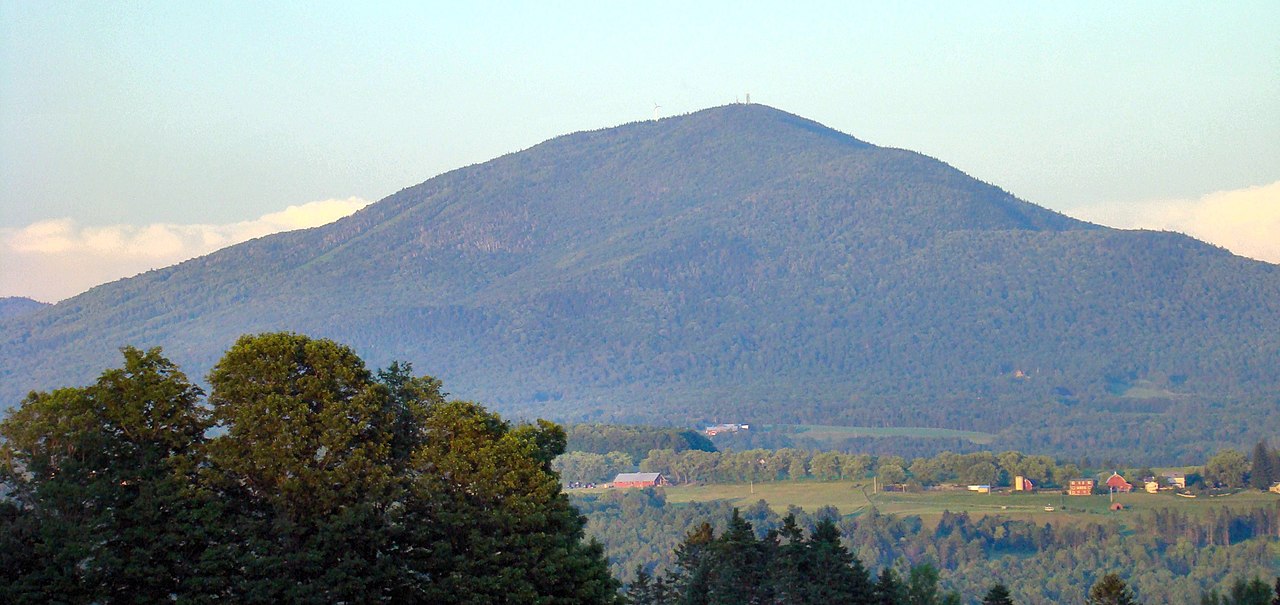
Bluff Mountain is a summit in Vermont, rising to 2,799 feet about 3 miles from the town of Island Pond. It sits in the high country of northern Vermont, and several trails start within a few miles, making it a natural anchor for a day of hiking in the area. Summer is the most comfortable time to go. Typical averages from a nearby weather station in Island Pond show July highs around 76°F with lows near 55°F, though that station sits well below the summit, so temperatures on top run cooler. Winters are cold, with January highs averaging about 24°F. The closest trails are the Lookout Trail and the Bluff Ridge Trail, both about 2 miles away, and the Bluff Mountain Community Trail is a little farther at about 2.4 miles. Paddlers can reach the Pherrins River, about 2 miles off.
Conditions and forecast
Daily highs and lows, wind and the chance of precipitation at the summit and route start for the next 7 days, from the Open-Meteo model.
- Summit elevation
- 2,799 ft
Elevation from USGS 3D Elevation Program terrain data (about 10 m resolution).
Map © Mapbox © OpenStreetMap contributors Hazards
- Muddy conditions
- Weather exposure on ridges
- Navigation challenges
- Seasonal ice
Season
Spring may have muddy conditions; fall offers excellent foliage; winter requires snowshoes or microspikes
Questions about Bluff Mountain
How tall is Bluff Mountain?
2,799 ft (853 m).
How many routes go to the summit of Bluff Mountain?
One: Bluff Ridge Trail.
When is the best time to climb Bluff Mountain?
Spring, summer, fall.
- Middle Mountain2,947 ft · Vermont1 route4.3 mi away
- Gore Mountain3,331 ft · Vermont1 route5.4 mi away
- Bald Mountain3,323 ft · Vermont2 routes8.9 mi away
 Mount Pisgah2,761 ft · Vermont2 routes12 mi awayPhoto: Lostdrewid, CC BY-SA 3.0 (via Wikimedia Commons)
- Wheeler Mountain2,369 ft · Vermont1 route14 mi away
- Monadnock Mountain3,138 ft · Vermont1 route16 mi away
- Pherrins RiverCanoeing2 mi
- Lookout TrailHiking2.1 mi
- Bluff Ridge TrailHiking2.1 mi
- Bluff Mountain Community TrailHiking2.4 mi
 Coaticook RiverCanoeingPhoto: Pierre Bona, CC BY-SA 3.0 (via Wikimedia Commons)6.6 mi
- Nulhegan RiverCanoeing6.8 mi
- Black Mountain NorthRock climbing7.3 mi
- Main CliffRock climbing7.4 mi
Source: Roamze catalog (indexable pages within 10 miles, PostGIS distance)
 Mont PinacleSummit · ~20 min drivePhoto: Ethier254, CC BY-SA 4.0 (via Wikimedia Commons)
 Mont BarnstonSummit · ~20 min drivePhoto: Richard Coté, CC BY-SA 4.0 (via Wikimedia Commons)
- Mount PisgahSummit · ~21 min drivePhoto: Lostdrewid, CC BY-SA 3.0 (via Wikimedia Commons)
 Burke MountainSummit · ~34 min drivePhoto: From the nek, CC BY-SA 3.0 (via Wikimedia Commons)
 Mont HerefordSummit · ~34 min drivePhoto: Richard Coté, CC BY-SA 4.0 (via Wikimedia Commons)
 Mont Owl's HeadSummit · ~44 min drivePhoto: Kevstan, CC BY-SA 3.0 (via Wikimedia Commons)
- Middle MountainSummit · ~7 min drive
- Gore MountainSummit · ~9 min drive
- Bald MountainSummit · ~15 min drive
- Black CatSummit · ~19 min drive
Best time to visit Bluff Mountain
No month here meets our mild-weather rule. Best months have typical highs of 55–85 °F, lows of 30 °F or warmer (32 °F where the station doesn't record snow), at most one snowy day and no more than 12 wet days.
Jan
24° / 3°
17 wet
Feb
27° / 4°
14 wet
Mar
36° / 14°
14 wet
Apr
49° / 29°
14 wet
May
64° / 41°
16 wet
Jun
72° / 51°
17 wet
Jul
76° / 55°
17 wet
Aug
75° / 54°
16 wet
Sep
68° / 46°
15 wet
Oct
54° / 36°
17 wet
Nov
41° / 26°
17 wet
Dec
30° / 13°
18 wet
Typical high / low (°F) and days with rain or snow, 1991–2020. Measured at Island Pond, VT, 3.4 mi away at 1,200 ft. The station sits about 1,600 ft lower than this place, so expect it a little cooler here. This station doesn't record snowfall. Source: NOAA NCEI U.S. Climate Normals 1991–2020.
