Allis State Park Campground
Campground
Campground · 0.2 mi from the trail
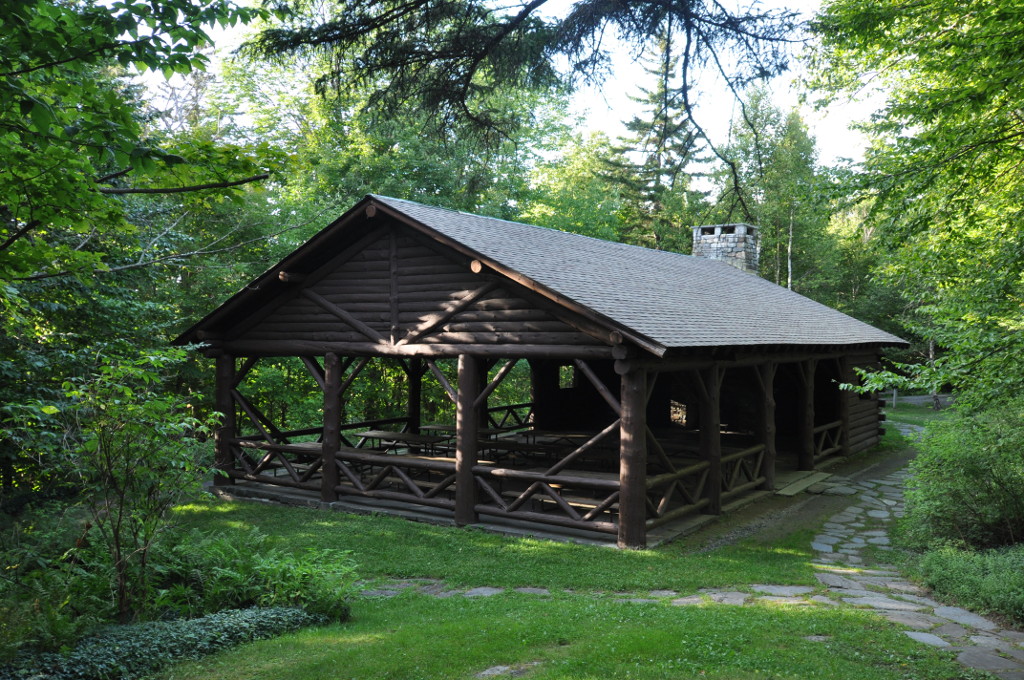 Photo: User:Magicpiano, CC BY-SA 3.0 (via Wikimedia Commons)
Clear at last check
Weather is good · OpenWeather · checked 12 h ago
Allis State Park is a Vermont state park managed by State Park and Recreation, about 6.5 miles from the town of Williamstown. It serves as a base for exploring the surrounding area, with paddling and hiking options within a short drive. Summer is the most comfortable time to visit. Typical averages from the nearby Northfield weather station show July highs around 81°F with lows near 55°F, while September cools to highs around 72°F. Paddlers can head to Ayers Brook, about 5 miles away, or the Third Branch White River, about 5.6 miles away. Hikers have the Yellow Trail and the Ridgeline Trail, both about 6 miles off. Climbers can find the Central Vermont climbing area roughly 9 miles away.
Allis State Park Campground
Campground
 If it rainsSMHCNorwich, CC BY-SA 4.0 · Wikimedia Commons
Places © OpenStreetMap contributors, Places © Overture Maps Foundation · Photos: SMHCNorwich, CC BY-SA 4.0 (commons)
More in RandolphPark size
643 acres
Campgrounds
Source: Roamze catalog (indexable pages within 10 miles, PostGIS distance)
 Silver Lake State ParkState park · ~37 min drivePhoto: User:Magicpiano, CC BY-SA 4.0 (via Wikimedia Commons)
 Molly’s Falls Pond State ParkState park · ~47 min drivePhoto: Niranjan Arminius, CC BY-SA 4.0 (via Wikimedia Commons)
 Bedell Bridge State ParkState park · ~49 min drivePhoto: Denimadept, CC BY-SA 4.0 (via Wikimedia Commons)
 Quechee State ParkState park · ~52 min drivePhoto: Slimguy, CC BY-SA 3.0 (via Wikimedia Commons)
 Mt. Philo State ParkState park · ~56 min drivePhoto: LunchboxLarry, CC BY 2.0 (via Wikimedia Commons)
 Camp Plymouth State ParkState park · ~1h 7m drivePhoto: User:Magicpiano, CC BY-SA 4.0 (via Wikimedia Commons)
 Green River Reservoir State ParkState park · ~1h 7m drivePhoto: Christian Aubry from Montreal, Quebec, Canada, CC BY 2.0 (via Wikimedia Commons)
 Ascutney State ParkState park · ~1h 13m drivePhoto: Miguel Vieira from Redwood City, CA, USA, CC BY 2.0 (via Wikimedia Commons)
 Franconia Notch State ParkState park · ~1h 21m drivePhoto: Stephen Sokolowski, CC BY-SA 3.0 (via Wikimedia Commons)
 Branbury State ParkState park · ~40 min drivePhoto: User:Magicpiano, CC BY-SA 4.0 (via Wikimedia Commons)
Best months: May–October. Best months have typical highs of 55–85 °F, lows of 30 °F or warmer (32 °F where the station doesn't record snow), at most one snowy day and no more than 12 wet days.
Jan
29° / 6°
10 wet
Feb
32° / 7°
8 wet
Mar
41° / 17°
9 wet
Apr
54° / 29°
10 wet
May
68° / 41°
12 wet
Jun
76° / 51°
12 wet
Jul
81° / 55°
12 wet
Aug
79° / 53°
10 wet
Sep
72° / 45°
9 wet
Oct
59° / 35°
11 wet
Nov
46° / 26°
10 wet
Dec
35° / 14°
11 wet
Typical high / low (°F) and days with rain or snow, 1991–2020. Measured at Northfield, VT, 8.1 mi away at 670 ft. We don't have this place's elevation, so higher spots nearby can run cooler. This station doesn't record snowfall. Source: NOAA NCEI U.S. Climate Normals 1991–2020.
