Loading…

Free — you'll pick up right here.
Watch this trail
Sign up to watch it — saving subscribes you to gate, closure and report changes.
Vermont
2.6 mi
Distance
1,136 ft
Gain
1h 17m
Time
An agency closure order is in effect for this area; weather is marginal
2 factors · 2 sources
Newest 6 h ago · oldest 27 d
problem: Agency alerts
44 active alerts in Green Mountain and Finger Lakes National Forests; most severe: Glastenbury fire tower is closed to public use
USFS27 d ago
caution: Weather
Rain, high 51°F / low 45°F, 100% precip — 65/100 for hike
OpenWeather6 h ago
Been out here in the last few days? One report keeps this current for everyone.
Why you'll love it
Slab Bridge Brook
AI-suggested draft · review before you go
No permit or access details on file for this trail — check with the local land manager before you go.
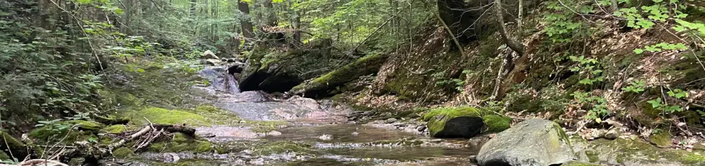
Slab Bridge Brook is a 2.61-mile out-and-back trail located in Vermont with a hard difficulty rating.
Morrill Brook
~0 min drive
A moderate 4.82-mile out-and-back trail in Vermont ideal for a half-day hike.
Velomont - Perspiration
~1 min drive
A 7.07-mile out-and-back trail in Vermont for hikers seeking a Vermont hiking experience.
Thousand Acre
~2 min drive
A 1.88-mile out-and-back trail in Vermont perfect for a quick nature walk.
Chittenden Brook
~6 min drive
A 7.14-mile loop following Chittenden Brook through Vermont forest.
A and D
~3 min drive
4.16-mile moderate out-and-back trail in Vermont.
Chitt. Bk. Outer Loop
~5 min drive
A moderate 6.84-mile loop through Vermont forest with varied terrain.
Bloodroot Gap
~5 min drive
A moderate 2.86-mile out-and-back trail in Vermont that connects to Telephone Gap, Wetmore Gap, and the Long Trail.
Long
~7 min drive
A 19.18-mile out-and-back Vermont trail offering extended backcountry hiking.
California Lot
~4 min drive
4.62-mile out-and-back trail in Vermont with moderate difficulty.
The Darning Needle
~9 min drive
A 7.42-mile out-and-back Vermont trail connecting to the Long Trail system.