Swamp Canyon Loop Trailhead
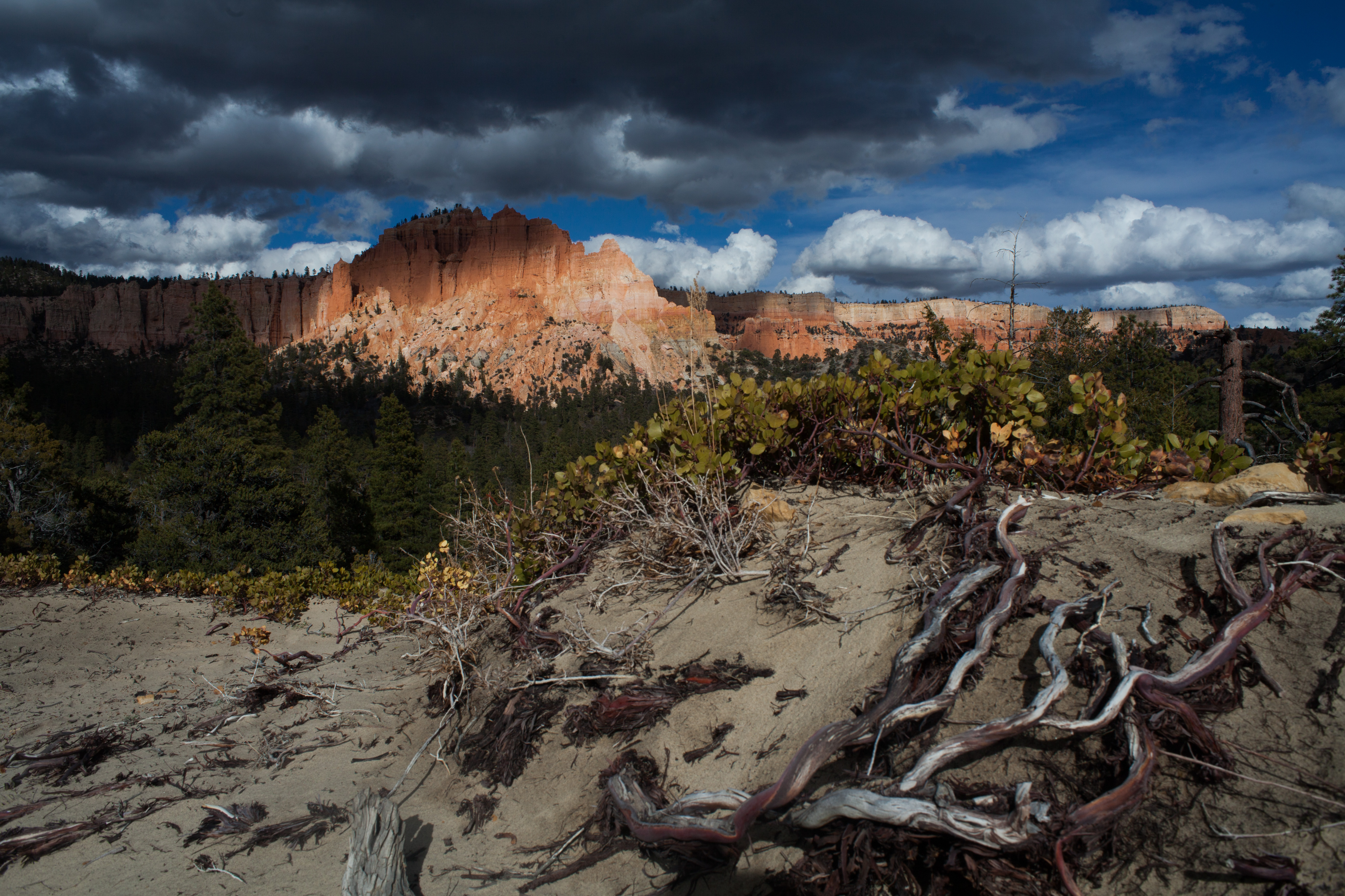 Photo: NPS Photo / Peter Densmore
- 0.9 mi
- loop
- 7,980 ft
- high point
- Loop
- route
- Easy
- difficulty
- May–Oct
- best months
Is Swamp Canyon Loop Trailhead open right now?
Closure in the area
There's a closure order in Bryce Canyon National Park. It doesn't name Swamp Canyon Loop Trailhead, so check the source for the area it covers.
Trail Closures Due to Recent Weather
Park closure covering Bryce Canyon National Park · NPS · Bryce Canyon National Park
Current Fire Restrictions
Park alert covering Bryce Canyon National Park · NPS · Bryce Canyon National Park
As of · Source: NPS · Bryce Canyon National Park. Agencies don't list every closure — check before you go.
Swamp Canyon Loop Difficulty: Moderate Total Distance: 4.0 miles (6.4 km) Ascent/Descent: 1,026 feet (313 m) / 1,034 feet (315 m) Average time: 3-4 hours The moderately strenuous 4.0 mi/6.4 km Swamp Canyon Loop begins here. The trail descends 647 ft/198 m to the canyon floor on a 3 - 4 hour hike. The loop is created by combining the Sheep Creek Connector Trail with 1.1 mi/1.8 km of the Under-the-Rim Trail and the Swamp Canyon Connector Trail. Both the Sheep Creek and Swamp Canyon connector trails provide access to the 23 mi/37 km Under-the-Rim Trail. Under-the-Rim Trail Difficulty: Strenuous Total Distance: 22.9 miles (37 km) from Rainbow Point to Bryce Point Ascent: 5,884 feet (1,793 m) Average time: 2-3 Days This trail may be inaccessible during mid-winter due to snow depths ranging from 2-15 ft (0.7-5 m). Experience the solitude of Bryce's forested backcountry on the Under-the-Rim Trail. Descending from the rim, this trail meanders through forests and meadows, offering stunning views of pink-hued cliffs in the distance. The Under the Rim Trail follows the base of the Paunsaugant Plateau and is largely forested. The hoodoos are part of the distant vistas to the west as you hike the valley floor. To preserve this experience, backcountry camping is permitted only in designated campsites. A backcountry permit must be obtained at the Visitor Center prior to any overnight trips. This trail is not as easily followed as developed trails within the Bryce Amphitheater. Backcountry Hiking and Camping The Under-the-Rim Trail is approximately 22.9 miles (36.9 km) from Bryce Point to Rainbow Point. Connecting trails offer access from the park's Scenic Drive and intersect the Under-the-Rim Trail at Swamp Canyon, and Whiteman Bench. Agua Canyon Connector Trail **is closed** until further notice due to storm damage. The Riggs Spring Loop is an 8.6 mile (13.9 km) hike beginning and ending at the Rainbow and Yovimpa Point parking lot at the south end of the Scenic Drive. Either the Yovimpa or Rainbow Point trailhead may be used to access this loop. A backcountry hiking map with mileage is available at the Visitor Center. More information Permits Required A Backcountry Permit is required for all overnight stays in the backcountry. Permit pick-up and walk-in permits are available at the Visitor Center from 8 a.m. until one hour before the visitor center closes. Backcountry campsites are limited to 6 people per regular site, and 15 people per group site. No Fires Permitted Though gas-powered cooking stoves are allowed, no open fires are allowed anywhere in the park outside of North and Sunset Campground's established fire rings. Bears and Other Wildlife Bryce Canyon is home to many animals including mountain lions, coyotes and black bears. Squirrels, snakes and other small animals may also be present near your campsite. Due to the presence of black bears within Bryce Canyon National Park, the use of bear-resistant food canisters on overnight backcountry hikes is highly recommended. Bear-resistant canisters are available for loan, free of charge, at the Visitor Center. Transportation No park-provided transportation is provided south of Bryce Point. You can arrange a private shuttle using approved providers listed on our Commercial Tours and Services page.
Local outfitters
- Ruby's Inn Bryce Canyon RV Park & Campground6 mi away
- Bryce Canyon Horseback Tours7 mi away
Not on Roamze yet. Their page has how to reach them.
- Nearby · Right Fork Swamp Canyon Campsite · Whiteman Trail Connections wayside · Rim Trail Inspiration Point Trailhead
Best time to go · May–Oct
Best time to visit Swamp Canyon Loop Trailhead
Best months: May–October. Best months have typical highs of 55–85 °F, lows of 30 °F or warmer (32 °F where the station doesn't record snow), at most one snowy day and no more than 12 wet days.
Jan
37° / 17°
6 wet
Feb
39° / 18°
7 wet
Mar
46° / 23°
7 wet
Apr
54° / 29°
6 wet
May
63° / 37°
5 wet
Jun
75° / 45°
4 wet
Jul
80° / 52°
8 wet
Aug
77° / 50°
10 wet
Sep
70° / 42°
7 wet
Oct
58° / 32°
5 wet
Nov
46° / 23°
5 wet
Dec
37° / 17°
6 wet
Typical high / low (°F) and days with rain or snow, 1991–2020. Measured at Bryce Canyon Np Hqrs, UT, 4.4 mi away at 7,890 ft. This station doesn't record snowfall. Source: NOAA NCEI U.S. Climate Normals 1991–2020.
Keep exploring — more trails worth the drive
 Photo: inkknife_2000 (7.5 million views +), CC BY-SA 2.0 (via Wikimedia Commons)
Right Fork Swamp Canyon Campsite
~1 min drive
Ultra-short walk to a backcountry campsite in Swamp Canyon.
HIKE
Whiteman Trail Connections wayside
~4 min drive
Here, the Whiteman Connecting Trail descends to the rugged 22.9-mile (36.9 km) Under-the-Rim backcountry trail, which travels north to Bryce Point and south to Rainbow Point. Day hikers can enjoy an out-and-back hike with views of the Paria Valley and Swamp Canyon.
HIKE
Rim Trail Inspiration Point Trailhead
~5 min drive
The Rim Trail Difficulty: Varies (Easy to Moderate) Total Distance: 5.5 miles (8.9 km) Ascent/Descent (South to North): 1,330 feet (405 m) / 1,825 feet (556 m) Average time: 3-4 hours The 5.5 mile (8.9 km) Rim Trail begins in the south at Bryce Point and ends in the north at…
HIKE
Grand View Trail
~6 min drive
Grand View Trail is a 149.84-mile out-and-back trail in Utah.
Photo: inkknife_2000 (7.5 million views +), CC BY-SA 2.0 (via Wikimedia Commons)Sheep Creek Connector Trail
~1 min drive
2.09-mile out-and-back trail in Utah with 794 ft elevation gain.
HIKE
Rim-Trail Inspiration Point wayside
~5 min drive
Rim Trail: Inspiration Point Orientation Hikers can enjoy an easy 0.7-mile (1.2 km) walk north to Sunset Point above the Silent City, or a moderate 1.5-mi (2.4 km) hike south along steep cliffs to Bryce Point. When the shuttle is running, it can be used to enjoy one-way…
HIKE
Peekaboo Loop, Hat Shop, and Under-the-Rim Trail Trailhead
~6 min drive
Peekaboo Loop Trail Difficulty: Strenuous Total Distance: 5.5 miles (8.8 km) Elevation change: 1,555 feet (473 m) Average time: 3-4 hours The Peekaboo Loop trail quickly descends over 1,000 feet (305 m) to the floor of the Bryce Amphitheater before travelling north into one…
HIKE
Whiteman Connecting Trail Trailhead
~4 min drive
Whiteman Connecting Trail Difficulty: Moderate Total Distance: 1.0 miles (1.6 km) Ascent/Descent: 16 feet (4.9 m) / 490 feet (149 m) Average time: 1-2 hours This trail may be inaccessible during mid-winter due to snow depths ranging from 2-15 ft (0.7-5 m). This trail…
HIKE
Wall of Windows Hike the Hoodoos
~5 min drive
I Hiked the Hoodoos Hiking is great exercise and Bryce Canyon's "I Hiked the Hoodoos!" program is not just hiking, it's also a scavenger hunt with a special reward! 1. Hike a minimum of 3 mi / 4.8 km, or find at least 3 benchmarks and complete steps 2 through 4 below. 2.…
 Photo: inkknife_2000 (7.5 million views +), CC BY-SA 2.0 (via Wikimedia Commons)
Peekaboo Loop Connector
~6 min drive
Peekaboo Loop Connector is a 0.98-mile out-and-back trail in Utah with 288 ft gain.
Also worth it near here


