

Muddy Creek Mining Co.
Hiking business nearby (~23 mi away) — hasn't claimed their Roamze page yet
Free — you'll pick up right here.
Watch this trail
Sign up to watch it — saving subscribes you to gate, closure and report changes.
Utah
4.2 mi
Distance
137 ft
Gain
1h 29m
Time
No agency boundary, access route or field report is mapped to it — so there is no verdict, and we won't guess. We'll tell you the moment this trail has something to say.
Covered nearby
Trails within 25 miles where we do have a current picture.
Nobody's filed a report here yet — be the first.
Why you'll love it
Lone Cedar Road
AI-suggested draft · review before you go
No permit or access details on file for this trail — check with the local land manager before you go.
Lone Cedar Road is a scenic 4.23-mile trail offering gentle terrain and minimal elevation gain, making it an ideal choice for families and casual hikers. This easy-going route winds through Utah's high desert landscape with characteristic vegetation and open vistas. The modest 137-foot elevation gain ensures a relaxed pace perfect for enjoying the surrounding natural beauty.
Lower Spring Canyon Trailhead
~60 min drive
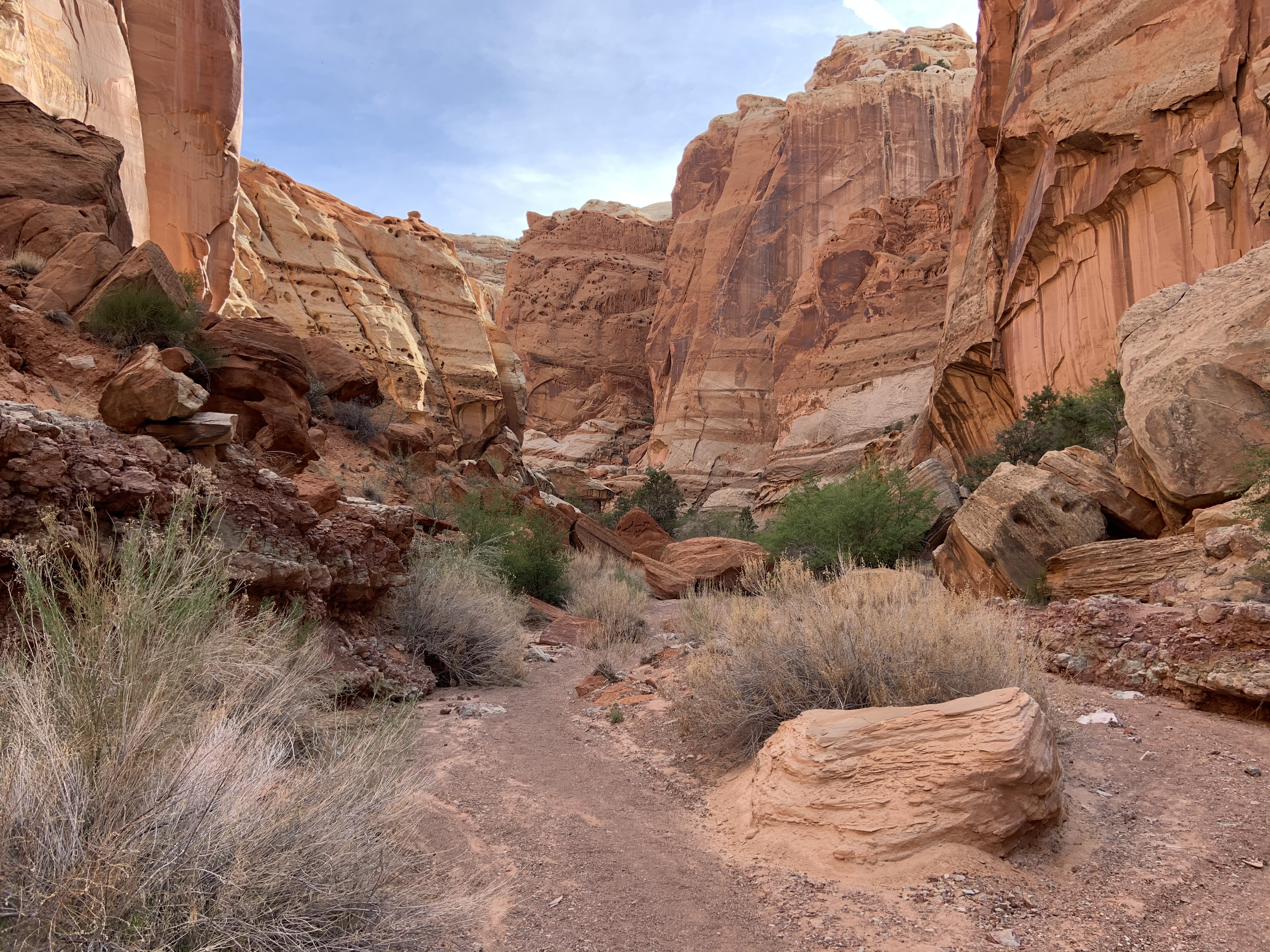
Up the road and across the river is the mouth of Lower Spring Canyon. This gorge extends behind the cliffs all the way west toward Chimney Rock. The trek twists through a towering tunnel of sandstone for over 7 miles (11.3 km). Lower Spring Canyon is one of many popular backpa…
South Fork Oak Creek Trail
~54 min drive
Moderate 9-mile creek canyon hike with 1,753 ft elevation gain through oak forest.
Jorgenson Trail
~59 min drive
Moderate 5.25-mile Utah trail with 474 ft elevation gain.
Bull Creek Pass Road
~12 min drive
Steady 8.4-mile climb to Bull Creek Pass with 2,884 ft elevation gain.
Nasty Flat Road
~18 min drive
Easy 2.65-mile trail with minimal elevation gain near Nasty Flat.
Mcmillan Springs Road
~20 min drive
Easy 2.48-mile road walk with minimal elevation gain near McMillan Springs.
Sr 95
~31 min drive
Remote 21-mile backcountry route with 2,100 ft elevation gain across Utah plateau.
Hite Crossing Bridge
~31 min drive
Quick riverside walk to historic Hite Crossing Bridge over the Colorado River.
Fortknocker Canyon Road
~33 min drive
Moderate 7.6-mile canyon road hike with 961 ft elevation gain.
Sr 95
~33 min drive
Easy 1.33-mile walk with minimal elevation gain along SR 95.
Local operatorsoffering guided trips. You book directly with them — Roamze doesn’t take a cut.
Muddy Creek Mining Co.
Hiking business nearby (~23 mi away) — hasn't claimed their Roamze page yet
Sand Creek RV Park & Campground
Hiking business nearby (~47 mi away) — hasn't claimed their Roamze page yet