South Loop Trail
- 2.7 mi
- round trip
- 288 ft
- climb
- Singletrack
- surface
- Out and back
- route
- Oct–May
- best months
Caution at last check
Agency alerts are in effect for this area; weather is good · USFS, OpenWeather · checked 16 h ago
Is South Loop Trail open right now?
Closure in the area
There's a closure order in National Forests in Texas. It doesn't name South Loop Trail, so check the source for the area it covers (2 listed).
Caddo-LBJ National Grasslands Office
Agency closure covering National Forests in Texas · USFS · National Forests in Texas
Know Before You Go, Davy Crockett and Sam Houston National Forests Road Work
Agency closure covering National Forests in Texas · USFS · National Forests in Texas
National Forests and Grasslands Burn Ban Information
Agency alert covering National Forests in Texas · USFS · National Forests in Texas
Sabine National Forest-Trail Between the Lakes
Agency alert covering National Forests in Texas · USFS · National Forests in Texas
Davy Crockett National Forest
Agency alert covering National Forests in Texas · USFS · National Forests in Texas
As of · Source: USFS · National Forests in Texas. Agencies don't list every closure — check before you go.
South Loop Trail is a 5.4-mile out-and-back mountain biking route in the Sam Houston Ranger District of the National Forests in Texas, managed by the Forest Service. The trail is rated moderate, with a one-way climb of about 74 feet from a starting elevation of 391 feet to a high point of 406 feet. The steepest stretch comes at about half a mile in, with a 7% grade. Spring and fall are the most comfortable times to ride. Typical averages from a nearby weather station in Huntsville show April highs around 77°F and October highs around 79°F, while July and August average in the low 90s. The North Loop Trail and Start Hill Trail both lie about 0.3 miles away, and the North Loop hike is a similar distance. For an overnight stay, Cagle Recreation Area is about 7 miles off.
- North Loop TrailMountain biking0.3 mi
- Start Hill TrailMountain biking0.3 mi
- North LoopHiking0.3 mi
- Dogwood TrailHiking0.5 mi
- SAM HOUSTON (Houston/Conroe/Huntsville Area)Lake fishing7.1 mi
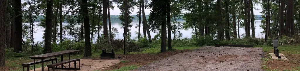 Cagle Recreation AreaCampingPhoto: Recreation.gov (RIDB) / public domain7.1 mi
 Stubblefield LakeCampingPhoto: Alexander Hatley, CC BY 2.0 (via Wikimedia Commons)8.5 mi
 CagleCampingPhoto: epicanis, CC BY-SA 3.0 (via Wikimedia Commons)8.6 mi
Source: Roamze catalog (indexable pages within 10 miles, PostGIS distance)
- North Loop TrailMountain biking · Next door
- North Loop TrailMountain biking · Next door
- Henry LakeMountain biking · ~42 min drive
- South Loop TrailMountain biking · Next door
- North Loop TrailMountain biking · ~3 min drive
- Dl Bike TrailMountain biking · ~42 min drive
- Start Hill TrailMountain biking · Next door
- Inner Loop TrailMountain biking · ~3 min drive
- Dl Bike Trail OutsideMountain biking · ~42 min drive
- North Loop TrailMountain biking · ~3 min drive
Best time to visit South Loop Trail
Best months: October–May. Best months have typical highs of 55–85 °F, lows of 30 °F or warmer (32 °F where the station doesn't record snow), at most one snowy day and no more than 12 wet days.
Jan
58° / 39°
9 wet
Feb
62° / 43°
9 wet
Mar
69° / 49°
8 wet
Apr
77° / 56°
7 wet
May
83° / 64°
7 wet
Jun
89° / 70°
8 wet
Jul
92° / 73°
7 wet
Aug
93° / 72°
7 wet
Sep
87° / 67°
7 wet
Oct
79° / 58°
7 wet
Nov
68° / 48°
7 wet
Dec
60° / 41°
9 wet
Typical high / low (°F) and days with rain or snow, 1991–2020. Measured at Huntsville, TX, 5.2 mi away at 494 ft. Source: NOAA NCEI U.S. Climate Normals 1991–2020.

Map and trail data © OpenStreetMap contributors
