Ycc
- 2.2 mi
- round trip
- 368 ft
- climb
- 351 ft
- high point
- Out and back
- route
- Oct–May
- best months
Is Ycc open right now?
Closure in the area
There's a closure order in National Forests in Texas. It doesn't name Ycc, so check the source for the area it covers.
Know Before You Go, Davy Crockett and Sam Houston National Forests Road Work
Agency closure covering National Forests in Texas · USFS · National Forests in Texas
National Forests and Grasslands Burn Ban Information
Agency alert covering National Forests in Texas · USFS · National Forests in Texas
Sabine National Forest-Trail Between the Lakes
Agency alert covering National Forests in Texas · USFS · National Forests in Texas
Davy Crockett National Forest
Agency alert covering National Forests in Texas · USFS · National Forests in Texas
As of · Source: USFS · National Forests in Texas. Agencies don't list every closure — check before you go.
Ycc is an easy out-and-back hike in the Sam Houston Ranger District of the National Forests in Texas, about 1.7 miles from the town of Moore Grove. The trail is managed by the Forest Service and is about 4.4 miles long, with a total elevation gain of 368 feet. The climb is gentle, with the steepest stretch at about 0.94 miles in, and the route reaches a high point of 351 feet. Spring and fall are the most comfortable times to go. Typical averages from a nearby weather station in Huntsville show April highs around 77°F and October highs around 79°F, while July and August average in the low 90s. Bikes and horses are both allowed on the trail. The Northwest and Fern hikes are each within about 2 miles, and the Cagle Recreation Area campground is about 3.2 miles away.
- NorthwestHiking1 mi
- FernHiking1.6 mi
- ZebraHiking1.7 mi
- SAM HOUSTON (Houston/Conroe/Huntsville Area)Lake fishing3.2 mi
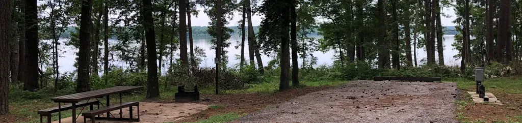 Cagle Recreation AreaCampingPhoto: Recreation.gov (RIDB) / public domain3.2 mi
 Stubblefield LakeCampingPhoto: Alexander Hatley, CC BY 2.0 (via Wikimedia Commons)4.1 mi
- Kelly's PondCamping6.7 mi
- West Fork San Jacinto RiverCanoeing9.4 mi
Source: Roamze catalog (indexable pages within 10 miles, PostGIS distance)
 Lake LoopHiking · ~5 min drivePhoto: epicanis, CC BY-SA 3.0 (via Wikimedia Commons)
 CagleHiking · ~5 min drivePhoto: epicanis, CC BY-SA 3.0 (via Wikimedia Commons)
 Triple C TrailHiking · ~8 min drivePhoto: Larry D. Moore, CC BY 4.0 (via Wikimedia Commons)
 Lone StarHiking · ~20 min drivePhoto: William L. Farr, CC BY 4.0 (via Wikimedia Commons)
- Little Lake CreekHiking · ~18 min drive
- Triple C CutoffHiking · ~6 min drivePhoto: Larry D. Moore, CC BY 4.0 (via Wikimedia Commons)
- FernHiking · ~3 min drive
- Iron Horse LoopHiking · ~17 min drive
- John's PointHiking · ~6 min drivePhoto: epicanis, CC BY-SA 3.0 (via Wikimedia Commons)
- ZebraHiking · ~3 min drive
Best time to visit Ycc
Best months: October–May. Best months have typical highs of 55–85 °F, lows of 30 °F or warmer (32 °F where the station doesn't record snow), at most one snowy day and no more than 12 wet days.
Jan
58° / 39°
9 wet
Feb
62° / 43°
9 wet
Mar
69° / 49°
8 wet
Apr
77° / 56°
7 wet
May
83° / 64°
7 wet
Jun
89° / 70°
8 wet
Jul
92° / 73°
7 wet
Aug
93° / 72°
7 wet
Sep
87° / 67°
7 wet
Oct
79° / 58°
7 wet
Nov
68° / 48°
7 wet
Dec
60° / 41°
9 wet
Typical high / low (°F) and days with rain or snow, 1991–2020. Measured at Huntsville, TX, 9.7 mi away at 494 ft. Source: NOAA NCEI U.S. Climate Normals 1991–2020.
