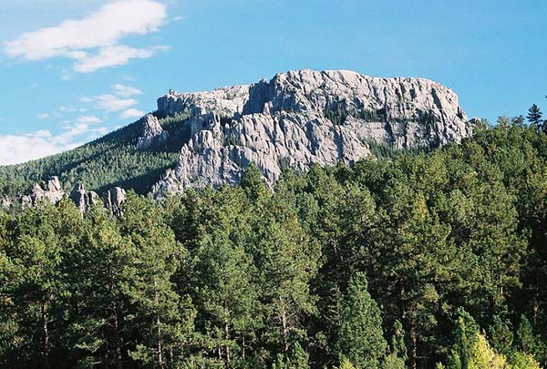
Sylvan Lake Campground
Campground
Campground · 0.7 mi from the trail
 Photo: Andrew Parlette from Elkridge,MD, US, CC BY 2.0 (via Wikimedia Commons)
Alert in the area
The Forest Service lists 5 alerts for Black Hills National Forest.
Pactola North Boat Ramp Closure
Agency alert covering Black Hills National Forest · USFS · Black Hills National Forest
14-day Limit for Camping/Occupancy in the Black Hills National Forest
Agency alert covering Black Hills National Forest · USFS · Black Hills National Forest
Topaz timber sale near Sturgis, SD Continues Operations
Agency alert covering Black Hills National Forest · USFS · Black Hills National Forest
Hwy 385 Construction Updates
Agency alert covering Black Hills National Forest · USFS · Black Hills National Forest
Open Fire Restriction - Black Hills NF in South Dakota
Agency alert covering Black Hills National Forest · USFS · Black Hills National Forest
As of · Source: USFS · Black Hills National Forest. Agencies don't list every closure — check before you go.
Thin Fin is a climbing area in South Dakota's Custer State Park, within the Hell Canyon Ranger District of Black Hills National Forest. State Park and Recreation manages the land, and the area sits close to the town of Custer, about 6 miles from the Custer weather station that provides typical climate averages. The climbing here runs from 5.6 to 5.10a, with 11 routes in all. About half are trad, and two are sport. The routes listed include Bend Over & Show Me Your Me Your Darkside at 5.6 and Nebulous at 5.10a, with a sport style. The Point / Beside The Point and The Galaxy climbing areas are both about 0.1 mile away. Summer is the most comfortable time to go. July typically averages a high of 80°F and a low of 56°F at the Custer station, while temperatures on the cliff run cooler than that. The station sits roughly 1,100 feet lower than the area, so expect the rock to be a bit colder. Nearby, the Little Devil's Tower Trail and the Cathedral Spires Trail are both about 0.4 mile away. Sylvan Lake is about 1.1 miles off, and Oreville Campground is about 4.2 miles away.
Sylvan Lake Campground
Campground
Laughing Water Restaurant
Restaurant
Bo The Bison
Attraction
Places © OpenStreetMap contributors
More in CusterThe Point / Beside The PointRock climbingPhoto: Andrew Parlette from Elkridge,MD, US, CC BY 2.0 (via Wikimedia Commons)0.1 miThe GalaxyRock climbingPhoto: Andrew Parlette from Elkridge,MD, US, CC BY 2.0 (via Wikimedia Commons)0.1 mi Oreville CampgroundCampingPhoto: Christine Warner, CC BY 2.0 (via Wikimedia Commons)4.2 mi
Source: Roamze catalog (indexable pages within 10 miles, PostGIS distance)
The GalaxyRock climbing · Next doorPhoto: Andrew Parlette from Elkridge,MD, US, CC BY 2.0 (via Wikimedia Commons) Bell TowerRock climbing · Next doorPhoto: Runner1928, CC BY-SA 4.0 (via Wikimedia Commons)SeashellRock climbing · Next doorPhoto: Runner1928, CC BY-SA 4.0 (via Wikimedia Commons)
 The FanRock climbing · Next doorPhoto: Runner1928, CC BY-SA 4.0 (via Wikimedia Commons)Needles Eye AreaRock climbing · Next doorPhoto: Runner1928, CC BY-SA 4.0 (via Wikimedia Commons)
 Spire TwoRock climbing · Next doorPhoto: Collin5526, CC BY-SA 4.0 (via Wikimedia Commons)Cathedral SpiresRock climbing · Next doorPhoto: Collin5526, CC BY-SA 4.0 (via Wikimedia Commons)
 Station 13Rock climbing · Next doorPhoto: w_lemay, CC BY-SA 2.0 (via Wikimedia Commons)Spire ThreeRock climbing · Next doorPhoto: w_lemay, CC BY-SA 2.0 (via Wikimedia Commons)
 East GruesomeRock climbing · ~1 min drivePhoto: w_lemay, CC BY-SA 2.0 (via Wikimedia Commons)
Best months: July–October. Best months have typical highs of 55–85 °F, lows of 30 °F or warmer (32 °F where the station doesn't record snow), at most one snowy day and no more than 12 wet days.
Jan
37° / 16°
5 wet
Feb
37° / 16°
5 wet
Mar
46° / 24°
7 wet
Apr
51° / 30°
9 wet
May
61° / 41°
14 wet
Jun
72° / 50°
13 wet
Jul
80° / 56°
11 wet
Aug
79° / 55°
9 wet
Sep
71° / 46°
7 wet
Oct
56° / 34°
6 wet
Nov
45° / 24°
4 wet
Dec
37° / 17°
4 wet
Typical high / low (°F) and days with rain or snow, 1991–2020. Measured at Custer, SD, 5.9 mi away at 5,480 ft. The station sits about 1,100 ft lower than this place, so expect it a little cooler here. This station doesn't record snowfall. Source: NOAA NCEI U.S. Climate Normals 1991–2020.