Steven Meadows Trail
- 0.6 mi
- loop
- 155 ft
- climb
- 487 ft
- high point
- Loop
- route
- Mar–Oct
- best months
Steven Meadows Trail is a short loop in Oregon, about 0.6 miles long, set at a low elevation of roughly 450 feet. It rises to about 490 feet and is rated easy, with a total climb of 155 feet. The trail is close to the community of Shadowood, about a mile away, and is compact enough to fit into a half hour. The loop is back-loaded, with the steepest section around 0.4 miles in, where the grade reaches about 8 percent. The total descent matches the climb. Spring and fall are the most comfortable times to go. Typical averages from the nearby Oregon City weather station, at about 170 feet, run from highs near 64°F in April to 65°F in October, while July and August average highs around 84°F. Rosemont Path at Luscher Farm starts just 0.2 miles away, and the Rosemont Trail is about a mile off. Farther out, Goose Hollow to Tryon Creek Trail lies roughly 2.4 miles away, and Fanno Creek offers paddling about 5.3 miles from the trail.
Local outfitters
- Beach Bandit Crab Snares9 mi away
- Wildwood Adventures9 mi away
Not on Roamze yet. Their page has how to reach them.
- Rosemont Path at Luscher FarmHiking0.2 mi
- Rosemont TrailHiking1.1 mi
- Goose Hollow to Tryon Creek TrailHiking2.4 mi
 Fanno CreekCanoeingPhoto: Finetooth, CC BY-SA 3.0 (via Wikimedia Commons)5.3 mi
- Abernethy CreekCanoeing9.3 mi
- Carver BoulderingRock climbing9.5 mi
- Main ForestRock climbing9.5 mi
- Rockgarden WallRock climbing9.5 mi
Source: Roamze catalog (indexable pages within 10 miles, PostGIS distance)
 Englewood Horse TrailHiking · ~5 min drivePhoto: mjfmjfmjf, CC BY 2.0 (via Flickr)
 Lewis & Clark College to Metzger Park TrailHiking · ~8 min drivePhoto: Doug Orleans, CC BY-SA 2.0 (via Flickr)
- West Horse LoopHiking · ~6 min drivePhoto: mjfmjfmjf, CC BY 2.0 (via Flickr)
- Goose Hollow to Tryon Creek TrailHiking · ~4 min drive
 Big Fir TrailHiking · ~6 min drivePhoto: mjfmjfmjf, CC BY 2.0 (via Flickr)
- Washington Park to Lesser Park TrailHiking · ~6 min drive
- Ruth Pennington Trillium TrailHiking · ~6 min drivePhoto: mjfmjfmjf, CC BY 2.0 (via Flickr)
- Tualatin River TrailHiking · ~6 min drive
- Maple Ridge TrailHiking · ~6 min drivePhoto: mjfmjfmjf, CC BY 2.0 (via Flickr)
- River View Natural Area TrailHiking · ~8 min drive
Also worth it near here
- George Rogers ParkBoat launch · ~4 min drive
 Mount SylvaniaSummit · ~6 min drivePhoto: M.O. Stevens, Public domain (via Wikimedia Commons)
- Fourth Avenue TrailMountain biking · ~6 min drive
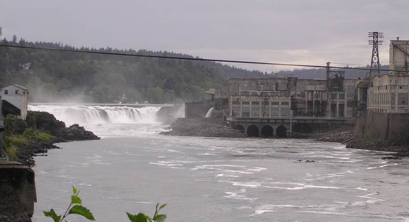 Willamette FallsWaterfall · ~8 min drivePhoto: The original uploader was Cacophony at English Wikipedia., CC BY-SA 3.0 (via Wikimedia Commons)
Best time to visit Steven Meadows Trail
Best months: March–October. Best months have typical highs of 55–85 °F, lows of 30 °F or warmer (32 °F where the station doesn't record snow), at most one snowy day and no more than 12 wet days.
Jan
48° / 37°
Feb
52° / 38°
Mar
58° / 40°
Apr
64° / 43°
May
71° / 48°
Jun
76° / 53°
Jul
84° / 57°
Aug
84° / 57°
Sep
78° / 53°
Oct
65° / 47°
Nov
53° / 41°
Dec
47° / 36°
Typical high / low (°F) and days with rain or snow, 1991–2020. Measured at Oregon City, OR, 5 mi away at 167 ft. This station doesn't record snowfall. Source: NOAA NCEI U.S. Climate Normals 1991–2020.
Map and trail data © OpenStreetMap contributors
