Little Minam Trail
- 1.6 mi
- round trip
- 888 ft
- climb
- 4,334 ft
- high point
- Out and back
- route
- Jun–Oct
- best months
Is Little Minam Trail open right now?
Closure in the area
There's a closure order in Wallowa-Whitman National Forest. It doesn't name Little Minam Trail, so check the source for the area it covers.
Anthony Fire Area Closure
Agency closure covering Wallowa-Whitman National Forest · USFS · Wallowa-Whitman National Forest
PHASE B FIRE RESTRICTIONS WALLOW-WHITMAN NATIONAL FOREST
Agency alert covering Wallowa-Whitman National Forest · Order 06-16-00-25-01 · USFS · Wallowa-Whitman National Forest
PHASE A FIRE RESTRICTIONS Wallowa-Whitman NATIONAL FOREST
Agency alert covering Wallowa-Whitman National Forest · Order 06-16-00-25-00 · USFS · Wallowa-Whitman National Forest
As of · Source: USFS · Wallowa-Whitman National Forest. Agencies don't list every closure — check before you go.
Little Minam Trail is an easy out-and-back hike in the Eagle Cap Wilderness, part of the Eagle Cap Ranger District of the Wallowa-Whitman National Forest in northeastern Oregon. The Forest Service manages the land, and the trail starts at about 3,892 feet, rising to a high point of 4,334 feet over a round-trip distance of about 3.2 miles with a total elevation gain of 888 feet. The steepest stretch comes at about 1.3 miles in, where the grade reaches 22%. Summer is the most comfortable time to go. Typical averages from a nearby weather station in Joseph, at a similar elevation, show July and August highs around 79 to 80°F with only five or six wet days a month, while winter highs stay in the mid-30s. Several other trails sit close by. Minam Lodge Trail is about 1.2 miles away, and Horse Ranch Trail is about 1.3 miles away. The Little Minam River, a canoeing route, is about 2.6 miles off, and Moss Springs Campground is about 5.2 miles away.
Local outfitters
- Oregon Backcountry Outfitting21 mi away
- Eagle Cap Mountain Guides26 mi away
Not on Roamze yet. Their page has how to reach them.
Best time to go · Jun–Oct
Best time to visit Little Minam Trail
Best months: June–October. Best months have typical highs of 55–85 °F, lows of 30 °F or warmer (32 °F where the station doesn't record snow), at most one snowy day and no more than 12 wet days.
Jan
35° / 19°
12 wet
Feb
39° / 19°
11 wet
Mar
46° / 26°
13 wet
Apr
52° / 30°
14 wet
May
61° / 39°
14 wet
Jun
68° / 44°
11 wet
Jul
79° / 49°
6 wet
Aug
80° / 49°
5 wet
Sep
71° / 43°
7 wet
Oct
56° / 34°
10 wet
Nov
43° / 25°
12 wet
Dec
35° / 18°
13 wet
Typical high / low (°F) and days with rain or snow, 1991–2020. Measured at Joseph, OR, 20.9 mi away at 4,184 ft. This station doesn't record snowfall. Source: NOAA NCEI U.S. Climate Normals 1991–2020.
Keep exploring — more trails worth the drive
 Photo: U.S. Forest Service- Pacific Northwest Region, Public domain (via Wikimedia Commons)
Wood Lake Trail
~19 min drive
6.8-mile out-and-back trail in Oregon with 3,031 ft elevation gain and loss.
 Photo: Forest Service Pacific Northwest Region, Public Domain Mark (via Flickr)
Francis Lake Trail
~23 min drive
17.96-mile out-and-back trail in Oregon with 4,921 ft elevation gain and loss.
 Photo: Forest Service Pacific Northwest Region, Public Domain Mark (via Flickr)
Long Lake Trail
~23 min drive
2.76-mile out-and-back hike in Oregon with 1,692 ft elevation gain
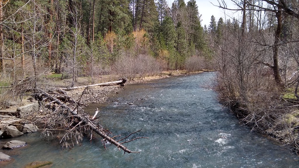 Photo: mjfmjfmjf, CC BY 2.0 (via Flickr)
Salmon Run Trail
~24 min drive
0.44-mile lollipop trail in Oregon with 321 ft gain and 260 ft loss.
HIKE
Standley Ridge Trail
~8 min drive
Standley Ridge Trail is a 4.98-mile out-and-back hike in Oregon with 453 feet of elevation gain.
HIKE
Horse Ranch Trail
~2 min drive
15.2-mile out-and-back trail in Oregon with 3,398 ft elevation gain
HIKE
Little Minam Trail
~6 min drive
7.02-mile out-and-back hike in Oregon with 1,878 ft elevation gain.
HIKE
Minam Lodge Trail
~2 min drive
1.38-mile out-and-back trail in Oregon with 741 ft elevation gain and 3,788 ft max elevation.
HIKE
Rock Springs Trail
~8 min drive
6.06-mile out-and-back hike in Oregon with 3,727 ft elevation gain/loss
HIKE
Jim White Trail
~5 min drive
16.76-mile out-and-back hike in Oregon with 4,725 ft elevation gain
Map and trail data © OpenStreetMap contributors
