Thunderbunny Trail
 Photo: RJ Bailey, CC BY 2.0 (via Flickr)
- 2.7 mi
- round trip
- 1,197 ft
- climb
- 830 ft
- high point
- Out and back
- route
- Jun–Oct
- best months
Thunderbunny Trail is a 5.3-mile out-and-back hike in Ohio, about 2.3 miles from the town of Sugar Creek. The route rises from a low point of 678 feet to a high of 830 feet, with a total elevation gain of 164 feet. It is rated moderate. Late spring and early fall are the most comfortable times to go. Typical averages from a nearby weather station in Athens show May highs around 72°F and September highs around 76°F, with September also seeing the fewest wet days of the year. Hollowpoint Trail starts just 0.1 mile away, and Blackhaw Accessible Trail and Vista Point Trail are each about 0.7 mile off. Climbers can find Commitment Boulder roughly 1.7 miles away.
Best time to go · Jun–Oct
Best time to visit Thunderbunny Trail
Best months: June–October. Best months have typical highs of 55–85 °F, lows of 30 °F or warmer (32 °F where the station doesn't record snow), at most one snowy day and no more than 12 wet days.
Jan
38° / 22°
13 wet
Feb
42° / 23°
11 wet
Mar
52° / 30°
12 wet
Apr
65° / 40°
13 wet
May
72° / 50°
13 wet
Jun
80° / 59°
12 wet
Jul
82° / 63°
11 wet
Aug
81° / 61°
10 wet
Sep
76° / 54°
9 wet
Oct
65° / 42°
10 wet
Nov
53° / 32°
11 wet
Dec
43° / 27°
13 wet
Typical high / low (°F) and days with rain or snow, 1991–2020. Measured at Athens Ou, OH, 4 mi away at 684 ft. This station doesn't record snowfall. Source: NOAA NCEI U.S. Climate Normals 1991–2020.
Keep exploring — more trails worth the drive
 Photo: RJ Bailey, CC BY 2.0 (via Flickr)
Blackhaw Accessible Trail
~1 min drive
0.94-mile out-and-back trail in Ohio with 561 ft elevation gain.
 Photo: MisterZero, CC BY-SA 3.0 (via Wikimedia Commons)
Sundown Trail
~4 min drive
6.28-mile point-to-point trail in Ohio with 1,589 ft gain.
 Photo: Wayne National Forest, Public Domain Mark (via Flickr)
Nebo Spirit
~10 min drive
10.45-mile out-and-back trail in Ohio with 1,070 ft elevation gain.
Photo: RJ Bailey, CC BY 2.0 (via Flickr)Vista Point Trail
~1 min drive
1.82-mile out-and-back trail in Ohio with 407 ft elevation gain.
 Photo: Wayne National Forest, Public Domain Mark (via Flickr)
Red Dog
~10 min drive
5.25-mile out-and-back trail in Ohio with 748 ft elevation gain
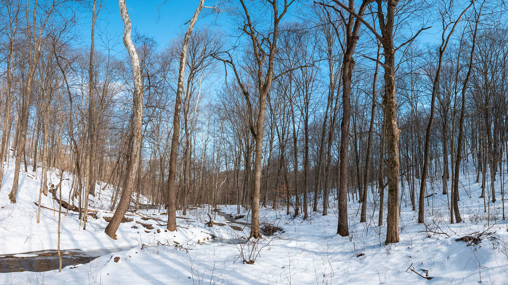 Photo: Wayne National Forest, Public Domain Mark (via Flickr)
Tipple Top
~11 min drive
8.88-mile out-and-back trail in Ohio with 611 ft elevation gain.
Photo: RJ Bailey, CC BY 2.0 (via Flickr)Broken Rock Trail
~2 min drive
1.29-mile point-to-point trail in Ohio with 323 ft gain.
Photo: Wayne National Forest, Public Domain Mark (via Flickr)Blue Devil
~11 min drive
5.33-mile out-and-back trail in Ohio with 761 ft elevation gain.
HIKE
Rockhouse Trail
~3 min drive
4.44-mile out-and-back hike in Ohio with 2,768 ft elevation gain.
Photo: MisterZero, CC BY-SA 3.0 (via Wikimedia Commons)Athens Trail
~2 min drive
0.71-mile out-and-back trail in Ohio with 106 ft gain and 378 ft loss.
Map and trail data © OpenStreetMap contributors
