Christmas Rocks Orange Loop Trail
- 1.9 mi
- one way
- 373 ft
- climb
- 1,189 ft
- high point
- Point to point
- route
- Apr–Oct
- best months
The Christmas Rocks Orange Loop Trail is a 1.9-mile point-to-point hike in Ohio's Christmas Rocks Dedicated Nature Preserve, managed by the State Department of Natural Resources. The route gains about 373 feet in elevation, with the high point at 1,189 feet and the low at 878 feet. The steepest stretch comes at about 1.3 miles in, where the grade reaches 25 percent. The trail is rated easy, and the preserve's rules make it a straightforward outing. Dogs, bikes and horses are not allowed, so plan on walking the route alone. For comfortable weather, aim for late spring or early fall. Typical averages from a nearby weather station in Lancaster put May highs around 74°F and September highs around 78°F, with October cooling to about 66°F. The Christmas Rocks Blue Loop Trail lies about a mile away, and the Lake Trail and Tulip Tree Trail are each roughly 2.8 miles off. Climbers can head to Geneva Hills, about 3.6 miles away.
Best time to go · Apr–Oct
Best time to visit Christmas Rocks Orange Loop Trail
Best months: April–October. Best months have typical highs of 55–85 °F, lows of 30 °F or warmer (32 °F where the station doesn't record snow), at most one snowy day and no more than 12 wet days.
Jan
37° / 22°
10 wet
Feb
41° / 24°
10 wet
Mar
52° / 32°
11 wet
Apr
65° / 41°
11 wet
May
74° / 52°
12 wet
Jun
82° / 61°
10 wet
Jul
85° / 65°
10 wet
Aug
84° / 63°
9 wet
Sep
78° / 55°
8 wet
Oct
66° / 44°
9 wet
Nov
53° / 34°
9 wet
Dec
42° / 27°
10 wet
Typical high / low (°F) and days with rain or snow, 1991–2020. Measured at Lancaster, OH, 5.7 mi away at 827 ft. This station doesn't record snowfall. Source: NOAA NCEI U.S. Climate Normals 1991–2020.
Keep exploring — more trails worth the drive
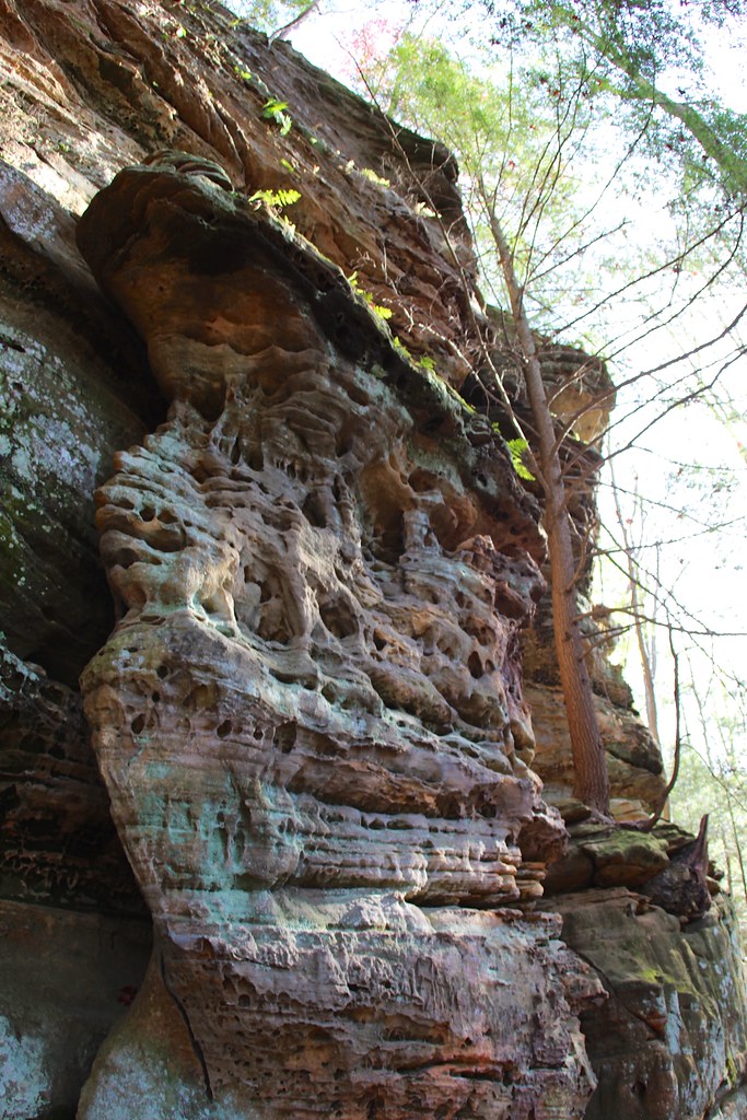 Photo: daveynin, CC BY 2.0 (via Flickr)
Cantwell Rim Trail
~13 min drive
0.58-mile lollipop trail in Ohio with 172 ft elevation gain.
 Photo: daveynin, CC BY 2.0 (via Flickr)
Conkles Hollow Rim Trail
~22 min drive
1.94-mile loop in Ohio with 706 ft gain and 770 ft loss.
HIKE
Cemetery Ridge Trail
~6 min drive
4.88-mile out-and-back hike in Ohio with 1,087 ft elevation gain
HIKE
Buckeye Trail (on-road)
~19 min drive
125-mile point-to-point trail in Ohio with 9,560 ft elevation gain.
 Photo: daveynin, CC BY 2.0 (via Flickr)
Rock Shelter Trail
~16 min drive
0.49-mile loop in Ohio with 82 ft gain and 145 ft loss.
HIKE
Chestnut Trail
~5 min drive
4.16-mile out-and-back trail in Ohio with 1,127 ft elevation gain.
HIKE
Christmas Rocks Blue Loop Trail
~2 min drive
1.64-mile loop trail in Ohio with 592 ft elevation gain/loss.
HIKE
Lake Trail
~5 min drive
0.96-mile out-and-back trail in Ohio with 290 ft of elevation gain.
HIKE
Tulip Tree Trail
~5 min drive
1.04-mile out-and-back trail in Ohio with 331 ft elevation gain
HIKE
Prairie Warbler Trail
~5 min drive
0.58-mile loop with 221 ft elevation gain in Ohio
Also worth it near here
Route details
- Distance
- 1.9 mi
- Climbing
- About 373 ft
- Summit
- 1,194 ft
- Difficulty
- Easy
- Time
- About 1 hour
Questions about this route
How long is the Christmas Rocks Orange Loop Trail on Jacobs Ladder?
About 1.9 mi.
How much elevation gain is on the Christmas Rocks Orange Loop Trail?
About 373 ft of climbing round trip.
How hard is the Christmas Rocks Orange Loop Trail?
It is rated easy.
How long does the Christmas Rocks Orange Loop Trail take?
About 1 hour round trip.
Conditions and forecast on Jacobs Ladder
Daily highs and lows, wind and the chance of precipitation at the summit and route start for the next 7 days, from the Open-Meteo model.
Map and trail data © OpenStreetMap contributors
