Forest River
- 46.7 mi
- distance
- 1,102 ft
- high point
- May–Sep
- best months
Forest River is a 47-mile paddling stretch near Forest River, North Dakota. It is intermittent and may run dry in some seasons. USGS models an average flow of about 37 cfs and a gradient of about 3.7 feet per mile.
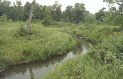 Tongue RiverCanoeing · ~1h 10m drivePhoto: Tim Kiser aka. Malepheasant at en.wikipedia, CC BY-SA 2.5 (via Wikimedia Commons)
 Goose RiverCanoeing · ~1h 20m drivePhoto: Andrew Filer, CC BY-SA 2.0 (via Wikimedia Commons)
- Park RiverCanoeing · ~26 min drive
- Snake RiverCanoeing · ~48 min drive
- Two RiversCanoeing · ~1h 12m drive
- Red Lake RiverCanoeing · ~1h 15m drive
Also worth it near here
Best time to visit Forest River
Best months: May–September. Best months have typical highs of 55–85 °F, lows of 30 °F or warmer (32 °F where the station doesn't record snow), at most one snowy day and no more than 12 wet days.
Jan
15° / 0°
Feb
21° / 4°
Mar
34° / 18°
Apr
52° / 33°
May
68° / 46°
Jun
79° / 57°
Jul
81° / 61°
Aug
80° / 59°
Sep
71° / 50°
Oct
54° / 36°
Nov
36° / 22°
Dec
21° / 7°
Typical high / low (°F) and days with rain or snow, 1991–2020. Measured at Grafton, ND, 12.3 mi away at 827 ft. This station doesn't record snowfall. Source: NOAA NCEI U.S. Climate Normals 1991–2020.


