Middle Hawksbill
Near Morganton
 Photo: npdoty, CC BY 2.0 (via Flickr)
- 29 routes
- 5.7 – 5.13a
- Sport · Trad · Mixed
Is Middle Hawksbill open right now?
Closure in the area
There's a closure order in National Forests in North Carolina. It doesn't name Middle Hawksbill, so check the source for the area it covers (2 listed).
Rainbow Springs Road closed for reconstruction
Agency closure covering National Forests in North Carolina · USFS · National Forests in North Carolina
Closures in anticipation of Hurricane Isaias
Agency closure covering National Forests in North Carolina · USFS · National Forests in North Carolina
Siddie Fields Day Use Area closed for improvements
Agency alert covering National Forests in North Carolina · USFS · National Forests in North Carolina
Pisgah National Forest Driving Safety Alert
Agency alert covering National Forests in North Carolina · USFS · National Forests in North Carolina
As of · Source: USFS · National Forests in North Carolina. Agencies don't list every closure — check before you go.
Best time to visit Middle Hawksbill
Best months: March–October. Best months have typical highs of 55–85 °F, lows of 30 °F or warmer (32 °F where the station doesn't record snow), at most one snowy day and no more than 12 wet days.
Jan
45° / 24°
Feb
47° / 26°
Mar
55° / 32°
Apr
64° / 39°
May
71° / 48°
Jun
78° / 57°
Jul
81° / 60°
Aug
80° / 59°
Sep
74° / 53°
Oct
65° / 42°
Nov
56° / 31°
Dec
48° / 27°
Typical high / low (°F) and days with rain or snow, 1991–2020. Measured at Spruce Pine 2 Ne, NC, 6.5 mi away at 2,850 ft. The station sits about 900 ft lower than this place, so expect it a little cooler here. This station doesn't record snowfall. Source: NOAA NCEI U.S. Climate Normals 1991–2020.
Middle Hawksbill is a climbing area in the Linville Gorge Wilderness, part of the Grandfather Ranger District of the National Forests in North Carolina. The Forest Service manages the land, and the area sits within designated wilderness, which sets it apart from other climbing spots in the state. The climbing here is a mix of sport, trad and mixed routes, with 29 routes in total. The grades run from 5.7 up to 5.13a, and the median is 5.11b. Among the named routes are Green Wall (5.7, mixed), Lichen Surprise (5.10a, sport) and Triple Bypass (5.13a, mixed). The area is close to Lower Hawksbill and Main Wall, both about 0.1 mile away. For timing, summer is the warmest stretch, with typical July highs around 81°F and lows near 60°F, based on averages from a nearby weather station at Spruce Pine. That station sits roughly 900 feet lower than the climbing area, so temperatures on the rock run cooler. Nearby, Jonas Ridge and the Hawksbill hike are both within half a mile. Linville Falls Campground is about 4.5 miles away, and the Linville River offers fishing about 3.6 miles off.
Routes (29)
Keep exploring — more climbs worth the drive
Photo: npdoty, CC BY 2.0 (via Flickr)Lower Hawksbill
~0 min drive
Lower Hawksbill in North Carolina has 18 routes across 11 grades, offering mixed and traditional climbing.
 Photo: npdoty, CC BY 2.0 (via Flickr)
Main Wall
~0 min drive
Main Wall in North Carolina has 6 traditional climbing routes across 5 grades.
Photo: npdoty, CC BY 2.0 (via Flickr)Hawksbill Mtn
~1 min drive
North Carolina mountain crag with varied climbing on natural rock.
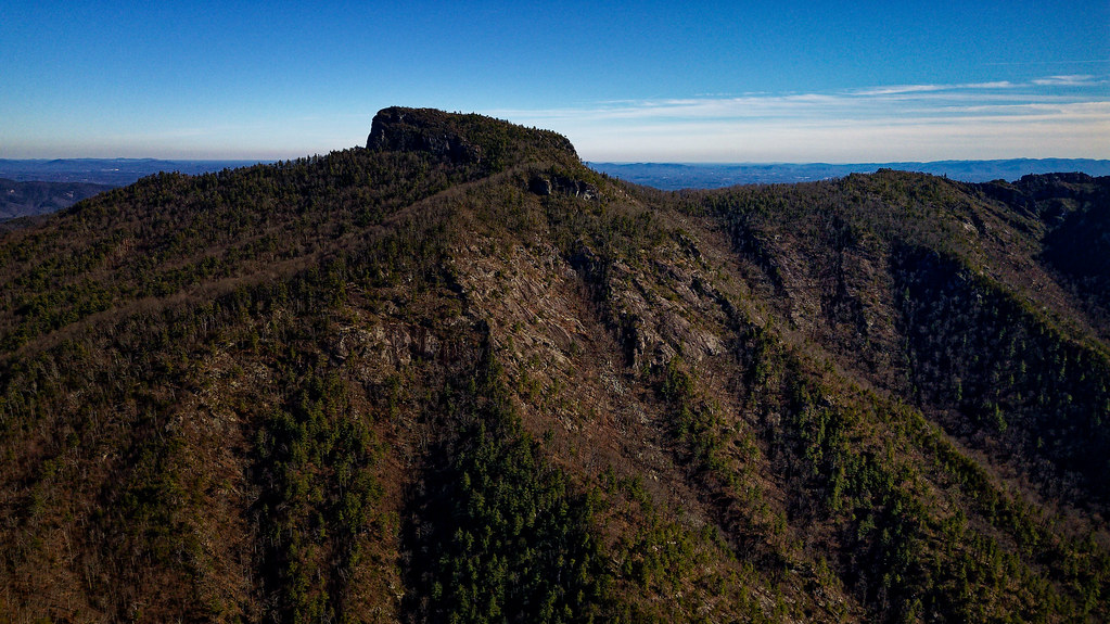 Photo: chascow, CC BY 2.0 (via Flickr)
Linville River Crag
~2 min drive
Linville River Crag in North Carolina has 21 climbing routes.
Photo: chascow, CC BY 2.0 (via Flickr)Linville Gorge Bouldering
~3 min drive
Linville Gorge Bouldering in North Carolina has 7 routes with 7 difficulty grades.
 Photo: LetTheCardsFall, CC BY-SA 2.0 (via Flickr)
Table Rock
~3 min drive
Table Rock in North Carolina has 63 climbing routes on mixed, sport, and trad.
Photo: LetTheCardsFall, CC BY-SA 2.0 (via Flickr)Henson Creek Canyon
~3 min drive
Henson Creek Canyon in North Carolina has 5 mixed and trad climbing routes across 4 grades.
Photo: LetTheCardsFall, CC BY-SA 2.0 (via Flickr)Conley Cove
~3 min drive
Conley Cove in North Carolina has 7 climbing routes with 5 difficulty grades.
 Photo: pmuellr, CC BY 2.0 (via Flickr)
Sunken Treasure
~23 min drive
Sunken Treasure in North Carolina has 12 climbing routes with 9 difficulty grades, offering mixed, sport, and trad styles.
 Photo: msprague, CC BY-SA 2.0 (via Flickr)
Wiseman's View
~2 min drive
Wiseman's View in North Carolina has 6 routes with mixed and traditional climbing styles.


