South Fork Rail Trail
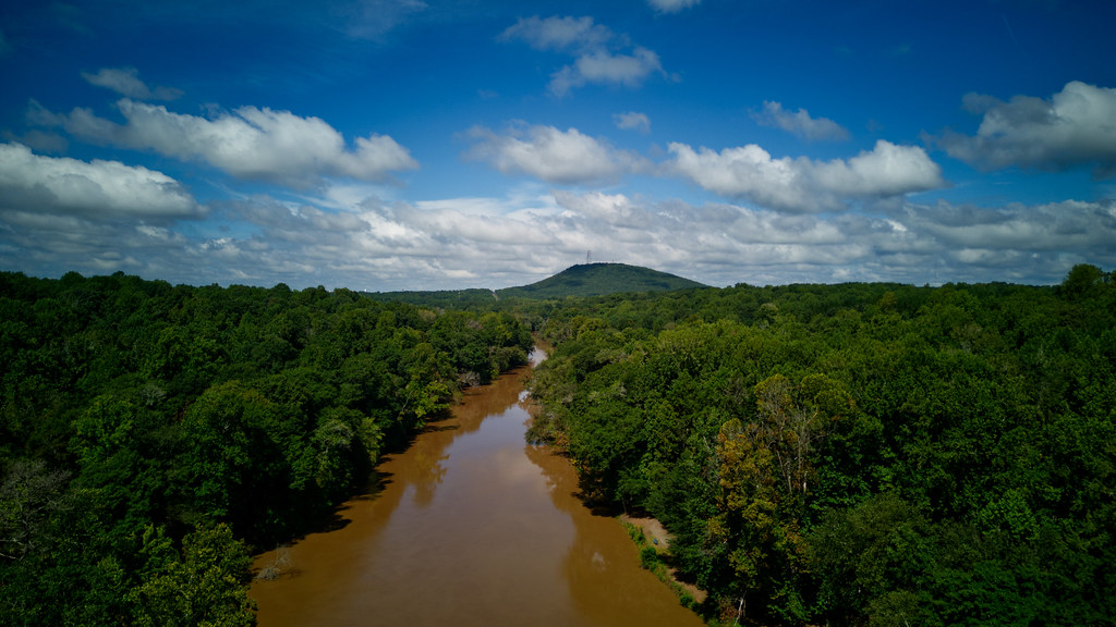
 Photo: chascow, CC BY 2.0 (via Flickr)
- 2.0 mi
- round trip
- 968 ft
- climb
- 865 ft
- high point
- Out and back
- route
- Feb–Jun, Sep–Nov
- best months
South Fork Rail Trail is an easy out-and-back hike in North Carolina, about 0.5 miles from the town of Laboratory. The trail is roughly 3.9 miles long, with a total elevation gain of 968 feet, and the high point reaches 865 feet. The climb is most pronounced in the middle of the route, with the steepest stretch at about 0.56 miles in, where the grade reaches 7 percent. Spring and fall are the most comfortable times to go. Typical averages from a nearby weather station in Lincolnton show October highs around 72°F with lows near 48°F, and April is similar at about 73°F by day and 47°F at night. Summer runs hotter, with July highs near 89°F. The trip takes about two hours. For more time on foot, Horseback Trail lies about 6.7 miles away. Paddlers can head to Long Creek, about 9.5 miles off, for canoeing.
Source: Roamze catalog (indexable pages within 10 miles, PostGIS distance)
 Spencer Mountain Loop (Yellow)Hiking · ~22 min drivePhoto: chascow, CC BY 2.0 (via Flickr)
 South Fork TrailHiking · ~25 min drivePhoto: chascow, CC BY 2.0 (via Flickr)
- Soccer Loop (Blue)Hiking · ~22 min drivePhoto: chascow, CC BY 2.0 (via Flickr)
 Tower TrailHiking · ~25 min drivePhoto: Bruce Kirchoff, CC BY 2.0 (via Flickr)
 Spencer Mountain Loop Option (Yellow)Hiking · ~22 min drivePhoto: chascow, CC BY 2.0 (via Flickr)
 Crowders TrailHiking · ~27 min drivePhoto: chascow, CC BY 2.0 (via Flickr)
- Soccer Loop (Green)Hiking · ~23 min drivePhoto: chascow, CC BY 2.0 (via Flickr)
- Crowders TrailHiking · ~27 min drivePhoto: chascow, CC BY 2.0 (via Flickr)
- Backside TrailHiking · ~25 min drivePhoto: Bruce Kirchoff, CC BY 2.0 (via Flickr)
 Ridgeline TrailHiking · ~29 min drivePhoto: pmuellr, CC BY 2.0 (via Flickr)
Also worth it near here
Best time to visit South Fork Rail Trail
Best months: February–June and September–November. Best months have typical highs of 55–85 °F, lows of 30 °F or warmer (32 °F where the station doesn't record snow), at most one snowy day and no more than 12 wet days.
Jan
51° / 30°
10 wet · 1 snow
Feb
56° / 33°
9 wet · 1 snow
Mar
64° / 39°
10 wet
Apr
73° / 47°
10 wet
May
79° / 56°
11 wet
Jun
85° / 64°
11 wet
Jul
89° / 67°
12 wet
Aug
87° / 66°
11 wet
Sep
82° / 60°
8 wet
Oct
72° / 48°
8 wet
Nov
62° / 38°
8 wet
Dec
54° / 33°
9 wet
Typical high / low (°F) and days with rain or snow, 1991–2020. Measured at Lincolnton 4 W, NC, 4.2 mi away at 887 ft. Source: NOAA NCEI U.S. Climate Normals 1991–2020.


Map and trail data © OpenStreetMap contributors
