Island Creek Loop C (orange)
- 1.7 mi
- loop
- 176 ft
- climb
- 126 ft
- high point
- Loop
- route
- Sep–May
- best months
Caution at last check
Agency alerts are in effect for this area; weather is good · USFS, OpenWeather · checked 18 h ago
Is Island Creek Loop C (orange) open right now?
Closure in the area
There's a closure order in National Forests in North Carolina. It doesn't name Island Creek Loop C (orange), so check the source for the area it covers (2 listed).
Maple Sally Road Closure
Agency closure covering National Forests in North Carolina · USFS · National Forests in North Carolina
Table Rock Road construction starts Nov. 2, 2026
Agency closure covering National Forests in North Carolina · USFS · National Forests in North Carolina
Temporary Closure - The Elk Falls Trail
Agency alert covering National Forests in North Carolina · USFS · National Forests in North Carolina
Rainbow Springs Road closed for reconstruction
Agency alert covering National Forests in North Carolina · USFS · National Forests in North Carolina
Siddie Fields Day Use Area closed for improvements
Agency alert covering National Forests in North Carolina · USFS · National Forests in North Carolina
As of · Source: USFS · National Forests in North Carolina. Agencies don't list every closure — check before you go.
Island Creek Loop C (orange) is a short, easy hike of about 1.7 miles in the Croatan Ranger District of the National Forests in North Carolina, managed by the Forest Service. The trail is a low-elevation outing, with a total climb of 176 feet and a drop of 140 feet along the way. The steepest stretch comes at about 0.58 miles in, with a grade of about 4 percent. Spring and fall are the most comfortable times to go. Typical averages from a nearby weather station in Perrytown show October highs around 74°F with lows near 54°F, and April is similar at about 74°F by day and 51°F at night. July and August run hotter, with highs in the upper 80s. The trail sits close to several other routes. Island Creek Loop B (yellow) is about 0.2 miles away and Island Creek Loop A (white) about 0.3 miles. Brice's Creek is roughly 5 miles off, and the New Bern Riverwalk is about 7.5 miles away.
- ISLAND CREEKHiking0.1 mi
- Island Creek Loop B (yellow)Hiking0.2 mi
- Island Creek Loop A (white)Hiking0.3 mi
- BRICE'S CREEKHiking5.2 mi
- New Bern RiverwalkHiking7.5 mi
- Jack Smith Creek Wetlands TrailHiking7.5 mi
- Explorer TrailHiking7.7 mi
- Island Pond TrailHiking8.5 mi
Source: Roamze catalog (indexable pages within 10 miles, PostGIS distance)
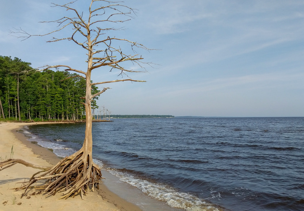 Wright TrailHiking · ~31 min drivePhoto: pmuellr, CC BY 2.0 (via Flickr)
 PINECLIFF HORSE TRAIL AHiking · ~33 min drivePhoto: bobistraveling, CC BY 2.0 (via Flickr)
- Neusiok TrailHiking · ~35 min drive
- Wright TrailHiking · ~31 min drivePhoto: pmuellr, CC BY 2.0 (via Flickr)
 PINECLIFF HORSE TRAIL CHiking · ~33 min drivePhoto: pmuellr, CC BY 2.0 (via Flickr)
- Weetock TrailHiking · ~27 min drive
- Wright TrailHiking · ~31 min drivePhoto: pmuellr, CC BY 2.0 (via Flickr)
- BRICE'S CREEKHiking · ~9 min drive
- Wright TrailHiking · ~32 min drivePhoto: pmuellr, CC BY 2.0 (via Flickr)
- Weetock TrailHiking · ~25 min drive
Best time to visit Island Creek Loop C (orange)
Best months: September–May. Best months have typical highs of 55–85 °F, lows of 30 °F or warmer (32 °F where the station doesn't record snow), at most one snowy day and no more than 12 wet days.
Jan
56° / 35°
11 wet
Feb
59° / 37°
10 wet
Mar
65° / 42°
11 wet
Apr
74° / 51°
10 wet
May
79° / 59°
11 wet
Jun
86° / 67°
12 wet
Jul
88° / 72°
14 wet
Aug
87° / 70°
14 wet
Sep
82° / 66°
12 wet
Oct
74° / 54°
10 wet
Nov
66° / 44°
10 wet
Dec
59° / 39°
12 wet
Typical high / low (°F) and days with rain or snow, 1991–2020. Measured at Perrytown, NC, 3.4 mi away at 28 ft. This station doesn't record snowfall. Source: NOAA NCEI U.S. Climate Normals 1991–2020.
Map and trail data © OpenStreetMap contributors
