Cattail Trail
- 0.8 mi
- loop
- 150 ft
- climb
- 704 ft
- high point
- Loop
- route
- Feb–May, Sep–Dec
- best months
Cattail Trail is a short, easy loop of about 0.77 miles inside Mecklenburg County Open Space - Latta Plantation Nature Preserve in North Carolina. The trail rises to a high point of about 704 feet and drops back down to around 640 feet, with the steepest stretch coming early on, about 0.21 miles from the start, where the grade reaches roughly 6 percent. Spring and fall are the most comfortable times to go. Typical averages from the nearby Charlotte Douglas airport weather station run from highs around 73°F in April and October to about 80°F in May, while July highs average around 90°F and winter brings lows near freezing. The Audubon Trail starts just 0.1 mile away, and the Catawba Trail and Spider Social Trail are within about half a mile. Climbers can head to Latta Nature Preserve, also about 0.6 mile off.
- Audubon TrailHiking0.1 mi
- Catawba TrailHiking0.5 mi
- Spider Social TrailHiking0.6 mi
 Buzzard Rock TrailHikingPhoto: chascow, CC BY 2.0 (via Flickr)0.6 mi
- Two-move rockRock climbing0.6 mi
- Wash RockRock climbing0.6 mi
- Latta Nature PreserveRock climbing0.6 mi
- Irwin CreekCanoeing8.7 mi
Source: Roamze catalog (indexable pages within 10 miles, PostGIS distance)
- Buzzard Rock TrailHiking · ~1 min drivePhoto: chascow, CC BY 2.0 (via Flickr)
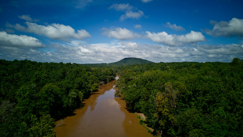 South Fork TrailHiking · ~17 min drivePhoto: chascow, CC BY 2.0 (via Flickr)
- Beechwood TrailHiking · ~1 min drivePhoto: chascow, CC BY 2.0 (via Flickr)
- Shady TrailHiking · ~2 min drivePhoto: chascow, CC BY 2.0 (via Flickr)
 Mountain Island TrailHiking · ~5 min drivePhoto: chascow, CC BY 2.0 (via Flickr)
 Canopy TrailHiking · ~17 min drivePhoto: chascow, CC BY 2.0 (via Flickr)
- Euler's Way TrailHiking · ~17 min drivePhoto: chascow, CC BY 2.0 (via Flickr)
- Eagle TrailHiking · ~18 min drivePhoto: chascow, CC BY 2.0 (via Flickr)
 Spencer Mountain Loop Option (Yellow)Hiking · ~19 min drivePhoto: chascow, CC BY 2.0 (via Flickr)
 Soccer Loop (Green)Hiking · ~19 min drivePhoto: chascow, CC BY 2.0 (via Flickr)
Best time to visit Cattail Trail
Best months: February–May and September–December. Best months have typical highs of 55–85 °F, lows of 30 °F or warmer (32 °F where the station doesn't record snow), at most one snowy day and no more than 12 wet days.
Jan
52° / 32°
10 wet · 1 snow
Feb
57° / 35°
9 wet · 1 snow
Mar
64° / 41°
10 wet
Apr
73° / 49°
9 wet
May
80° / 58°
10 wet
Jun
87° / 66°
10 wet
Jul
90° / 70°
11 wet
Aug
89° / 69°
10 wet
Sep
83° / 63°
8 wet
Oct
73° / 50°
8 wet
Nov
63° / 40°
8 wet
Dec
55° / 35°
10 wet
Typical high / low (°F) and days with rain or snow, 1991–2020. Measured at Charlotte Douglas Ap, NC, 8.9 mi away at 728 ft. Source: NOAA NCEI U.S. Climate Normals 1991–2020.
Map and trail data © OpenStreetMap contributors
