Badin Lake
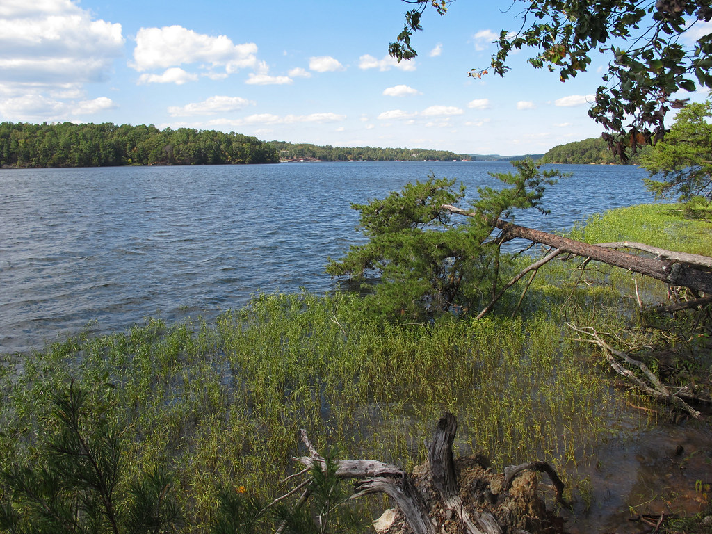 Photo: pmuellr, CC BY 2.0 (via Flickr)
- 5.4 mi
- loop
- 1,381 ft
- climb
- 683 ft
- high point
- Loop
- route
- Feb–Jun, Sep–Nov
- best months
Caution at last check
Agency alerts are in effect for this area; weather is good · USFS, OpenWeather · checked 15 h ago
Is BADIN LAKE open right now?
Closure in the area
There's a closure order in National Forests in North Carolina. It doesn't name BADIN LAKE, so check the source for the area it covers (2 listed).
Maple Sally Road Closure
Agency closure covering National Forests in North Carolina · USFS · National Forests in North Carolina
Table Rock Road construction starts Nov. 2, 2026
Agency closure covering National Forests in North Carolina · USFS · National Forests in North Carolina
Temporary Closure - The Elk Falls Trail
Agency alert covering National Forests in North Carolina · USFS · National Forests in North Carolina
Rainbow Springs Road closed for reconstruction
Agency alert covering National Forests in North Carolina · USFS · National Forests in North Carolina
Siddie Fields Day Use Area closed for improvements
Agency alert covering National Forests in North Carolina · USFS · National Forests in North Carolina
As of · Source: USFS · National Forests in North Carolina. Agencies don't list every closure — check before you go.
Badin Lake is a moderate loop hike of about 5.4 miles in the Uwharrie Ranger District of the National Forests in North Carolina, managed by the Forest Service. The route starts at about 562 feet and climbs to a high point of 683 feet, with a total gain of 1,381 feet and a total loss of 1,422 feet over the course of the loop. The steepest stretch comes at about 3.4 miles in, where the grade reaches 16 percent. Spring and fall are the most comfortable times to go. Typical averages from a nearby weather station in Albemarle show October highs around 73°F with lows near 50°F, and April highs around 72°F with lows near 48°F. The trail sits right beside Badin Lake, and Badin Lake Campground and Badin Lake Recreation Area are each about half a mile away. Arrowhead Campground is about 1.1 miles off, and the Blackburn Trail is about 1.4 miles away.
 Badin Lake CampgroundCampingPhoto: Nyttend, Public domain (via Wikimedia Commons)0.5 mi
- Badin Lake Recreation AreaLake fishing0.5 mi
- Badin Lake Group CampgroundCampingPhoto: Nyttend, Public domain (via Wikimedia Commons)0.5 mi
- GREG'S LOOPHikingPhoto: pmuellr, CC BY 2.0 (via Flickr)1.1 mi
- Arrowhead CampgroundCamping1.1 mi
- Cove Boat RampLake fishing1.2 mi
- BLACKBURN TRAILHiking1.4 mi
- LAKE TRAILHiking1.4 mi
Source: Roamze catalog (indexable pages within 10 miles, PostGIS distance)
- GREG'S LOOPHiking · ~2 min drivePhoto: pmuellr, CC BY 2.0 (via Flickr)
 Falls Dam TrailHiking · ~7 min drivePhoto: bobistraveling, CC BY 2.0 (via Flickr)
- Green Gap TrailHiking · ~8 min drivePhoto: bobistraveling, CC BY 2.0 (via Flickr)
 Fall Mountain TrailHiking · ~8 min drivePhoto: Gerry Dincher, CC BY-SA 2.0 (via Flickr)
- BLACKBURN TRAILHiking · ~2 min drive
 BUTTERMILK TRAILHiking · ~8 min drivePhoto: chascow, CC BY 2.0 (via Flickr)
- LAKE TRAILHiking · ~2 min drive
- BATES TRAILHiking · ~4 min drive
- LESLIE TRAILHiking · ~2 min drive
- Daniel TrailHiking · ~5 min drive
Best time to visit BADIN LAKE
Best months: February–June and September–November. Best months have typical highs of 55–85 °F, lows of 30 °F or warmer (32 °F where the station doesn't record snow), at most one snowy day and no more than 12 wet days.
Jan
51° / 31°
8 wet
Feb
55° / 33°
7 wet
Mar
62° / 40°
8 wet
Apr
72° / 48°
7 wet
May
79° / 57°
7 wet
Jun
85° / 66°
8 wet
Jul
89° / 69°
8 wet
Aug
87° / 68°
8 wet
Sep
81° / 62°
6 wet
Oct
73° / 50°
6 wet
Nov
62° / 40°
6 wet
Dec
54° / 34°
8 wet
Typical high / low (°F) and days with rain or snow, 1991–2020. Measured at Albemarle, NC, 7.7 mi away at 610 ft. This station doesn't record snowfall. Source: NOAA NCEI U.S. Climate Normals 1991–2020.
