Big Indian Mountain
- 3,699 ft
- summit
- 2
- ways up
- Sep
- best months
Big Indian Mountain is a summit in New York, 3,699 feet elevation. It is reached by the Big Indian - Fir Herd Path, a public trail that passes within 150 meters of the summit.
Conditions and forecast
Daily highs and lows, wind and the chance of precipitation at the summit and route start for the next 7 days, from the Open-Meteo model.
- Summit elevation
- 3,699 ft
Elevation from USGS 3D Elevation Program terrain data (about 10 m resolution).
- Big Indian - Fir Herd PathModerateabout 879 ft of climbing3.5 mi round trip
- Pine Hill - West Branch TrailModerateabout 4,323 ft of climbing13.5 mi
Compare the routes Big Indian - Fir Herd Path Pine Hill - West Branch Trail Climbing About 879 ft About 4,323 ft Round trip 3.5 mi 13.5 mi Difficulty Moderate Moderate Terrain Hike Hike Map © Mapbox © OpenStreetMap contributors Questions about Big Indian Mountain
How tall is Big Indian Mountain?
3,699 ft (1,127 m).
How many routes go to the summit of Big Indian Mountain?
2: Big Indian - Fir Herd Path and Pine Hill - West Branch Trail.
What is the shortest route up Big Indian Mountain?
Big Indian - Fir Herd Path, about 3.5 mi round trip.
- Fir Mountain3,629 ft · New York2 routes1.5 mi away
 Graham Mountain3,867 ft · New York1 route2.7 mi awayPhoto: Daniel Case, CC BY-SA 3.0 (via Wikimedia Commons)
- Haynes Mountain3,412 ft · New York1 route3.1 mi away
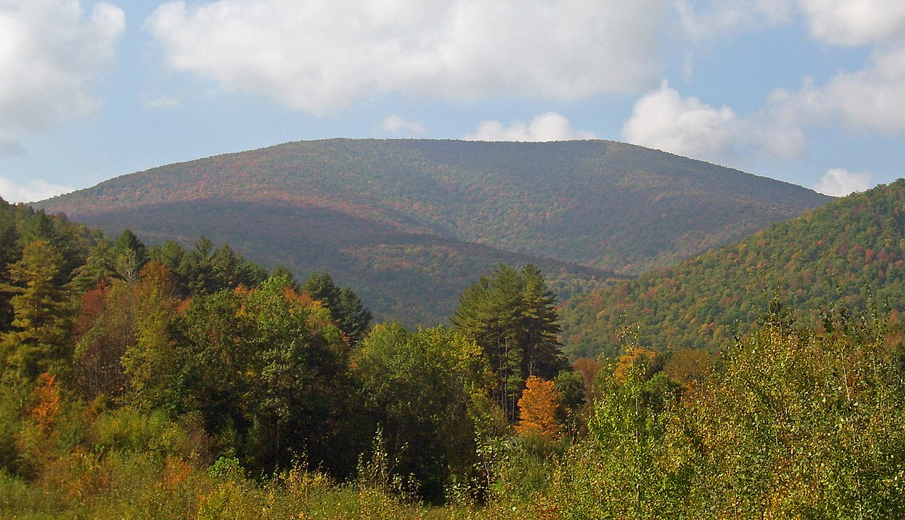 Balsam Mountain3,607 ft · New York1 route3.9 mi awayPhoto: Daniel Case, CC BY-SA 3.0 (via Wikimedia Commons)
 Panther Mountain3,724 ft · New York1 route5.5 mi awayPhoto: The original uploader was Daniel Case at English Wikipedia., CC BY-SA 3.0 (via Wikimedia Commons)
- Lone Mountain3,699 ft · New York2 routes7.1 mi away
- Big Indian - Fir Herd PathHiking1.5 mi
- Fir Herd PathHiking1.8 mi
- Seager - Big indian Trail (Yellow)Hiking2.7 mi
- Oliverea-Mapledale Trail - redHiking2.7 mi
- Line ShackHiking3 mi
- Rocky RoadHiking3 mi
- Primitive CampsiteCamping4.9 mi
 Esopus CreekCanoeingPhoto: Daniel Case, CC BY-SA 4.0 (via Wikimedia Commons)8.8 mi
Source: Roamze catalog (indexable pages within 10 miles, PostGIS distance)
 Eagle MountainSummit · ~3 min drivePhoto: TheTurducken. Edited slightly prior to upload by Daniel Case, CC BY 2.0 (via Wikimedia Commons)
- Graham MountainSummit · ~5 min drivePhoto: Daniel Case, CC BY-SA 3.0 (via Wikimedia Commons)
- Balsam MountainSummit · ~7 min drivePhoto: Daniel Case, CC BY-SA 3.0 (via Wikimedia Commons)
 Balsam Lake MountainSummit · ~9 min drivePhoto: Daniel Case, CC BY-SA 3.0 (via Wikimedia Commons)
- Panther MountainSummit · ~9 min drivePhoto: The original uploader was Daniel Case at English Wikipedia., CC BY-SA 3.0 (via Wikimedia Commons)
 Slide MountainSummit · ~11 min drivePhoto: Famartin, CC BY-SA 4.0 (via Wikimedia Commons)
 Table MountainSummit · ~12 min drivePhoto: Daniel Case, CC BY-SA 3.0 (via Wikimedia Commons)
 Peekamoose MountainSummit · ~13 min drivePhoto: Kevin Kenny from Niskayuna, NY, Schenectady. Cropped and color-corrected prior to upload by Daniel Case, CC BY-SA 2.0 (via Wikimedia Commons)
 Mount SherrillSummit · ~20 min drivePhoto: Daniel Case, CC BY-SA 3.0 (via Wikimedia Commons)
 High PointSummit · ~23 min drivePhoto: Magpieturtle, CC BY 4.0 (via Wikimedia Commons)
Best time to visit Big Indian Mountain
Best months: September. Best months have typical highs of 55–85 °F, lows of 30 °F or warmer (32 °F where the station doesn't record snow), at most one snowy day and no more than 12 wet days.
Jan
28° / 12°
16 wet
Feb
30° / 13°
14 wet
Mar
38° / 20°
15 wet
Apr
51° / 31°
13 wet
May
62° / 43°
15 wet
Jun
69° / 51°
14 wet
Jul
74° / 56°
13 wet
Aug
73° / 54°
13 wet
Sep
67° / 48°
12 wet
Oct
55° / 38°
14 wet
Nov
43° / 28°
13 wet
Dec
32° / 19°
16 wet
Typical high / low (°F) and days with rain or snow, 1991–2020. Measured at Slide Mtn, NY, 4.3 mi away at 2,650 ft. The station sits about 1,000 ft lower than this place, so expect it a little cooler here. This station doesn't record snowfall. Source: NOAA NCEI U.S. Climate Normals 1991–2020.

