Bear Mountain
- 2,188 ft
- summit
- 1
- way up
- Aug–Sep
- best months
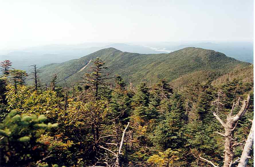
Bear Mountain is a summit in New York, rising to 2,188 feet about 3 miles from the community of Cranberry Lake. It sits in a cluster of trails, with Bear Mountain Trail and Campground Trail both within a mile, so it works well as a destination for a short outing or as a high point to pair with a longer walk in the area. Summer is the most comfortable time to go. Typical averages from a nearby weather station show July highs around 79°F with lows near 55°F, and the summit sits higher than that station, so temperatures on top run cooler. Winters are cold, with January highs averaging about 29°F. Bear Mountain Trail and Campground Trail are the closest routes, and Hedgehog Pond Trail is about 2 miles away. For time on the water, the Oswegatchie River is roughly 10 miles off.
Conditions and forecast
Daily highs and lows, wind and the chance of precipitation at the summit and route start for the next 7 days, from the Open-Meteo model.
- Summit elevation
- 2,188 ft
Elevation from USGS 3D Elevation Program terrain data (about 10 m resolution).
Map © Mapbox © OpenStreetMap contributors Questions about Bear Mountain
How tall is Bear Mountain?
2,188 ft (667 m).
How many routes go to the summit of Bear Mountain?
One: Bear Mountain Trail.
- Cat Mountain2,266 ft · New York1 route7.1 mi away
- Goodman Mountain2,185 ft · New York1 route15 mi away
 Coney Mountain2,297 ft · New York1 route16 mi awayPhoto: Dclemens1971, CC BY 4.0 (via Wikimedia Commons)
 Buck Mountain2,423 ft · New York1 route17 mi awayPhoto: Dclemens1971, CC BY 4.0 (via Wikimedia Commons)
- Floodwood Mountain2,315 ft · New York1 route20 mi away
- Long Pond Mountain2,530 ft · New York1 route24 mi away
 Campground TrailHikingPhoto: Tony Webster, CC BY 2.0 (via Flickr)0.8 mi
- Bear Mountain TrailHikingPhoto: Tony Webster, CC BY 2.0 (via Flickr)0.9 mi
- Hedgehog Pond TrailHiking1.9 mi
 Peavine Swamp Ski Trail - Loop 1HikingPhoto: Tony Webster, CC BY-SA 2.0 (via Flickr)2.4 mi
- Peavine Swamp Ski Trail - Loop 2HikingPhoto: Tony Webster, CC BY-SA 2.0 (via Flickr)3 mi
- Brandy Brook Flow TrailHiking3.1 mi
- J: Cranberry LakeRock climbing7.9 mi
 Oswegatchie RiverCanoeingPhoto: Mwanner, CC BY-SA 3.0 (via Wikimedia Commons)9.8 mi
Source: Roamze catalog (indexable pages within 10 miles, PostGIS distance)
- Coney MountainSummit · ~27 min drivePhoto: Dclemens1971, CC BY 4.0 (via Wikimedia Commons)
 Mount MorrisSummit · ~29 min drivePhoto: Dclemens1971, CC BY 4.0 (via Wikimedia Commons)
- Buck MountainSummit · ~29 min drivePhoto: Dclemens1971, CC BY 4.0 (via Wikimedia Commons)
 Owls Head MountainSummit · ~39 min drivePhoto: Dclemens1971, CC BY 4.0 (via Wikimedia Commons)
 Kempshall MountainSummit · ~46 min drivePhoto: Andy Arthur, CC BY 2.0 (via Wikimedia Commons)
 Stony Creek MountainSummit · ~47 min drivePhoto: Mwanner at en.wikipedia, CC BY-SA 3.0 (via Wikimedia Commons)
 Azure MountainSummit · ~49 min drivePhoto: Mwanner, CC BY-SA 3.0 (via Wikimedia Commons)
 Mount EmmonsSummit · ~51 min drivePhoto: petersent, Public domain (via Wikimedia Commons)
 Donaldson MountainSummit · ~51 min drivePhoto: petersent, Public domain (via Wikimedia Commons)
 Blue MountainSummit · ~52 min drivePhoto: Anne LaBastille, Public domain (via Wikimedia Commons)
Best time to visit Bear Mountain
Best months: August–September. Best months have typical highs of 55–85 °F, lows of 30 °F or warmer (32 °F where the station doesn't record snow), at most one snowy day and no more than 12 wet days.
Jan
29° / 5°
17 wet
Feb
31° / 5°
14 wet
Mar
40° / 13°
13 wet
Apr
54° / 30°
12 wet
May
67° / 41°
13 wet
Jun
76° / 50°
13 wet
Jul
79° / 55°
13 wet
Aug
78° / 54°
12 wet
Sep
71° / 46°
12 wet
Oct
57° / 36°
14 wet
Nov
45° / 25°
15 wet
Dec
33° / 14°
17 wet
Typical high / low (°F) and days with rain or snow, 1991–2020. Measured at Wanakena Rngr School, NY, 5.5 mi away at 1,510 ft. The station sits about 700 ft lower than this place, so expect it a little cooler here. This station doesn't record snowfall. Source: NOAA NCEI U.S. Climate Normals 1991–2020.
