Samuel F. Pryor III Shawangunk Gateway Campground
Campground
Campground · 1.6 mi from the trail
 Photo: Tom Marvel, CC BY 2.0 (via Wikimedia Commons)
Trapps Trail is an easy out-and-back hike of about 2.7 miles on the Mohonk Preserve in New York, managed by a non-governmental organization. The trail starts at roughly 1,047 feet and reaches a high point of about 1,072 feet, with a total elevation gain of about 619 feet for the round trip. The steepest stretch comes at about 0.6 miles in, with a grade of about 4 percent. Late spring and early fall are the most comfortable times to go. Typical averages from the nearby Mohonk Lake weather station show May highs around 71°F and September highs around 73°F, while winter brings highs in the mid-30s and several snowy days a month from December through February. The hike takes about an hour. The trail is close to several climbing areas, including d. Harvest Moon to the End and Peterskill Bouldering, both about 0.8 miles away, and the Millbrook Mountain Trail, about 0.9 miles away.
Samuel F. Pryor III Shawangunk Gateway Campground
Campground
 If it rainsThe original uploader was Daniel Case at English Wikipedia ., CC BY-SA 3.0 · Wikimedia Commons
Places © OpenStreetMap contributors, Places © Overture Maps Foundation · Photos: The original uploader was Daniel Case at English Wikipedia ., CC BY-SA 3.0 (commons)
More in New WindsorNot on Roamze yet. Their page has how to reach them.
 t. Mya to the East EndRock climbingPhoto: bgreenlee, CC BY 2.0 (via Flickr)0.8 mi
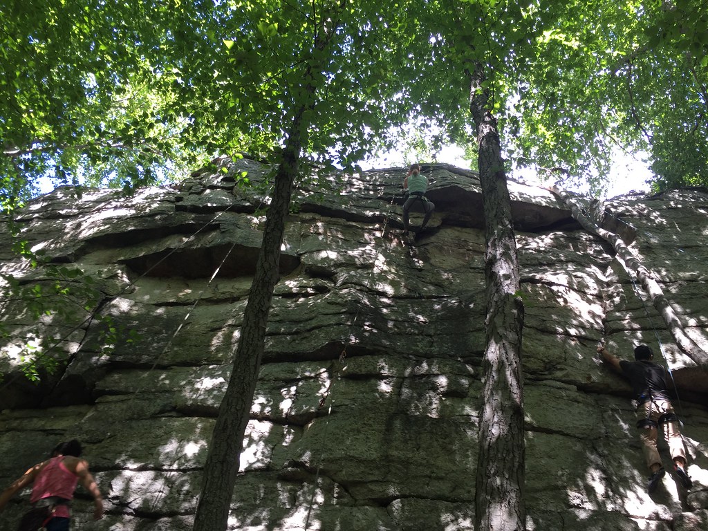 s. The Golden WallRock climbingPhoto: bgreenlee, CC BY 2.0 (via Flickr)0.8 mi
 Millbrook Mountain TrailHikingPhoto: Tainanian, CC BY 2.0 (via Flickr)0.9 mi
 Coxing TrailHikingPhoto: Tainanian, CC BY 2.0 (via Flickr)1.3 mi
 Millbrook Ridge TrailHikingPhoto: sarahebourne, CC BY 2.0 (via Flickr)1.3 miHigh Peter's Kill TrailHikingPhoto: Tom Marvel, CC BY 2.0 (via Wikimedia Commons)1.4 mi
Source: Roamze catalog (indexable pages within 10 miles, PostGIS distance)
Millbrook Mountain TrailHiking · ~2 min drivePhoto: Tainanian, CC BY 2.0 (via Flickr)Coxing TrailHiking · ~2 min drivePhoto: Tainanian, CC BY 2.0 (via Flickr)Millbrook Ridge TrailHiking · ~2 min drivePhoto: sarahebourne, CC BY 2.0 (via Flickr)High Peter's Kill TrailHiking · ~2 min drivePhoto: Tom Marvel, CC BY 2.0 (via Wikimedia Commons)King's LaneHiking · ~2 min drivePhoto: sarahebourne, CC BY 2.0 (via Flickr)Old Minnewaska TrailHiking · ~3 min drivePhoto: sarahebourne, CC BY 2.0 (via Flickr) Undivided Lot TrailHiking · ~10 min drivePhoto: ossguy, CC BY-SA 2.0 (via Flickr)
 Lower Awosting CarriagewayHiking · ~6 min drivePhoto: ceonyc, CC BY-SA 2.0 (via Flickr)
 Gertrude's Nose TrailHiking · ~3 min drivePhoto: Tainanian, CC BY 2.0 (via Flickr)
 Wallkill Valley Rail Trail - HikingHiking · ~11 min drivePhoto: MAXahf, CC BY-SA 3.0 (via Wikimedia Commons)
Best months: April and June–October. Best months have typical highs of 55–85 °F, lows of 30 °F or warmer (32 °F where the station doesn't record snow), at most one snowy day and no more than 12 wet days.
Jan
34° / 19°
11 wet · 7 snow
Feb
37° / 20°
9 wet · 6 snow
Mar
46° / 27°
11 wet · 4 snow
Apr
60° / 39°
11 wet · 1 snow
May
71° / 50°
13 wet
Jun
78° / 59°
12 wet
Jul
83° / 64°
12 wet
Aug
80° / 63°
11 wet
Sep
73° / 56°
10 wet
Oct
61° / 45°
11 wet
Nov
49° / 35°
10 wet · 2 snow
Dec
38° / 25°
11 wet · 5 snow
Typical high / low (°F) and days with rain or snow, 1991–2020. Measured at Mohonk Lake, NY, 4.3 mi away at 1,245 ft. Source: NOAA NCEI U.S. Climate Normals 1991–2020.
Map and trail data © OpenStreetMap contributors
