Lone-Rocky Herd Path
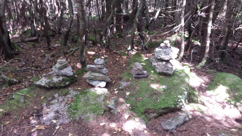 Photo: ke9tv, CC BY-SA 2.0 (via Flickr)
- 1.0 mi
- round trip
- 790 ft
- climb
- 3,707 ft
- high point
- Out and back
- route
- Sep
- best months
Lone-Rocky Herd Path is a 2-mile out-and-back hike in the Slide Mountain Wilderness of New York, managed by the State Department of Conservation. The trail starts at the high point of 3,707 feet and descends to 3,205 feet, with a total elevation gain of 790 feet for the round trip. The climb is back-loaded, with the steepest stretch at about 0.2 miles from the start, where the grade reaches 26 percent. Summer is the most comfortable time to go. Typical averages from a nearby weather station at Slide Mtn, which sits about 1,050 feet lower, show July highs around 74°F with lows near 56°F. That station's figures are not directly comparable to the trail's higher elevation, so expect cooler temperatures on the path. The hike takes about an hour. Fisherman's Path - Lone Herd Path lies just 0.1 mile away, and Friday - Wittenberg - Cornell - Slide Trail Herd Path is about 2 miles off. Primitive Campsite and the Phoenicia - East Branch Trail are both roughly 2.3 miles away.
Local outfitters
- Catskill Outfitters8 mi away
Not on Roamze yet. Their page has how to reach them.
Conditions and forecast on Lone Mountain
Daily highs and lows, wind and the chance of precipitation at the summit and route start for the next 7 days, from the Open-Meteo model.
- Fisherman's Path - Lone Herd PathHikingPhoto: ke9tv, CC BY-SA 2.0 (via Flickr)0.1 mi
 Friday - Wittenberg - Cornell - Slide Trail Herd PathHikingPhoto: New York Public Library, No restrictions (via Wikimedia Commons)2 mi
- Fishermen's PathHiking2 mi
- Primitive CampsiteCamping2.3 mi
 Phoenicia - East Branch TrailHikingPhoto: daveclausen, CC BY 2.0 (via Flickr)2.3 mi
 Esopus CreekCanoeingPhoto: Daniel Case, CC BY-SA 4.0 (via Wikimedia Commons)3.6 mi
 Rondout CreekCanoeingPhoto: Daniel Case, CC BY-SA 3.0 (via Wikimedia Commons)8.2 mi
- Phoenicia, Sportsman's WallRock climbing9.1 mi
Source: Roamze catalog (indexable pages within 10 miles, PostGIS distance)
- Friday - Wittenberg - Cornell - Slide Trail Herd PathHiking · ~3 min drivePhoto: New York Public Library, No restrictions (via Wikimedia Commons)
- Phoenicia - East Branch TrailHiking · ~4 min drivePhoto: daveclausen, CC BY 2.0 (via Flickr)
 Ashokan High Point Trail (Red)Hiking · ~7 min drivePhoto: New York Public Library, No restrictions (via Wikimedia Commons)
 Dry Brook Ridge TrailHiking · ~20 min drivePhoto: cm195902, CC BY 2.0 (via Flickr)
- Moon Haw to Friday-Balsam Cap Col Herd PathHiking · ~6 min drivePhoto: New York Public Library, No restrictions (via Wikimedia Commons)
- Ashokan High Point Trail (Red)Hiking · ~10 min drivePhoto: New York Public Library, No restrictions (via Wikimedia Commons)
 Giant Ledge - Panther - Fox Hollow TrailHiking · ~7 min drivePhoto: GRI SHA, CC BY-SA 2.0 (via Flickr)
 Wittenberg - Cornell - Slide TrailHiking · ~7 min drivePhoto: ke9tv, CC BY-SA 2.0 (via Flickr)
 Lost Clove TrailHiking · ~19 min drivePhoto: Russ Nelson, CC BY-SA 2.0 (via Flickr)
 Dinch Road Connector TrailHiking · ~12 min drivePhoto: Daniel Case, CC BY-SA 3.0 (via Wikimedia Commons)
Also worth it near here
Best time to visit Lone-Rocky Herd Path
Best months: September. Best months have typical highs of 55–85 °F, lows of 30 °F or warmer (32 °F where the station doesn't record snow), at most one snowy day and no more than 12 wet days.
Jan
28° / 12°
16 wet
Feb
30° / 13°
14 wet
Mar
38° / 20°
15 wet
Apr
51° / 31°
13 wet
May
62° / 43°
15 wet
Jun
69° / 51°
14 wet
Jul
74° / 56°
13 wet
Aug
73° / 54°
13 wet
Sep
67° / 48°
12 wet
Oct
55° / 38°
14 wet
Nov
43° / 28°
13 wet
Dec
32° / 19°
16 wet
Typical high / low (°F) and days with rain or snow, 1991–2020. Measured at Slide Mtn, NY, 3.6 mi away at 2,650 ft. The station sits about 1,100 ft lower than this place, so expect it a little cooler here. This station doesn't record snowfall. Source: NOAA NCEI U.S. Climate Normals 1991–2020.

Route details
- Distance
- 1.0 mi round trip
- Climbing
- About 790 ft
- Summit
- 3,699 ft
- Difficulty
- Moderate
- Time
- About 0.5 hours
Other routes up Lone Mountain
Questions about this route
How long is the Lone-Rocky Herd Path on Lone Mountain?
About 1.0 mi round trip.
How much elevation gain is on the Lone-Rocky Herd Path?
About 790 ft of climbing round trip.
How hard is the Lone-Rocky Herd Path?
It is rated moderate.
How long does the Lone-Rocky Herd Path take?
About 0.5 hours round trip.
How many routes go up Lone Mountain?
2: Lone-Rocky Herd Path and Fisherman's Path - Lone Herd Path.
Map and trail data © OpenStreetMap contributors
