West Fork Shortcut
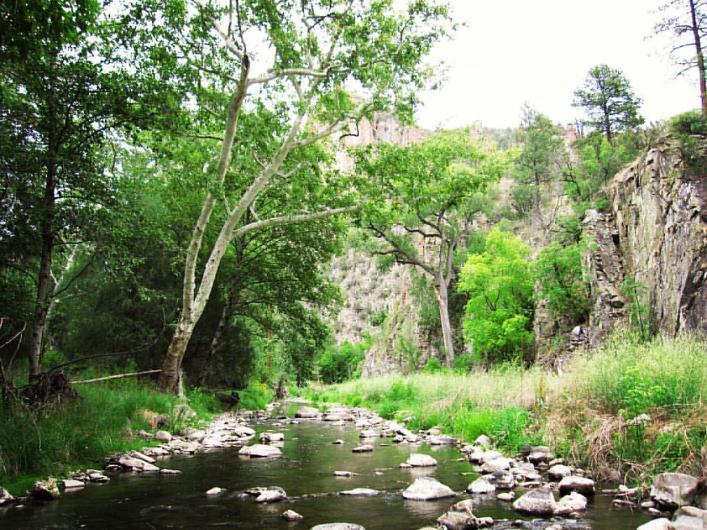 Photo: cm195902, CC BY 2.0 (via Flickr)
- 1.1 mi
- round trip
- 32 ft
- climb
- 5,735 ft
- high point
- Out and back
- route
- Apr–May, Sep–Oct
- best months
Is West Fork Shortcut open right now?
Closure in the area
There's a closure order in Gila National Forest. It doesn't name West Fork Shortcut, so check the source for the area it covers.
Beaverhead Water Non-Potable
Agency closure covering Gila National Forest · USFS · Gila National Forest
Harmful algae detected in Lake Roberts
Agency alert covering Gila National Forest · USFS · Gila National Forest
Potentially Dangerous Animal Encounters
Agency alert covering Gila National Forest · USFS · Gila National Forest
As of · Source: USFS · Gila National Forest. Agencies don't list every closure — check before you go.
West Fork Shortcut is a short, easy hike in Gila Cliff Dwellings National Monument, managed by the National Park Service. It sits within the Wilderness Ranger District of Gila National Forest, about a mile from the monument's visitor center road. The trail is an out-and-back of about 1.1 miles, with a low point of 5,700 feet and a high of 5,735 feet. The climb is minimal, with only about 32 feet of elevation gain one way. Spring and fall are the most comfortable times to go. Typical averages from the nearby Gila Hot Springs weather station show April highs around 73°F and October highs around 75°F, while July and August bring the most wet days of the year. Several other trails start close by. Little Bear Canyon Trail #729 is about 0.7 miles away, and the Grand Enchantment Trail is about 0.8 miles away. Ee Canyon is about 1.1 miles away, and Forks Campground is about 4.7 miles away.
Local outfitters
- Silver City RV Park31 mi away
- Burro Mountain Homestead RV Park43 mi away
Not on Roamze yet. Their page has how to reach them.
Best time to go · Apr–May, Sep–Oct
Best time to visit West Fork Shortcut
Best months: April–May and September–October. Best months have typical highs of 55–85 °F, lows of 30 °F or warmer (32 °F where the station doesn't record snow), at most one snowy day and no more than 12 wet days.
Jan
57° / 17°
5 wet · 1 snow
Feb
60° / 22°
5 wet
Mar
66° / 25°
4 wet
Apr
73° / 30°
2 wet
May
81° / 36°
3 wet
Jun
90° / 44°
5 wet
Jul
89° / 53°
12 wet
Aug
87° / 53°
13 wet
Sep
83° / 45°
8 wet
Oct
75° / 33°
5 wet
Nov
65° / 24°
4 wet
Dec
56° / 18°
5 wet · 1 snow
Typical high / low (°F) and days with rain or snow, 1991–2020. Measured at Gila Hot Springs, NM, 4 mi away at 5,636 ft. Source: NOAA NCEI U.S. Climate Normals 1991–2020.
Keep exploring — more trails worth the drive
Photo: cm195902, CC BY 2.0 (via Flickr)Grand Enchantment Trail
Next door
0.09-mile out-and-back trail in New Mexico with 64 ft of elevation gain.
 Photo: cm195902, CC BY 2.0 (via Flickr)
Little Bear Canyon Trail #729
~1 min drive
3.95-mile out-and-back hike in Little Bear Canyon with 955 ft gain.
 Photo: Chris M Morris, CC BY 2.0 (via Wikimedia Commons)
Big Bear Canyon Trail #28
~3 min drive
6.99-mile out-and-back hike in Big Bear Canyon with 1,792 ft gain.
HIKE
Ring Canyon Trail
~9 min drive
9.26-mile out-and-back hike in New Mexico with 2,312 ft gain and 7,857 ft max elevation.
Photo: cm195902, CC BY 2.0 (via Flickr)Grand Enchantment Trail
~1 min drive
Ultra-short introductory walk in New Mexico's Grand Enchantment area.
Photo: Chris M Morris, CC BY 2.0 (via Wikimedia Commons)Ee Canyon
~2 min drive
5.66-mile out-and-back trail in New Mexico with 1,055 ft elevation gain.
Photo: Chris M Morris, CC BY 2.0 (via Wikimedia Commons)Lilley Park
~3 min drive
50.40-mile out-and-back trail in New Mexico with 4,034 ft elevation gain.
HIKE
Grand Enchantment Trail
~2 min drive
Ultra-short scenic walk in New Mexico's enchanting high country.
 Photo: maximalideal, CC BY-SA 2.0 (via Flickr)
Alum Camp Trail
~11 min drive
2.48-mile out-and-back trail in New Mexico with 1,266 ft elevation gain
HIKE
Brushy Mountain Trail #403
~10 min drive
7.26-mile out-and-back trail in New Mexico with 958 ft gain

