Shady Acres Campground
Campground
Campground · 2.4 mi from the trail
Closure in the area
There's a closure order in Delaware Water Gap National Recreation Area. It doesn't name Mt.Tammany, so check the source for the area it covers (2 listed).
Old Mine Road North Construction Closure Begins April 6, 2026
Park closure covering Delaware Water Gap National Recreation Area · NPS · Delaware Water Gap National Recreation Area
Dingmans Falls Trail, Road, and Access Closed for Bridge Replacement
Park closure covering Delaware Water Gap National Recreation Area · NPS · Delaware Water Gap National Recreation Area
As of · Source: NPS · Delaware Water Gap National Recreation Area. Agencies don't list every closure — check before you go.
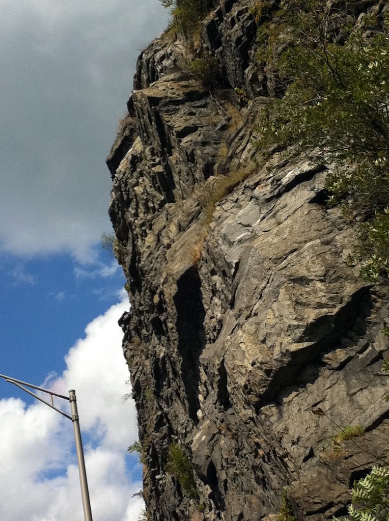
Mt. Tammany is a climbing area in Delaware Water Gap National Recreation Area in New Jersey, managed by the National Park Service. It sits within the park's land, about 5.8 miles from the E Stroudsburg, PA weather station, which sits roughly 1,000 feet lower than the area. Late spring and early fall are the most comfortable times to visit. Typical averages from that nearby station show May highs around 72°F and September highs around 75°F, with July the warmest month at about 84°F. Several climbing areas and trails start right around Mt. Tammany. The L. Double Overhang Area, c. Top-Roper's Buttress and j. Friends in High Places Area are each about 0.1 mile away, and the Blue Blaze Trail is also about 0.1 mile off. For fishing, Brodhead Creek and the Paulins Kill are both about 8 miles away.
Shady Acres Campground
Campground
Slateford Inn
Bar
 If it rainsJerrye & Roy Klotz, MD, CC BY-SA 3.0 · Wikimedia Commons
Places © OpenStreetMap contributors · Photos: Jerrye & Roy Klotz, MD, CC BY-SA 3.0 (commons)
More in HackettstownBest months: April and June–October. Best months have typical highs of 55–85 °F, lows of 30 °F or warmer (32 °F where the station doesn't record snow), at most one snowy day and no more than 12 wet days.
Jan
36° / 19°
13 wet
Feb
39° / 21°
11 wet
Mar
48° / 28°
12 wet
Apr
62° / 37°
12 wet
May
72° / 47°
14 wet
Jun
80° / 56°
12 wet
Jul
84° / 61°
12 wet
Aug
82° / 59°
12 wet
Sep
75° / 52°
10 wet
Oct
63° / 40°
12 wet
Nov
51° / 32°
11 wet
Dec
40° / 24°
12 wet
Typical high / low (°F) and days with rain or snow, 1991–2020. Measured at E Stroudsburg, PA, 5.8 mi away at 471 ft. The station sits about 1,000 ft lower than this place, so expect it a little cooler here. This station doesn't record snowfall. Source: NOAA NCEI U.S. Climate Normals 1991–2020.
 Photo: Famartin, CC BY-SA 3.0 (via Wikimedia Commons)
f. Land of the Giants
~1 min drive
f. Land of the Giants in New Jersey has 5 trad routes on 4 difficulty grades.
 Photo: Famartin, CC BY-SA 3.0 (via Wikimedia Commons)
Mount Minsi
~1 min drive
Mount Minsi in New Jersey has 10 trad climbing routes across 7 difficulty grades.
Photo: Famartin, CC BY-SA 3.0 (via Wikimedia Commons)h. High Wall
~1 min drive
h. High Wall is a climbing area in New Jersey with 7 routes.
CLIMB
m. The Great Arch
Next door
m. The Great Arch in New Jersey has 9 traditional climbing routes across 6 grades.
CLIMB
e. Trapdoor Chimney Area
Next door
e. Trapdoor Chimney Area in New Jersey has 5 trad climbing routes.
CLIMB
l. Double Overhang Area
Next door
l. Double Overhang Area in New Jersey has 5 trad climbing routes on 4 difficulty grades.
CLIMB
b. Roadside Area
Next door
6 traditional climbing routes in New Jersey, 5 difficulty grades.
CLIMB
d. Die Hard Area
Next door
7 climbing routes at d. Die Hard Area in New Jersey, 5 difficulty grades.
CLIMB
h. The Black Wall
Next door
h. The Black Wall is a New Jersey climbing crag with 6 routes.
CLIMB
j. Friends in High Places Area
Next door
j. Friends in High Places Area in New Jersey has 5 traditional climbing routes.