Salmon Falls Trail
- 0.5 mi
- loop
- 103 ft
- climb
- 520 ft
- high point
- Loop
- route
- Apr, Aug–Oct
- best months
Salmon Falls Trail is a short, easy hike in New Hampshire, about half a mile long and rising about 100 feet from roughly 500 feet to about 520 feet. It sits just 0.3 miles from the town of Milton, making it an easy addition to a day spent in the area. The trail is a gentle walk with a low point near 440 feet and a high point around 520 feet. The steepest stretch comes early on, at about 0.14 miles in, with a grade of about 10 percent. The climb is light, and the whole route takes about half an hour to complete. Summer is the most comfortable time to go. Typical averages from a nearby weather station in Rochester show July highs around 82°F with lows near 60°F, while winter highs stay in the low to mid 30s. Several other trails lie within a few miles, including the Farmington Recreational Rail-Trail and the Carl Seimon Trail. The Salmon Falls River, about 6.5 miles away, offers paddling, and the Ellis R Hatch Bouldering area is roughly 9.4 miles off.
 Farmington Recreational Rail-TrailHikingPhoto: Kyle Leach, CC BY-SA 3.0 (via Wikimedia Commons)4.3 mi
- Carl Seimon TrailHiking4.4 mi
- Jones Forest TrailHiking4.5 mi
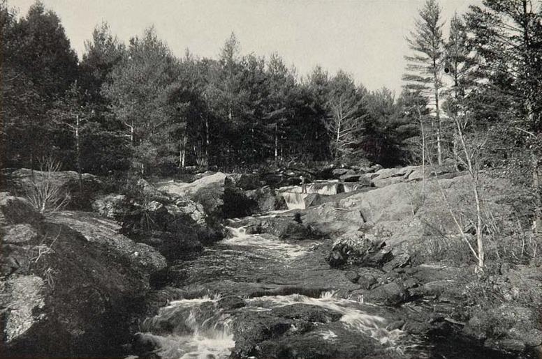 Salmon Falls RiverCanoeingPhoto: Unknown photographer, Public domain (via Wikimedia Commons)6.5 mi
- Dominicus Hanson Park Interpretive TrailHiking7 mi
- Fen TrailHiking7.5 mi
- Ellis R Hatch BoulderingRock climbing9.4 mi
- Rand MountainRock climbing9.9 mi
Source: Roamze catalog (indexable pages within 10 miles, PostGIS distance)
- Farmington Recreational Rail-TrailHiking · ~7 min drivePhoto: Kyle Leach, CC BY-SA 3.0 (via Wikimedia Commons)
- Farmington Recreational Rail-TrailHiking · ~8 min drivePhoto: Kyle Leach, CC BY-SA 3.0 (via Wikimedia Commons)
- Phoebe's Nable TrailHiking · ~14 min drive
- Farmington Recreational Rail-TrailHiking · ~8 min drivePhoto: Kyle Leach, CC BY-SA 3.0 (via Wikimedia Commons)
- North TrailHiking · ~14 min drive
 Wintergreen TrailHiking · ~13 min drivePhoto: pauljohnson414, CC BY 2.0 (via Flickr)
- Sanford-Springvale Rail TrailHiking · ~14 min drive
 Main LoopHiking · ~15 min drivePhoto: Magicpiano, CC BY-SA 4.0 (via Wikimedia Commons)
- Carl Seimon TrailHiking · ~8 min drive
- Jones Forest TrailHiking · ~8 min drive
Best time to visit Salmon Falls Trail
Best months: April and August–October. Best months have typical highs of 55–85 °F, lows of 30 °F or warmer (32 °F where the station doesn't record snow), at most one snowy day and no more than 12 wet days.
Jan
33° / 15°
10 wet
Feb
35° / 17°
9 wet
Mar
44° / 25°
11 wet
Apr
57° / 35°
12 wet
May
67° / 45°
13 wet
Jun
77° / 54°
13 wet
Jul
82° / 60°
14 wet
Aug
81° / 58°
12 wet
Sep
73° / 50°
11 wet
Oct
60° / 39°
12 wet
Nov
48° / 31°
10 wet
Dec
37° / 22°
11 wet
Typical high / low (°F) and days with rain or snow, 1991–2020. Measured at Rochester Skyhaven Ap, NH, 9.7 mi away at 323 ft. This station doesn't record snowfall. Source: NOAA NCEI U.S. Climate Normals 1991–2020.
Map and trail data © OpenStreetMap contributors
