Bowl of Fire Trail
 Photo: sufw, CC BY-SA 2.0 (via Flickr)
- 0.6 mi
- round trip
- 400 ft
- climb
- 2,536 ft
- high point
- Out and back
- route
- Oct–Apr
- best months
Is Bowl of Fire Trail open right now?
Closure in the area
There's a closure order in Lake Mead National Recreation Area. It doesn't name Bowl of Fire Trail, so check the source for the area it covers.
Government Wash Campground Anticipated Reopening
Park closure covering Lake Mead National Recreation Area · NPS · Lake Mead National Recreation Area
River Mountains Loop Trail Covered by Flood Debris in Multiple Areas
Park alert covering Lake Mead National Recreation Area · NPS · Lake Mead National Recreation Area
Harmful Algae Bloom
Park alert covering Lake Mead National Recreation Area · NPS · Lake Mead National Recreation Area
As of · Source: NPS · Lake Mead National Recreation Area. Agencies don't list every closure — check before you go.
Bowl of Fire Trail is a short, easy hike in Lake Mead National Recreation Area in Nevada, managed by the National Park Service. The trail is about 0.6 miles from the nearest town, and the route is an out-and-back that covers roughly 1.2 miles with a total climb of about 400 feet. Spring and fall are the most comfortable times to go. Typical averages from a nearby weather station show April highs around 79°F and October highs around 83°F, while July and August average in the mid-100s. The trail is front-loaded, with the steepest stretch near the start. The climb reaches a high point of about 2,536 feet before returning to the starting elevation of about 2,331 feet. Northshore Summit is about 0.6 miles away, and the North Bowl of Fire Trail is about 1.5 miles off. Cottonwood Wash Trail and Bowls of Fire South Trail are both within about 2.5 miles.
- Northshore SummitHikingPhoto: sufw, CC BY-SA 2.0 (via Flickr)0.6 mi
- North Bowl of Fire TrailHiking1.5 mi
- Cottonwood Wash TrailHiking2.5 mi
- Bowls of Fire South TrailHiking2.6 mi
- Anniversary Narrows TrailHiking4.7 mi
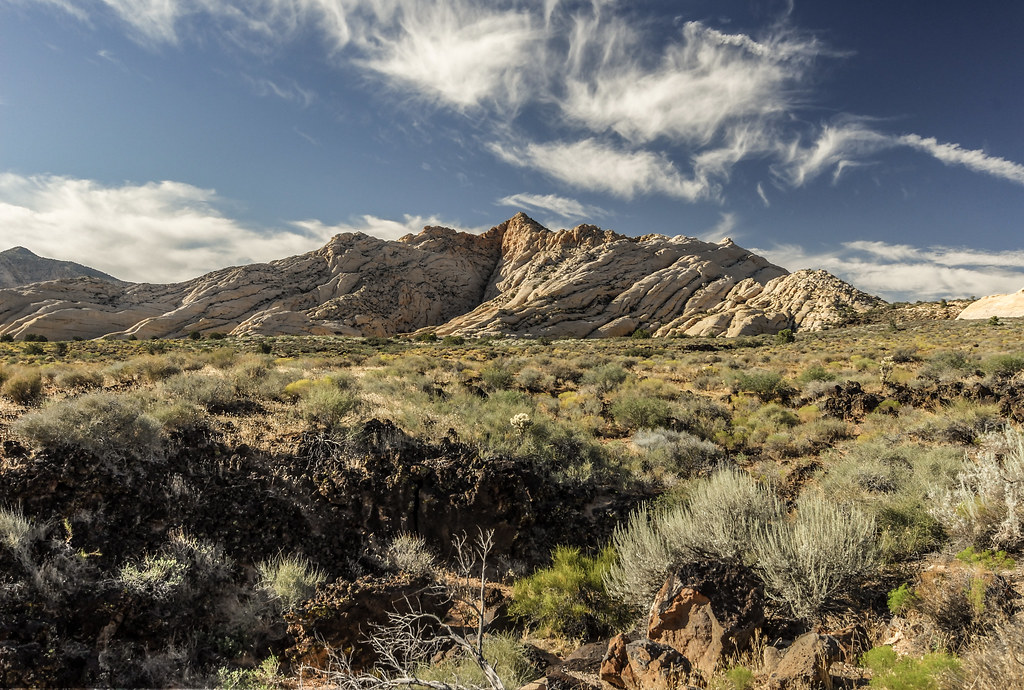 RedstoneHikingPhoto: aaronx, CC BY 2.0 (via Flickr)6.2 mi
- Bitter Springs TrailHiking7 mi
 Callville SummitHikingPhoto: Ken Lund from Reno, Nevada, USA, CC BY-SA 2.0 (via Wikimedia Commons)8.7 mi
Source: Roamze catalog (indexable pages within 10 miles, PostGIS distance)
- Northshore SummitHiking · ~1 min drivePhoto: sufw, CC BY-SA 2.0 (via Flickr)
 Old Arrowhead RdHiking · ~21 min drivePhoto: InSapphoWeTrust from Los Angeles, California, USA, CC BY-SA 2.0 (via Wikimedia Commons)
 Prospect TrailHiking · ~24 min drivePhoto: Shaan Hurley from Portland OR, United States, CC BY 2.0 (via Wikimedia Commons)
- Bitter Springs TrailHiking · ~12 min drive
- RedstoneHiking · ~11 min drivePhoto: aaronx, CC BY 2.0 (via Flickr)
- Goldstrike CanyonHiking · ~30 min drive
 Historic Railroad TrailHiking · ~31 min drivePhoto: Capt' Gorgeous, CC BY 2.0 (via Flickr)
- Callville SummitHiking · ~15 min drivePhoto: Ken Lund from Reno, Nevada, USA, CC BY-SA 2.0 (via Wikimedia Commons)
- Bowls of Fire South TrailHiking · ~4 min drive
 Pinnacles LoopHiking · ~23 min drivePhoto: Tom Hilton, CC BY 2.0 (via Flickr)
Best time to visit Bowl of Fire Trail
Best months: October–April. Best months have typical highs of 55–85 °F, lows of 30 °F or warmer (32 °F where the station doesn't record snow), at most one snowy day and no more than 12 wet days.
Jan
58° / 40°
4 wet
Feb
63° / 44°
4 wet
Mar
71° / 50°
3 wet
Apr
79° / 56°
2 wet
May
89° / 65°
1 wet
Jun
100° / 76°
1 wet
Jul
105° / 82°
2 wet
Aug
104° / 80°
2 wet
Sep
96° / 73°
2 wet
Oct
83° / 60°
2 wet
Nov
68° / 48°
2 wet
Dec
57° / 39°
3 wet
Typical high / low (°F) and days with rain or snow, 1991–2020. Measured at Valley Of Fire Sp, NV, 14.7 mi away at 2,000 ft. The station sits about 500 ft lower than this place, so expect it a little cooler here. This station doesn't record snowfall. Source: NOAA NCEI U.S. Climate Normals 1991–2020.

Map and trail data © OpenStreetMap contributors
