Free — you'll pick up right here.
Watch this trail
Sign up to watch it — saving subscribes you to gate, closure and report changes.
Nevada
Baker Creek Loop Trail
0.5 mi
Distance
358 ft
Gain
15 min
Time
No verdict for this trail
We won't guess. Here is exactly what we do and don't know.
What we do know
Inside Great Basin National Park
National Park unit boundary is mapped — agency alerts for it feed this page automatically.
Boundary data
What's missing
No access route mapped
We don't yet know which road reaches this trailhead, so we can't tell you if it's gated.
Nobody's filed a report here yet — be the first.
Why you'll love it
Here's your day, mapped
Baker Creek Loop Trail
AI-suggested draft · review before you go
Meals
Gear for the day
Elevation & route
- Distance
- 0.5 mi
- Elevation gain
- 358 ft
- Elevation loss
- 358 ft
- Highest point
- 8,968 ft
- Lowest point
- 8,841 ft
Photos
Directions & GPX
Permits & access
- Managing agency
- National Park Service
About this trail
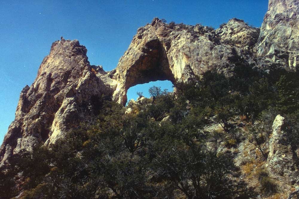
Baker Creek Loop Trail is a short out-and-back route in Nevada covering 0.98 miles with 358 feet of elevation gain. The trail reaches a maximum elevation of 8,968 feet.
Add to a trip & share
Keep exploring — more trails worth the drive
Baker Creek Trailhead
~2 min drive
Located about three miles up the Baker Creek Road, the Baker Creek Trailhead has access to three trails; South Fork Baker trail, Timber Creek Trail, and Baker Lake. These trails venture through aspen groves and pine tree stands up to alpine lakes and meadows. Parking is limit…
Snake Creek Trailhead
~5 min drive
Snake Creek Trailhead is located 12 miles down the Snake Creek Road. This trailhead offers access to many different trails; Shoshone Trail, Dead Lake Trail, Johnson Lake Trail, and the ADA Shoshone Trail. These trails offer views of aspen groves, sweeping views, and mountain l…
Lehman Creek Trailhead
~6 min drive
Lehman Creek Trailhead is located in the Upper Lehman Creek Campground. This trailhead offer access to the Lehman Creek trail. This trailhead also is the point of access for the alpine lakes and bristlecone area during the winter. Parking is limited, please follow all parking…
Timber Creek Trail
~2 min drive
7.22-mile out-and-back trail in Nevada with 3,290 ft gain/loss and a max elevation of 9,859 ft.
Lincoln Cirque Trail
~9 min drive
2.9-mile out-and-back hike to Lincoln Cirque in Nevada with 704 ft gain.
Baker Creek Trail
~4 min drive
5.67-mile out-and-back hike in Nevada with 1,392 ft gain and 2,754 ft loss.
Pole Canyon Trailhead
~5 min drive
Pole Canyon Trailhead located near the Grey Cliff Campground. This trailhead offers access to the Pole Canyon Trail. This trail goes through meadows and over low mountain passes. Offering great views of Snake valley and aspen groves this trail is a great choice for hike any ti…
Pole Canyon Trail
~1 min drive
7.08-mile out-and-back hike in Nevada with 2,110 ft elevation gain
Johnson Lake Trail
~5 min drive
7.74-mile out-and-back trail in Nevada with 3,206 ft elevation gain
Highland Ridge Route
~4 min drive
18.18-mile out-and-back trail in Nevada with 6,859 ft elevation gain/loss

Map and trail data © OpenStreetMap contributors
