East Fork North Fork Blackfoot River
- 9.3 mi
- distance
- 5,973 ft
- high point
- May–Sep
- best months
Is East Fork North Fork Blackfoot River open right now?
No closures listed
The Forest Service lists no closures for Helena-Lewis and Clark National Forest.
As of · Source: USFS · Helena-Lewis and Clark National Forest. Agencies don't list every closure — check before you go.
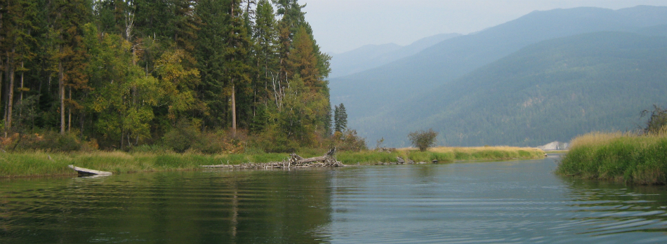
The East Fork North Fork Blackfoot River is a paddling route in Montana's Scapegoat Wilderness, within the Lincoln Ranger District of the Helena-Lewis and Clark National Forest. The Forest Service manages the land, and the river lies about 9 miles from the town of Lincoln. Summer is the most comfortable time to paddle. Typical averages from a nearby weather station show July and August highs around 81°F with lows in the low 40s, while temperatures at the river run cooler because the station sits roughly 1,400 feet lower. Several hikes start close by, including Mineral Creek and Twin Lakes, and the North Fork Blackfoot River offers more paddling about 4.5 miles away. For an overnight stay, Big Nelson Campground Complex is about 8.5 miles off.
- Mineral CreekHiking0.4 mi
- Mineral Creek CutoffHiking0.9 mi
- Twin LakesHiking1.3 mi
- Bugle MountainHiking1.4 mi
- MEADOW CREEK CUTOFF TRAILHiking2.2 mi
- North Fork Blackfoot RiverCanoeing4.5 mi
- Big Nelson Cg ComplexCamping8.5 mi
- Dry Fork North Fork Blackfoot RiverCanoeing9 mi
Source: Roamze catalog (indexable pages within 10 miles, PostGIS distance)
 Dearborn RiverCanoeing · ~19 min drivePhoto: Jet Lowe, Public domain (via Wikimedia Commons)
- Gibson Boating SiteBoat launch · ~51 min drive
- Lowry BridgeFloat trip · ~1h 17m drive
 Blackfoot RiverCanoeing · ~36 min drivePhoto: mypubliclands, Public domain (via Wikimedia Commons)
- Home Gulch Boat LaunchBoat launch · ~53 min drive
 Sun RiverCanoeing · ~52 min drivePhoto: Qfl247 (Transferred by Citypeek/Original uploaded by Qfl247), CC BY-SA 3.0 (via Wikimedia Commons)
- Whitaker Bridge Day UseBoat launch · ~1h 9m drive
 Clearwater RiverCanoeing · ~1h 2m drivePhoto: Bswc blackfootchallenge, CC BY-SA 4.0 (via Wikimedia Commons)
- Holter Dam Boat RampBoat launch · ~1h 9m drive
 Swan RiverCanoeing · ~1h 18m drivePhoto: USFWS, Public domain (via Wikimedia Commons)
Best time to visit East Fork North Fork Blackfoot River
Best months: May–September. Best months have typical highs of 55–85 °F, lows of 30 °F or warmer (32 °F where the station doesn't record snow), at most one snowy day and no more than 12 wet days.
Jan
32° / 12°
9 wet
Feb
35° / 15°
8 wet
Mar
44° / 22°
9 wet
Apr
53° / 27°
9 wet
May
63° / 33°
11 wet
Jun
71° / 40°
12 wet
Jul
81° / 44°
8 wet
Aug
81° / 42°
7 wet
Sep
70° / 35°
7 wet
Oct
54° / 29°
8 wet
Nov
39° / 20°
8 wet
Dec
30° / 13°
8 wet
Typical high / low (°F) and days with rain or snow, 1991–2020. Measured at Lincoln Rs, MT, 17 mi away at 4,575 ft. The station sits about 1,400 ft lower than this place, so expect it a little cooler here. This station doesn't record snowfall. Source: NOAA NCEI U.S. Climate Normals 1991–2020.
