Montana · Camping
Fifty Mountain
Is Fifty Mountain open right now?
Closure in the area
There's a closure order in Glacier National Park. It doesn't name Fifty Mountain, so check the source for the area it covers.
Going-to-the-Sun Road Seasonal Closure
Park closure covering Glacier National Park · NPS · Glacier National Park
As of · Source: NPS · Glacier National Park. Agencies don't list every closure — check before you go.
- At 6,680 ft
- Glacier National Park
Fifty Mountain is a campground in Montana at about 6,680 feet. It is managed by the National Park Service.
Local outfitters
- North American RV Park & Yurt Village30 mi away
- Mountain Meadow RV Park & Cabins33 mi away
Not on Roamze yet. Their page has how to reach them.
 Sue Lake Observation TrailHikingPhoto: USGS, Public domain (via Wikimedia Commons)0.6 mi
- Raven Quiver FallsWaterfall1.1 mi
- Paiota FallsWaterfall1.5 mi
- Atsina FallsWaterfall1.5 mi
- Cleveland South Ridge RouteHiking2 mi
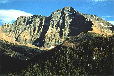 Mount ClevelandSummitPhoto: CC BY-SA 3.0 (via Wikimedia Commons)5 mi
- Swiftcurrent MountainSummit6.3 mi
- Swiftcurrent Boat RampBoat launch9.7 mi
Source: Roamze catalog (indexable pages within 10 miles, PostGIS distance)
 Alderson LakeCamping · ~23 min drivePhoto: aoiaio, CC BY 3.0 (via Wikimedia Commons)
- Stoney Indian Lake CampCamping · ~4 min drive
- Mokowanis Lake CampCamping · ~5 min drive
- Mokowanis Junction CampCamping · ~6 min drive
- Head Glenns Lake CampCamping · ~6 min drive
- Flattop Mountain CampgroundCamping · ~8 min drive
- Helen Lake CampCamping · ~9 min drive
- Kootenai LakeCamping · ~9 min drive
- Foot Glenns Lake CampCamping · ~10 min drive
- Head Elizabeth Lake CampCamping · ~11 min drive
Also worth it near here
- Sue Lake Observation TrailHiking · ~1 min drivePhoto: USGS, Public domain (via Wikimedia Commons)
- Mokowanis LakeLake fishing · ~5 min drive
- Mount ClevelandSummit · ~9 min drivePhoto: CC BY-SA 3.0 (via Wikimedia Commons)
 Grinnell FallsWaterfall · ~15 min drivePhoto: Roy Luck, CC BY 2.0 (via Wikimedia Commons)
Facts about this campground
Map and trail data © OpenStreetMap contributors
