Highway K
- Mar–Jun, Sep–Nov
- best months
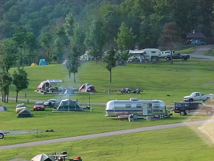
Highway K is a boat launch in Missouri, set within the Clearwater Recreation Area and managed by the Army Corps of Engineers. The nearest town is Annapolis, about 4.6 miles away. For the most comfortable conditions, aim for late spring or early fall: typical averages from the nearby Clearwater Dam weather station put May highs around 77°F and September highs near 80°F, while July and August average highs in the upper 80s. Other spots close by include Sinking Creek, a canoeing destination about 7 miles away, and Bluff View on Clearwater Lake, a lake fishing site roughly 10 miles off.
- Managed by
- Army Corps of Engineers
Source: Roamze catalog (indexable pages within 10 miles, PostGIS distance)
 Saint Francis RiverCanoeing · ~25 min drivePhoto: NOAA employee, Public domain (via Wikimedia Commons)
- Jeff’s Canoe AccessBoat launch · ~10 min drive
- Big SpringTubing · ~48 min drive
 Stouts CreekCanoeing · ~33 min drivePhoto: Adam Moss from Macomb, IL, United States, CC BY-SA 2.0 (via Wikimedia Commons)
- SmileyBoat launch · ~10 min drive
- Sinking CreekCanoeing · ~12 min drive
- Hwy 143Boat launch · ~13 min drive
- Webb CreekCanoeing · ~24 min drive
- Twin Rivers LandingBoat launch · ~15 min drive
- Logan CreekCanoeing · ~25 min drive
Best time to visit Highway K
Best months: March–June and September–November. Best months have typical highs of 55–85 °F, lows of 30 °F or warmer (32 °F where the station doesn't record snow), at most one snowy day and no more than 12 wet days.
Jan
43° / 23°
8 wet
Feb
48° / 27°
8 wet
Mar
58° / 35°
9 wet
Apr
69° / 44°
9 wet
May
77° / 54°
10 wet
Jun
85° / 63°
9 wet
Jul
89° / 68°
8 wet
Aug
88° / 66°
8 wet
Sep
80° / 57°
7 wet
Oct
70° / 45°
7 wet
Nov
57° / 35°
8 wet
Dec
46° / 27°
8 wet
Typical high / low (°F) and days with rain or snow, 1991–2020. Measured at Clearwater Dam, MO, 13.3 mi away at 660 ft. This station doesn't record snowfall. Source: NOAA NCEI U.S. Climate Normals 1991–2020.
Map and trail data © OpenStreetMap contributors
