Eleven Point National Wild and Scenic River
- Mar–Jun, Sep–Nov
- best months
Is Eleven Point National Wild and Scenic River open right now?
Alert in the area
The Forest Service lists 10 alerts for Mark Twain National Forest.
Crane Lake Dam
Agency alert covering Mark Twain National Forest · USFS · Mark Twain National Forest
Delays on Forest Road 557
Agency alert covering Mark Twain National Forest · USFS · Mark Twain National Forest
Forest Order - Trail 119 Closure Extended (Chadwick Motorized Trail System)
Agency alert covering Mark Twain National Forest · USFS · Mark Twain National Forest
Weather Conditions
Agency alert covering Mark Twain National Forest · USFS · Mark Twain National Forest
Red Bridge Road - Bridge Closure
Agency alert covering Mark Twain National Forest · USFS · Mark Twain National Forest
As of · Source: USFS · Mark Twain National Forest. Agencies don't list every closure — check before you go.
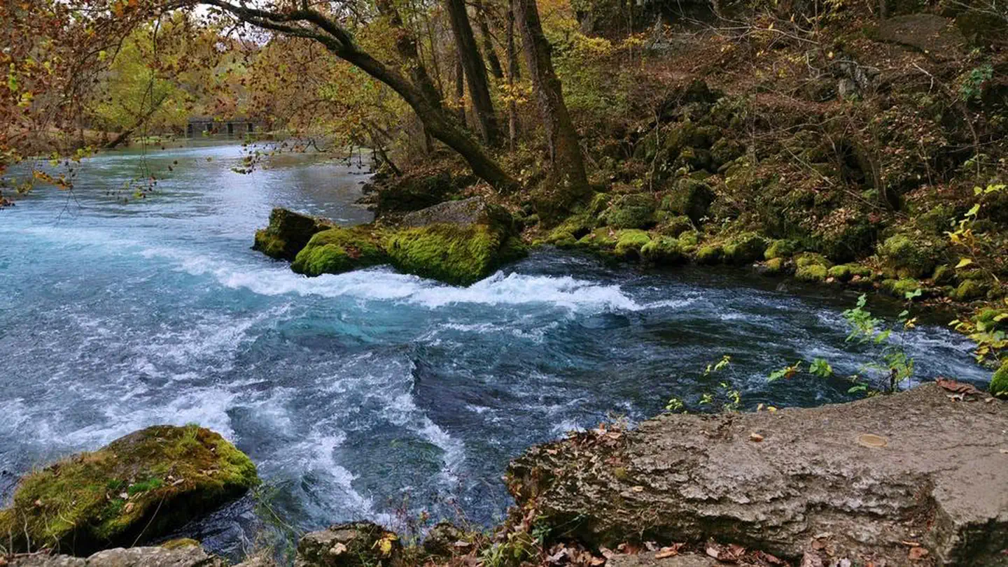
The Eleven Point National Wild and Scenic River was established in 1968 as a 44-mile scenic river, free of impoundments with a largely undeveloped shoreline and watershed. This portion of the river between Thomasville, Missouri and the Highway 142 bridge is near Gatewood, Missouri. It became one of the 8 initial units of the National Wild and Scenic River system in 1968.The Eleven Point National Wild and Scenic River meanders through the picturesque Ozark hills of southern Missouri. Its course is cut in the shadows of steep bluffs, through sloping forested valleys, and low-lying riparian ecosystems. Barely more than a small stream at its upper reaches near Thomasville, it gains considerable width and depth as its proceeds south-eastward.Springs pouring from dolomite bluffs or rushing up from a vast network of underground flow systems provide a continuous source of water and beauty. Alternating stretches of rapids and deep clear pools wind around moss covered boulders and shading bottomland hardwood trees.Greer Spring is the world's 10th biggest spring and doubles the size of the river while turning it into a cold water fishery.Access to the River: There are currently eleven designated access points to the river by vehicle. Of these access points, 7 sites have amenities. The remaining 4 access sites have no amenities. In addition, there are 7 float camps designated on the river to provide overnight camping for river users, most of these are only accessible by boat.Boating on the River: The river has been designated for both motorized and non-motorized use. The motorized users must adhere to a 25 horsepower limit.Fishing: There are opportunities aplenty for small mouth bass and pan fish. Special regulations apply. Visit the Missouri Department of Conservation website for more information. Trout fishing starts at the confluence of the Greer spring branch and the river. This is the beginning of the blue ribbon trout section which extends about 6 miles to Turner Mill spring. More detailed information is available below under Fishing.For Steam Flow and Flooding forecast.A printable Brochure is available.
- Greer CrossingCamping0.3 mi
 Greer Rec Area SpurHikingPhoto: altonwoods, CC BY 2.0 (via Flickr)0.3 mi
 Greer Spring TrailHikingPhoto: altonwoods, CC BY 2.0 (via Flickr)1.1 mi
- Greer Mill TrailHikingPhoto: altonwoods, CC BY 2.0 (via Flickr)1.1 mi
- Stinking Pond Float CampCamping4.7 mi
- Horseshoe Bend Float CampCamping5.9 mi
- Hurricane CreekCanoeing6.8 mi
- Piney CreekCanoeing9.6 mi
Source: Roamze catalog (indexable pages within 10 miles, PostGIS distance)
- Big SpringRiver fishing · ~39 min drive
- Pinewoods Lake Rec AreaPier fishing · ~54 min drive
- Bluff View(clearwater Lake)Lake fishing · ~1h 9m drive
- Jacks ForkRiver fishing · ~43 min drive
- Alley SpringRiver fishing · ~43 min drive
- Loggers Lake CampgroundPier fishing · ~1h 10m drive
- Noblett LakeLake fishing · ~1h 14m drive
- Current RiverRiver fishing · ~47 min drive
- Two RiversRiver fishing · ~48 min drive
- Mccormack LakeLake fishing · ~4 min drive
Best time to visit Eleven Point National Wild and Scenic River
Best months: March–June and September–November. Best months have typical highs of 55–85 °F, lows of 30 °F or warmer (32 °F where the station doesn't record snow), at most one snowy day and no more than 12 wet days.
Jan
44° / 22°
7 wet
Feb
49° / 25°
7 wet
Mar
58° / 34°
8 wet
Apr
69° / 43°
9 wet
May
76° / 53°
9 wet
Jun
85° / 62°
7 wet
Jul
88° / 66°
7 wet
Aug
88° / 64°
7 wet
Sep
81° / 55°
5 wet
Oct
70° / 43°
7 wet
Nov
57° / 33°
7 wet
Dec
46° / 26°
7 wet
Typical high / low (°F) and days with rain or snow, 1991–2020. Measured at Alton, MO, 7.9 mi away at 813 ft. This station doesn't record snowfall. Source: NOAA NCEI U.S. Climate Normals 1991–2020.