Lane Spring
- april to October
- season
- Apr, Jun
- best months
Is Lane Spring open right now?
Closure in the area
There's a closure order in Houston/Rolla/Cedar Creek Ranger District. It doesn't name Lane Spring, so check the source for the area it covers.
Forest Closure - Bridge Replacement at Paddy Creek
Agency closure covering Houston/Rolla/Cedar Creek Ranger District · Order 09-05-03-26-01 · USFS · Houston/Rolla/Cedar Creek Ranger District
Crane Lake Dam
Agency alert covering Mark Twain National Forest · USFS · Mark Twain National Forest
Delays on Forest Road 557
Agency alert covering Mark Twain National Forest · USFS · Mark Twain National Forest
Forest Order - Trail 119 Closure Extended (Chadwick Motorized Trail System)
Agency alert covering Mark Twain National Forest · USFS · Mark Twain National Forest
Weather Conditions
Agency alert covering Mark Twain National Forest · USFS · Mark Twain National Forest
As of · Source: USFS · Houston/Rolla/Cedar Creek Ranger District. Agencies don't list every closure — check before you go.
- At 823 ft
- Houston/Rolla/Cedar Creek Ranger DistrictMark Twain National Forest
Lane Spring is a Forest Service campground in the Houston/Rolla/Cedar Creek Ranger District of Mark Twain National Forest in Missouri. It sits within the district's recreation network, and the nearest town is Rolla, about 12 miles away. The site is a simple base for short outings. Vault toilets are the only facility listed, and a fee is charged for stays. The surrounding area offers several options within a few tenths of a mile, so it works well as a starting point for a day of hiking, fishing or exploring the trails. Spring and fall are the most comfortable times to visit. Typical averages from a nearby weather station in Rolla show October highs around 69°F with lows near 47°F, and May highs around 76°F. July is the warmest month, with typical highs near 89°F. Blossom Rock is a hike just 0.1 mile away, and the Lane Spring Recreation Area, a river fishing spot, is 0.2 mile off. Cedar Bluff Trail is 0.3 mile away. For a longer outing, the Kaintuck Trail - South Green is about 4.6 miles from the campground.
- Blossom RockHiking0.1 mi
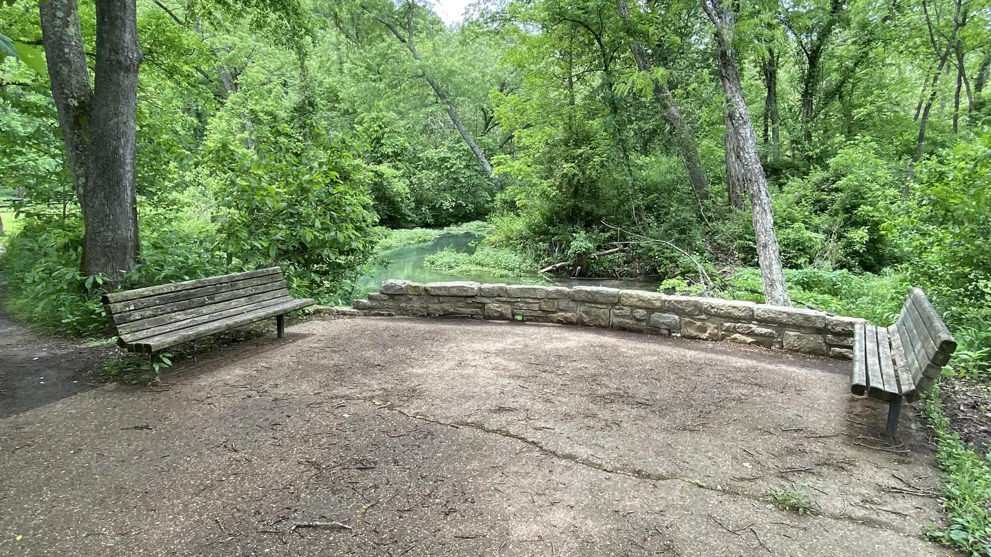 Lane Spring Recreation AreaRiver fishing0.2 mi
- Cedar Bluff TrailHiking0.3 mi
- Kaintuck Trail - South GreenHiking4.6 mi
- Kaintuck Trail South RedHiking4.6 mi
- Kaintuck Trail South BlueHiking4.7 mi
- Kaintuck Trail WhiteHiking5.9 mi
- Little Piney CreekCanoeing8 mi
Source: Roamze catalog (indexable pages within 10 miles, PostGIS distance)
 Alley SpringCamping · ~1h 25m drivePhoto: pasa47 — CC BY 2.0 (via Flickr)
- SlabtownCamping · ~33 min drive
- Paddy CreekCamping · ~35 min drive
- Big Piney trail primitiveCamping · ~36 min drive
- Forest ServiceCamping · ~38 min drive
- AkersCamping · ~55 min drive
- Little Scotia PondCamping · ~57 min drive
- Red BluffCamping · ~1h 3m drive
- PulltiteCamping · ~1h 4m drive
- Sinking Creek CampgroundCamping · ~1h 10m drive
Best time to visit Lane Spring
Best months: April, June and September–November. Best months have typical highs of 55–85 °F, lows of 30 °F or warmer (32 °F where the station doesn't record snow), at most one snowy day and no more than 12 wet days.
Jan
41° / 22°
9 wet · 5 snow
Feb
46° / 26°
9 wet · 4 snow
Mar
56° / 35°
12 wet · 3 snow
Apr
67° / 45°
12 wet · 1 snow
May
76° / 56°
13 wet
Jun
84° / 65°
11 wet
Jul
89° / 69°
9 wet
Aug
88° / 67°
9 wet
Sep
80° / 59°
8 wet
Oct
69° / 47°
9 wet
Nov
56° / 36°
9 wet · 1 snow
Dec
45° / 27°
9 wet · 4 snow
Typical high / low (°F) and days with rain or snow, 1991–2020. Measured at Rolla Missouri S&T, MO, 11.6 mi away at 1,173 ft. Source: NOAA NCEI U.S. Climate Normals 1991–2020.
Lane Spring
Book on Recreation.gov
