Douglas State Trail
- 0.9 mi
- round trip
- 27 ft
- climb
- 1,028 ft
- high point
- Out and back
- route
- Apr, Jul–Oct
- best months
Douglas State Trail is a short, flat cross-country ski route in Minnesota, about 2 miles from the town of Pine Island. The trail is an out-and-back, roughly 1.7 miles long, with a high point of 1,028 feet and a low of 1,017 feet. The climb is nearly flat, with a total gain and loss of about 27 feet each, and the steepest stretch comes at about 0.45 miles in, with a grade of about 2%. Winter is the natural season for this trail. Typical averages from a nearby weather station show January highs around 23°F with lows near 3°F and about seven snow days. By April, highs reach about 55°F, and snow days drop to one. Summer is warm, with July highs around 81°F. Paddlers can pair a ski day with time on the water. The Middle Fork Zumbro River is about 6 miles away, and the Zumbro River is about 10 miles away.
- Middle Fork Zumbro RiverCanoeing6 mi
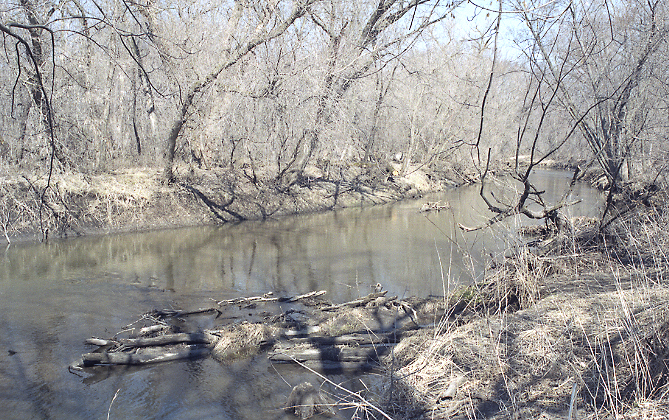 Zumbro RiverCanoeingPhoto: The original uploader was Malepheasant at English Wikipedia., CC BY-SA 2.5 (via Wikimedia Commons)9.8 mi
Source: Roamze catalog (indexable pages within 10 miles, PostGIS distance)
- Douglas State TrailCross-country skiing · ~1 min drive
- The PipeCross-country skiing · ~31 min drive
- MeanderCross-country skiing · ~31 min drive
- Hammer TrailCross-country skiing · ~31 min drive
- Welch VillageDownhill skiing · ~46 min drive
- Douglas State TrailCross-country skiing · ~1 min drive
- The PipeCross-country skiing · ~30 min drive
- Interpretive TrailCross-country skiing · ~1h 21m drive
- Lone Rock LoopCross-country skiing · ~1h 10m drive
- Douglas State TrailCross-country skiing · ~2 min drive
Best time to visit Douglas State Trail
Best months: April and July–October. Best months have typical highs of 55–85 °F, lows of 30 °F or warmer (32 °F where the station doesn't record snow), at most one snowy day and no more than 12 wet days.
Jan
23° / 3°
7 wet · 7 snow
Feb
27° / 6°
6 wet · 6 snow
Mar
40° / 20°
8 wet · 4 snow
Apr
55° / 31°
10 wet · 1 snow
May
68° / 44°
13 wet
Jun
78° / 55°
13 wet
Jul
81° / 58°
11 wet
Aug
79° / 55°
11 wet
Sep
72° / 47°
10 wet
Oct
58° / 33°
9 wet
Nov
42° / 23°
7 wet · 2 snow
Dec
28° / 11°
7 wet · 6 snow
Typical high / low (°F) and days with rain or snow, 1991–2020. Measured at Byron 4north, MN, 6.2 mi away at 1,041 ft. Source: NOAA NCEI U.S. Climate Normals 1991–2020.
Map and trail data © OpenStreetMap contributors
