Saint Louis River
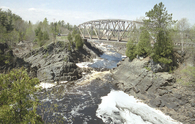 Photo: The original uploader was Malepheasant at English Wikipedia., CC BY-SA 2.5 (via Wikimedia Commons)
- 33.4 mi
- distance
- 1,672 ft
- high point
- May, Jul–Sep
- best months
Clear at last check
Weather is good · usgs_nwis, OpenWeather · checked 21 h ago
The Saint Louis River is a canoeing destination in northeastern Minnesota, about 3.8 miles from the town of Palo. It is a paddling route rather than a single trail, and its length makes it a destination for a full day on the water. Summer is the most comfortable time to paddle. Typical averages from a nearby weather station in Eveleth show July highs around 77°F with lows near 56°F, while winter is severe, with January highs around 17°F and lows near -2°F. The Laurentian Ranger District, a lake fishing area about 8 miles away, is the closest nearby spot.
Local outfitters
- Piragis Northwoods Company39 mi away
- Voyageur North Outfitters40 mi away
Not on Roamze yet. Their page has how to reach them.
Source: Roamze catalog (indexable pages within 10 miles, PostGIS distance)
 Sturgeon RiverCanoeing · ~58 min drivePhoto: McGhiever, CC BY-SA 4.0 (via Wikimedia Commons)
- Eshquaguma Boat LandingBoat launch · ~4 min drive
- Whiteface RiverCanoeing · ~34 min drive
- Norway Point Boat AccessBoat launch · ~15 min drive
- East Swan RiverCanoeing · ~43 min drive
- Whiteface Reservoir Boat AccessBoat launch · ~20 min drive
- Cloquet RiverCanoeing · ~51 min drive
- Dark Lake Boat AccessBoat launch · ~43 min drive
- Little Fork RiverCanoeing · ~54 min drive
- Hoodoo Public Water Access SiteBoat launch · ~46 min drive
Best time to visit Saint Louis River
Best months: May and July–September. Best months have typical highs of 55–85 °F, lows of 30 °F or warmer (32 °F where the station doesn't record snow), at most one snowy day and no more than 12 wet days.
Jan
17° / -2°
9 wet
Feb
22° / 2°
7 wet
Mar
35° / 14°
7 wet
Apr
49° / 28°
8 wet
May
63° / 41°
12 wet
Jun
72° / 51°
13 wet
Jul
77° / 56°
12 wet
Aug
75° / 54°
11 wet
Sep
66° / 45°
11 wet
Oct
51° / 33°
11 wet
Nov
34° / 20°
10 wet
Dec
22° / 6°
11 wet
Typical high / low (°F) and days with rain or snow, 1991–2020. Measured at Eveleth Wwtp, MN, 9.3 mi away at 1,445 ft. This station doesn't record snowfall. Source: NOAA NCEI U.S. Climate Normals 1991–2020.

