Burntside Lake (NE) Public Water Access Site
- Aug–Sep
- best months
Is Burntside Lake (NE) Public Water Access Site open right now?
Closure in the area
There's a closure order in Superior National Forest. It doesn't name Burntside Lake (NE) Public Water Access Site, so check the source for the area it covers.
Post Wildfire Closures, Effective October 1, 2026
Agency closure covering Superior National Forest · Order 09-09-00-26-11 · USFS · Superior National Forest
Forest Road Improvement Projects
Agency alert covering Superior National Forest · USFS · Superior National Forest
As of · Source: USFS · Superior National Forest. Agencies don't list every closure — check before you go.
Burntside Lake (NE) Public Water Access Site is a boat launch on Burntside Lake in northeastern Minnesota, about 5 miles from Ely. It sits within the Kawishiwi Ranger District of Superior National Forest and is managed by the Minnesota DNR Division of Parks and Trails. Summer is the most comfortable time to visit. Typical averages from a nearby weather station in Ely show July highs around 79°F with lows near 53°F, while winter highs stay in the teens and 20s. Several other spots lie within a few miles. The Northarm-Twin hike is about 2 miles away, and the Circle Route canoeing route is about 2.7 miles off. The Dry Lake hike and the Bass Lake Trail are both within about 3 miles.
- Managed by
- Minnesota DNR Division of Parks and Trails
- Northarm-TwinHiking2 mi
- Circle RouteCanoeing2.7 mi
 Dry LakeHikingPhoto: Abnormally Weird, CC BY 2.0 (via Flickr)2.8 mi
 BASS LAKE TRAILHikingPhoto: USDAgov, Public Domain Mark (via Flickr)2.9 mi
- North Star RunHiking3 mi
- SentinelsCross-country skiing3 mi
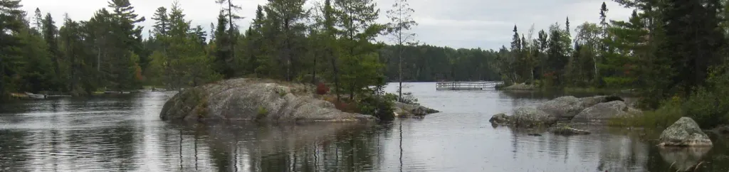 Fenske Lake CampgroundPier fishingPhoto: Recreation.gov (RIDB) / public domain3.3 mi
- Science BoulderRock climbing5 mi
Source: Roamze catalog (indexable pages within 10 miles, PostGIS distance)
- County Road 88 Public Water Access SiteBoat launch · ~3 min drive
- Circle RouteCanoeing · ~5 min drive
- Ccounty Road 404 Public Water Access SiteBoat launch · ~5 min drive
- South Kawishiwi RiverCanoeing · ~23 min drive
- Little Long Lake Public Water Access SiteBoat launch · ~5 min drive
- Horse RiverCanoeing · ~27 min drive
- North Arm Boat LandingBoat launch · ~6 min drive
- BWCA Entry PointsCanoeing · ~29 min drive
- Fenske Lake Public Water Access SiteBoat launch · ~6 min drive
- Tuck RiverCanoeing · ~30 min drive
Best time to visit Burntside Lake (NE) Public Water Access Site
Best months: August–September. Best months have typical highs of 55–85 °F, lows of 30 °F or warmer (32 °F where the station doesn't record snow), at most one snowy day and no more than 12 wet days.
Jan
15° / -7°
11 wet
Feb
23° / -5°
9 wet
Mar
36° / 10°
9 wet
Apr
51° / 25°
10 wet
May
65° / 38°
13 wet
Jun
75° / 49°
14 wet
Jul
79° / 53°
13 wet
Aug
78° / 52°
12 wet
Sep
68° / 44°
12 wet
Oct
52° / 32°
14 wet
Nov
34° / 19°
11 wet
Dec
21° / 3°
11 wet
Typical high / low (°F) and days with rain or snow, 1991–2020. Measured at Ely, MN, 4.1 mi away at 1,382 ft. This station doesn't record snowfall. Source: NOAA NCEI U.S. Climate Normals 1991–2020.
Closures we've recorded since August 2026
Forest-wide Fire Restrictions
Superior National Forest · Order dated July 12, 2026; seen Aug 23, 2026 → lifted Aug 25, 2026 · Forest Service
Map and trail data © OpenStreetMap contributors
