Tamarack Point Campground
- May, Jul–Sep
- best months
Caution at last check
Agency alerts are in effect for this area; weather is good · USFS, OpenWeather · checked 21 h ago
Is Tamarack Point Campground open right now?
Closure in the area
There's a closure order in Chippewa National Forest. It doesn't name Tamarack Point Campground, so check the source for the area it covers.
Emergency Road Closure Notice - FR 2382 (West Pigeon Lake Rd)
Agency closure covering Chippewa National Forest · USFS · Chippewa National Forest
As of · Source: USFS · Chippewa National Forest. Agencies don't list every closure — check before you go.
- At 1,307 ft
- Deer River Ranger DistrictChippewa National Forest
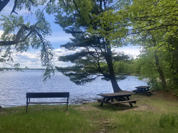
Tamarack Point Campground is a Forest Service campground in the Deer River Ranger District of Chippewa National Forest in Minnesota. It sits within the national forest, which the Forest Service manages, and no site is listed as the nearest town. Summer is the most comfortable time to visit. Typical averages from the nearby Leech Lake weather station run to highs around 80°F in July, with lows near 58°F. Winters are cold, with January highs around 18°F and lows near -2°F. The campground is not reservable. That makes it a good choice for spontaneous trips, but plan ahead for a stay rather than a last-minute booking. Winnie Dam Campground - USACE lies about 3.5 miles away. Deer Lake and Williams Narrows are both about 4.9 miles off. Simpson Creek/seelye Point is roughly 5.6 miles away.
- Winnie Dam Campground - USACECamping3.5 mi
 Deer LakeSurf fishing4.9 mi
 Williams NarrowsCampingPhoto: Recreation.gov (RIDB) / public domain4.9 mi
- Little Cut Foot Sioux Boat AreaLake fishing5.6 mi
- Simpson Creek/seelye PointHiking5.6 mi
- East Seelye BayCamping5.7 mi
- East Seelye Bay Boat AreaLake fishing5.8 mi
- Simpson Creek Trail Spur CHiking5.9 mi
Source: Roamze catalog (indexable pages within 10 miles, PostGIS distance)
- Winnie Campground - USFSCamping · ~16 min drive
- Williams NarrowsCamping · ~8 min drive
- OnegumeCamping · ~10 min drive
- Tamarack Point _USFSCamping · Next door
- Winnie Dam - COECamping · ~6 min drive
- Cut Foot Dispersed Site #1Camping · ~8 min drive
- Deer LakeCamping · ~8 min drive
- South Deer Lake CampgroundCamping · ~8 min drive
- North Deer Lake CampgroundCamping · ~9 min drive
- West Seelye BayCamping · ~10 min drive
Best time to visit Tamarack Point Campground
Best months: May and July–September. Best months have typical highs of 55–85 °F, lows of 30 °F or warmer (32 °F where the station doesn't record snow), at most one snowy day and no more than 12 wet days.
Jan
18° / -2°
6 wet
Feb
24° / 1°
5 wet
Mar
37° / 15°
6 wet
Apr
52° / 29°
7 wet
May
66° / 43°
11 wet
Jun
75° / 53°
13 wet
Jul
80° / 58°
12 wet
Aug
78° / 56°
10 wet
Sep
69° / 47°
10 wet
Oct
54° / 35°
9 wet
Nov
36° / 21°
7 wet
Dec
23° / 7°
6 wet
Typical high / low (°F) and days with rain or snow, 1991–2020. Measured at Leech Lake, MN, 14.4 mi away at 1,302 ft. This station doesn't record snowfall. Source: NOAA NCEI U.S. Climate Normals 1991–2020.
Tamarack Point Campground
Book on Recreation.gov
