Dobson Bridge Access
- Jun–Sep
- best months
Is Dobson Bridge Access open right now?
Alert in the area
The Forest Service lists 4 alerts for Huron-Manistee National Forest.
USE CAUTION - KNOW BEFORE YOU GO!
Agency alert covering Huron-Manistee National Forest · USFS · Huron-Manistee National Forest
Winter Storm Impacts Huron Zone of the Forests - Know Before You Go.
Agency alert covering Huron-Manistee National Forest · USFS · Huron-Manistee National Forest
'Do Not Eat' Advisory for Deer
Agency alert covering Huron-Manistee National Forest · USFS · Huron-Manistee National Forest
'Do Not Eat' Advisory for Fish
Agency alert covering Huron-Manistee National Forest · USFS · Huron-Manistee National Forest
As of · Source: USFS · Huron-Manistee National Forest. Agencies don't list every closure — check before you go.
Dobson Bridge Access is a boat launch in the Cadillac Ranger District of the Huron-Manistee National Forest in Michigan, about 5 miles from the town of Caberfae. It is a day-use site with vault toilets, and a fee applies for each visit. Day use costs $5 per vehicle per day or $15 for seven days. The vault toilets are the only facility on site. Summer is the most comfortable time to visit. Typical averages from a nearby weather station show July highs around 81°F with lows near 54°F, and June and August run close behind. Winters are cold, with January highs averaging about 28°F. Peterson Bridge campground is about 2.5 miles away, and the Mackenzie Bike Spur 4 hike is about 3.8 miles off. Sand Lake Campground and the Pine River canoeing route are both within about 8 miles.
- Fee
- Day Use: $5 vehicle per day $15 per seven day
- Restrooms
- Yes
- Peterson BridgeCamping2.5 mi
- Mackenzie Bike Spur 4Hiking3.8 mi
- Mackenzie Bike Spur 1Hiking4.2 mi
- Mackenzie Bike Spur 7Hiking4.5 mi
- Pine RiverCanoeing7.3 mi
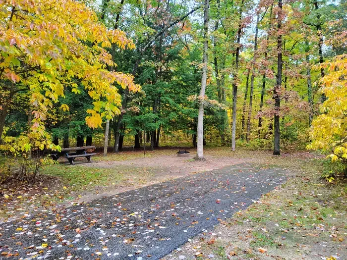 Sand Lake CampgroundCampingPhoto: Recreation.gov (RIDB) / public domain8.5 mi
- Upper Manistee River Backcounty CampsitesCamping8.6 mi
- Manistee RiverRiver fishing9.6 mi
Source: Roamze catalog (indexable pages within 10 miles, PostGIS distance)
 Big Sable RiverCanoeing · ~31 min drivePhoto: Doug Coldwell, CC BY-SA 3.0 (via Wikimedia Commons)
- Peterson Bridge AccessBoat launch · ~4 min drive
 Pere Marquette RiverCanoeing · ~40 min drivePhoto: en:User:Yetiwriter, CC BY-SA 3.0 (via Wikimedia Commons)
- Canoe LandingBoat launch · ~4 min drive
- Pine RiverCanoeing · ~12 min drive
- Low Bridge Canoe LandingBoat launch · ~13 min drive
- Bear CreekCanoeing · ~31 min drive
- Government LandingBoat launch · ~15 min drive
- Upper Tippy Dam Boat RampBoat launch · ~18 min drive
- Lower Tippy Dam Boat RampBoat launch · ~18 min drive
Best time to visit Dobson Bridge Access
Best months: June–September. Best months have typical highs of 55–85 °F, lows of 30 °F or warmer (32 °F where the station doesn't record snow), at most one snowy day and no more than 12 wet days.
Jan
28° / 12°
18 wet
Feb
31° / 12°
14 wet
Mar
41° / 19°
12 wet
Apr
55° / 29°
13 wet
May
68° / 40°
13 wet
Jun
77° / 50°
12 wet
Jul
81° / 54°
10 wet
Aug
79° / 53°
10 wet
Sep
72° / 46°
12 wet
Oct
57° / 36°
16 wet
Nov
44° / 26°
15 wet
Dec
33° / 18°
17 wet
Typical high / low (°F) and days with rain or snow, 1991–2020. Measured at Wellston 1n, MI, 10.4 mi away at 773 ft. We don't have this place's elevation, so higher spots nearby can run cooler. This station doesn't record snowfall. Source: NOAA NCEI U.S. Climate Normals 1991–2020.
