Sugar Bush Trail
 Photo: Christian Collins, CC BY-SA 2.0 (via Flickr)
- 0.6 mi
- loop
- 617 ft
- high point
- Loop
- route
- Easy
- difficulty
- Apr–Sep
- best months
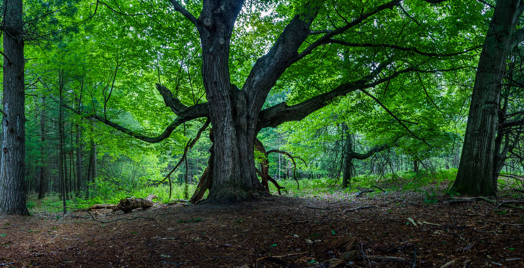
Sugar Bush Trail is a 0.63-mile loop at Chippewa Nature Center in Michigan, a short outing that fits easily into a longer visit to the center's network of trails. The route stays low, with a high point of 617 feet and a low of 605 feet, and the climb is gentle, with the steepest stretch at about 0.24 miles into the walk, where the grade reaches 9 percent. It is an easy trail, and it is managed by a non-governmental organization. Late spring and early fall are the most comfortable times to go. Typical averages from a nearby weather station in Midland put May highs around 68°F and September highs around 73°F, with July the warmest month at about 82°F. The trail is open year-round, and there is no set season for a visit. Bikes are not allowed on this trail. Field Trail starts just 0.1 mile away, and River Trail, Wood Duck Trail and Arboretum Trail are all within about half a mile.
- Field TrailHikingPhoto: Christian Collins, CC BY-SA 2.0 (via Flickr)0.1 mi
 River TrailHikingPhoto: Christian Collins, CC BY-SA 2.0 (via Flickr)0.3 mi
- Wood Duck TrailHikingPhoto: Christian Collins, CC BY-SA 2.0 (via Flickr)0.4 mi
 Arboretum TrailHikingPhoto: Christian Collins, CC BY-SA 2.0 (via Flickr)0.4 mi
 Arbury TrailHikingPhoto: Christian Collins, CC BY-SA 2.0 (via Flickr)0.6 mi
- Meadow Mouse TrailHikingPhoto: Christian Collins, CC BY-SA 2.0 (via Flickr)0.7 mi
- Ridge TrailHikingPhoto: Christian Collins, CC BY-SA 2.0 (via Flickr)0.8 mi
- River Point TrailHikingPhoto: Christian Collins, CC BY-SA 2.0 (via Flickr)0.9 mi
Source: Roamze catalog (indexable pages within 10 miles, PostGIS distance)
- Field TrailHiking · Next doorPhoto: Christian Collins, CC BY-SA 2.0 (via Flickr)
- Blue TrailHiking · ~59 min drive
- River TrailHiking · Next doorPhoto: Christian Collins, CC BY-SA 2.0 (via Flickr)
- Wood Duck TrailHiking · Next doorPhoto: Christian Collins, CC BY-SA 2.0 (via Flickr)
- Arboretum TrailHiking · Next doorPhoto: Christian Collins, CC BY-SA 2.0 (via Flickr)
- Arbury TrailHiking · ~1 min drivePhoto: Christian Collins, CC BY-SA 2.0 (via Flickr)
- Meadow Mouse TrailHiking · ~1 min drivePhoto: Christian Collins, CC BY-SA 2.0 (via Flickr)
- Ridge TrailHiking · ~1 min drivePhoto: Christian Collins, CC BY-SA 2.0 (via Flickr)
- River Point TrailHiking · ~2 min drivePhoto: Christian Collins, CC BY-SA 2.0 (via Flickr)
- Wetlands TrailHiking · ~2 min drivePhoto: Christian Collins, CC BY-SA 2.0 (via Flickr)
Best time to visit Sugar Bush Trail
Best months: April–September. Best months have typical highs of 55–85 °F, lows of 30 °F or warmer (32 °F where the station doesn't record snow), at most one snowy day and no more than 12 wet days.
Jan
29° / 17°
12 wet
Feb
32° / 17°
9 wet
Mar
43° / 25°
10 wet
Apr
56° / 36°
12 wet
May
68° / 48°
12 wet
Jun
78° / 57°
11 wet
Jul
82° / 62°
11 wet
Aug
80° / 60°
10 wet
Sep
73° / 52°
10 wet
Oct
60° / 42°
13 wet
Nov
46° / 32°
12 wet
Dec
34° / 23°
12 wet
Typical high / low (°F) and days with rain or snow, 1991–2020. Measured at Midland, MI, 4.3 mi away at 640 ft. This station doesn't record snowfall. Source: NOAA NCEI U.S. Climate Normals 1991–2020.
Map and trail data © OpenStreetMap contributors
