Pond Loop
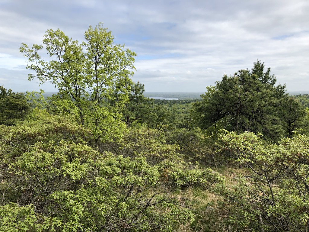
 Photo: ian02054, CC BY 2.0 (via Flickr)
- 2.8 mi
- one way
- 56 ft
- climb
- 93 ft
- high point
- Point to point
- route
- Apr, Jun–Nov
- best months
Pond Loop is an easy hike of about 2.8 miles in Massachusetts, about a mile from the town of Millbrook. The route is a point-to-point trail with a low elevation gain of 56 feet, so it's a gentle outing that works well for a short walk or a ride on a bike. Bikes are allowed, which makes it an option for both hikers and riders. The trail has a steepest stretch of about 12% at roughly 2.5 miles in, but the overall climb is minimal. For comfortable weather, late spring and early fall are the best bets. Typical averages from the nearby Plymouth-Kingston weather station show May highs around 69°F and September highs around 76°F, with July the warmest month at about 84°F. Several other trails lie within a few miles. The Wildlands Trust - Phillips Farm Path is about 3.2 miles away and the Wildlands Trust - the Nook Trail about 3.5 miles. The Bay Circuit Trail is about 4.6 miles off, and paddlers can reach the Jones River, about 4.7 miles away.
- Wildlands Trust - Phillips Farm PathHiking3.2 mi
 Wildlands Trust - the Nook TrailHikingPhoto: OldPine, CC BY-SA 3.0 (via Wikimedia Commons)3.5 mi
- Bay Circuit TrailHiking4.6 mi
 Jones RiverCanoeingPhoto: OldPine, CC BY-SA 3.0 (via Wikimedia Commons)4.7 mi
- Kingston Coast to Hills PathwayHiking6.6 mi
- Great River RaceCanoeing7.3 mi
 Indian Head RiverCanoeingPhoto: 0x0077BE, CC0 (via Wikimedia Commons)8.5 mi
- Winnetuxet RiverCanoeing10 mi
Source: Roamze catalog (indexable pages within 10 miles, PostGIS distance)
- Wildlands Trust - the Nook TrailHiking · ~6 min drivePhoto: OldPine, CC BY-SA 3.0 (via Wikimedia Commons)
- Plymouth Sea to Shining Sea TrailHiking · ~13 min drive
- Pine Barrens PathHiking · ~27 min drive
 Bentley LoopHiking · ~24 min drivePhoto: OldPine, CC BY-SA 3.0 (via Wikimedia Commons)
- Plymouth Wishbone TrailHiking · ~28 min drive
- East Head Reservoir LoopHiking · ~24 min drivePhoto: OldPine, CC BY-SA 3.0 (via Wikimedia Commons)
 Cross-Wareham FootwayHiking · ~37 min drivePhoto: Photo by Stephen Coffrin. – U.S. Department of Energy from United States, Public domain (via Wikimedia Commons)
 Quarries Foot PathHiking · ~37 min drivePhoto: Ktr101, CC BY-SA 2.0 (via Flickr)
 Savoy PathHiking · ~37 min drivePhoto: clembore, CC BY-SA 2.0 (via Flickr)
- Red Dot LoopHiking · ~38 min drivePhoto: clembore, CC BY-SA 2.0 (via Flickr)
Best time to visit Pond Loop
Best months: April and June–November. Best months have typical highs of 55–85 °F, lows of 30 °F or warmer (32 °F where the station doesn't record snow), at most one snowy day and no more than 12 wet days.
Jan
41° / 22°
12 wet · 5 snow
Feb
43° / 23°
11 wet · 4 snow
Mar
49° / 29°
12 wet · 3 snow
Apr
59° / 38°
12 wet
May
69° / 48°
13 wet
Jun
79° / 58°
12 wet
Jul
84° / 64°
11 wet
Aug
82° / 63°
11 wet
Sep
76° / 57°
10 wet
Oct
65° / 46°
12 wet
Nov
55° / 36°
12 wet
Dec
46° / 28°
12 wet · 2 snow
Typical high / low (°F) and days with rain or snow, 1991–2020. Measured at Plymouth-Kingston, MA, 4.5 mi away at 45 ft. Source: NOAA NCEI U.S. Climate Normals 1991–2020.
Map and trail data © OpenStreetMap contributors
