Kebo Mountain Trail
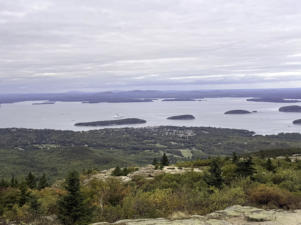 Photo: Klieg, Public Domain Mark (via Flickr)
- 0.8 mi
- one way
- 305 ft
- climb
- 421 ft
- high point
- Point to point
- route
- Jun–Oct
- best months
Is Kebo Mountain Trail open right now?
Closure in the area
There's a closure order in Acadia National Park. It doesn't name Kebo Mountain Trail, so check the source for the area it covers (2 listed).
Cadillac Summit Road closed to all users Nov 9-25 and Dec 1-18
Park closure covering Acadia National Park · NPS · Acadia National Park
Eastern Section of Beech Mountain Loop Trail Closed for Repairs
Park closure covering Acadia National Park · NPS · Acadia National Park
As of · Source: NPS · Acadia National Park. Agencies don't list every closure — check before you go.
Kebo Mountain Trail is a short, steep hike in Acadia National Park in Maine, managed by the National Park Service. The trail is about 0.8 miles long, with a one-way climb of 305 feet from a starting elevation of 281 feet to a high point of 421 feet. The steepest stretch comes at about 0.7 miles in, where the grade reaches 17%. Summer is the most comfortable time to go. Typical averages from a nearby weather station show July highs around 79°F with lows near 60°F, while winter highs stay in the low to mid 30s. A fee is charged for the trail, and bikes and horses are not allowed. The trail is a point-to-point route, so plan on returning the way you came. Several other trails start within about 0.2 miles, including Stratheden Path, Hemlock Road and Hemlock Trail. Climbers can find the Precipice, also known as The South Wall, about 1.9 miles away.
Local outfitters
- Atlantic Climbing School2 mi away
Not on Roamze yet. Their page has how to reach them.
Best time to go · Jun–Oct
Best time to visit Kebo Mountain Trail
Best months: June–October. Best months have typical highs of 55–85 °F, lows of 30 °F or warmer (32 °F where the station doesn't record snow), at most one snowy day and no more than 12 wet days.
Jan
33° / 15°
12 wet
Feb
35° / 18°
10 wet
Mar
42° / 25°
12 wet
Apr
53° / 35°
12 wet
May
65° / 45°
13 wet
Jun
74° / 54°
12 wet
Jul
79° / 60°
11 wet
Aug
78° / 60°
10 wet
Sep
71° / 53°
11 wet
Oct
58° / 43°
12 wet
Nov
48° / 33°
12 wet
Dec
38° / 22°
13 wet
Typical high / low (°F) and days with rain or snow, 1991–2020. Measured at Acadia Np, ME, 2.2 mi away at 470 ft. This station doesn't record snowfall. Source: NOAA NCEI U.S. Climate Normals 1991–2020.
Keep exploring — more trails worth the drive
 Photo: Klieg, Public Domain Mark (via Flickr)
Stratheden Path
Next door
Stratheden Path is a 0.68-mile point-to-point trail in Maine with 196 ft of elevation gain.
Photo: Klieg, Public Domain Mark (via Flickr)Gorge Path
Next door
1.54-mile point-to-point trail in Maine with 815 ft gain
Photo: Klieg, Public Domain Mark (via Flickr)Schiff Path
Next door
Schiff Path is a 1.03-mile point-to-point trail in Maine with 824 ft of elevation gain.
Photo: Klieg, Public Domain Mark (via Flickr)Hemlock Trail
Next door
0.44-mile point-to-point trail in Maine with 259 ft elevation gain.
 Photo: Klieg, Public Domain Mark (via Flickr)
Beachcroft Path
~1 min drive
Beachcroft Path is a 1.16-mile point-to-point trail in Maine with 342 ft of elevation gain.
 Photo: Idawriter, CC BY-SA 3.0 (via Wikimedia Commons)
Cadillac-Dorr
~2 min drive
0.57-mile point-to-point trail in Maine with 135 ft gain.
 Photo: Klieg, Public Domain Mark (via Flickr)
Hemlock Road
Next door
0.68-mile point-to-point trail in Maine with 143 ft gain.
 Photo: Klieg, Public Domain Mark (via Flickr)
Dorr Mountain North Ridge Trail
~1 min drive
0.95-mile point-to-point trail in Maine with 950 ft elevation gain
 Photo: Andrew Turner, CC BY 2.0 (via Flickr)
Great Meadow Loop
Next door
1.80-mile loop trail in Maine with 274 ft elevation gain.
 Photo: Tony Webster, CC BY 2.0 (via Flickr)
Cadillac North Ridge Trail
~2 min drive
2.10-mile point-to-point trail in Maine with 1,296 ft elevation gain.
Also worth it near here


Route details
- Distance
- 0.8 mi
- Climbing
- About 305 ft
- Summit
- 408 ft
- Difficulty
- Hard
- Time
- About 0.5 hours
Questions about this route
How long is the Kebo Mountain Trail on Kebo Mountain?
About 0.8 mi.
How much elevation gain is on the Kebo Mountain Trail?
About 305 ft of climbing round trip.
How hard is the Kebo Mountain Trail?
It is rated hard.
How long does the Kebo Mountain Trail take?
About 0.5 hours round trip.
Conditions and forecast on Kebo Mountain
Daily highs and lows, wind and the chance of precipitation at the summit and route start for the next 7 days, from the Open-Meteo model.
Map and trail data © OpenStreetMap contributors
