Jordan Cliffs Trail
 Photo: Klieg, Public Domain Mark (via Flickr)
- 1.3 mi
- one way
- 768 ft
- climb
- 888 ft
- high point
- Point to point
- route
- Jun–Oct
- best months
Is Jordan Cliffs Trail open right now?
Closure in the area
There's a closure order in Acadia National Park. It doesn't name Jordan Cliffs Trail, so check the source for the area it covers (2 listed).
Cadillac Summit Road closed to all users Nov 9-25 and Dec 1-18
Park closure covering Acadia National Park · NPS · Acadia National Park
Eastern Section of Beech Mountain Loop Trail Closed for Repairs
Park closure covering Acadia National Park · NPS · Acadia National Park
As of · Source: NPS · Acadia National Park. Agencies don't list every closure — check before you go.
Jordan Cliffs Trail is a 1.3-mile hike in Acadia National Park in Maine, managed by the National Park Service. It is a point-to-point route, climbing from a low of about 358 feet to a high of 888 feet, with a total elevation gain of 768 feet and a longer descent of 1,076 feet. The trail is rated easy and takes about an hour to complete. It is a short outing that fits easily into a day spent exploring the park's network of interconnected paths and climbing areas. Summer is the most comfortable time to go. Typical averages from a nearby weather station show July highs around 79°F with lows near 60°F, while September cools to highs around 71°F. A fee is charged, and dogs, bikes and horses are not allowed. Deer Brook Trail and Penobscot East Trail both start within about a third of a mile, and climbers can find South Bubble and Penobscot Mountain Trail within about half a mile.
Local outfitters
- Atlantic Climbing School5 mi away
Not on Roamze yet. Their page has how to reach them.
Best time to go · Jun–Oct
Best time to visit Jordan Cliffs Trail
Best months: June–October. Best months have typical highs of 55–85 °F, lows of 30 °F or warmer (32 °F where the station doesn't record snow), at most one snowy day and no more than 12 wet days.
Jan
33° / 15°
12 wet
Feb
35° / 18°
10 wet
Mar
42° / 25°
12 wet
Apr
53° / 35°
12 wet
May
65° / 45°
13 wet
Jun
74° / 54°
12 wet
Jul
79° / 60°
11 wet
Aug
78° / 60°
10 wet
Sep
71° / 53°
11 wet
Oct
58° / 43°
12 wet
Nov
48° / 33°
12 wet
Dec
38° / 22°
13 wet
Typical high / low (°F) and days with rain or snow, 1991–2020. Measured at Acadia Np, ME, 2.6 mi away at 470 ft. This station doesn't record snowfall. Source: NOAA NCEI U.S. Climate Normals 1991–2020.
Keep exploring — more trails worth the drive
Photo: Klieg, Public Domain Mark (via Flickr)Deer Brook Trail
Next door
0.77-mile out-and-back trail in Maine with 13 ft gain and 797 ft loss.
Photo: Klieg, Public Domain Mark (via Flickr)Penobscot East Trail
Next door
0.32-mile out-and-back trail in Maine with 259 ft of elevation loss.
 Photo: Klieg, Public Domain Mark (via Flickr)
Maple Spring Trail
Next door
1.44-mile out-and-back trail in Maine with 629 ft gain.
 Photo: Klieg, Public Domain Mark (via Flickr)
Penobscot Mountain Trail
Next door
2.16-mile out-and-back hike in Maine with 1,231 ft gain.
 Photo: Klieg, Public Domain Mark (via Flickr)
Bubbles Divide
~1 min drive
0.57-mile out-and-back trail in Maine with 200 ft gain and 426 ft loss.
Photo: Klieg, Public Domain Mark (via Flickr)Hadlock Brook Trail
~1 min drive
Peaceful out-and-back stream walk through Maine forest.
Photo: Klieg, Public Domain Mark (via Flickr)Sargent South Ridge Trail
Next door
Steady out-and-back climb to Sargent Mountain with expanding island views.
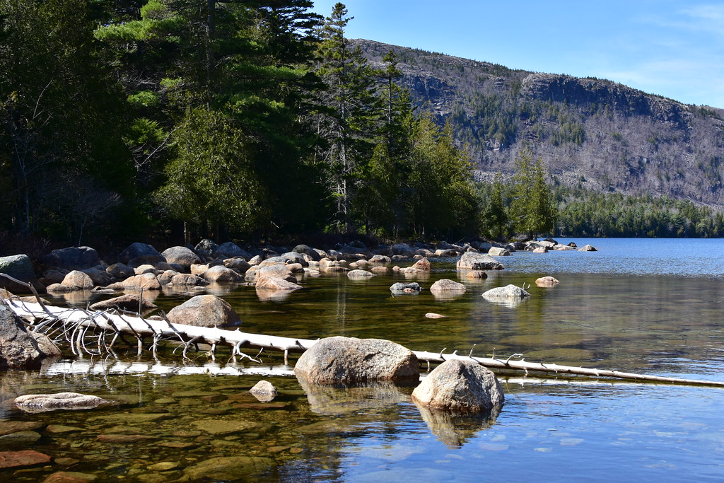 Photo: pedrik — CC BY 2.0 (via Flickr)
Jordan Pond Path
~2 min drive
3.11-mile loop around Jordan Pond in Maine.
 Photo: aparlette, CC BY 2.0 (via Flickr)
Amphitheatre Trail
~2 min drive
1.47-mile out-and-back hike in Maine with 867 ft gain.
Photo: Klieg, Public Domain Mark (via Flickr)Sargent East Cliffs Trail
~1 min drive
0.59-mile out-and-back trail in Maine with 15 ft gain and 699 ft loss.


Map and trail data © OpenStreetMap contributors
